MyTopo
Classic USGS Owen Wisconsin 7.5'x7.5' Topo Map
Couldn't load pickup availability
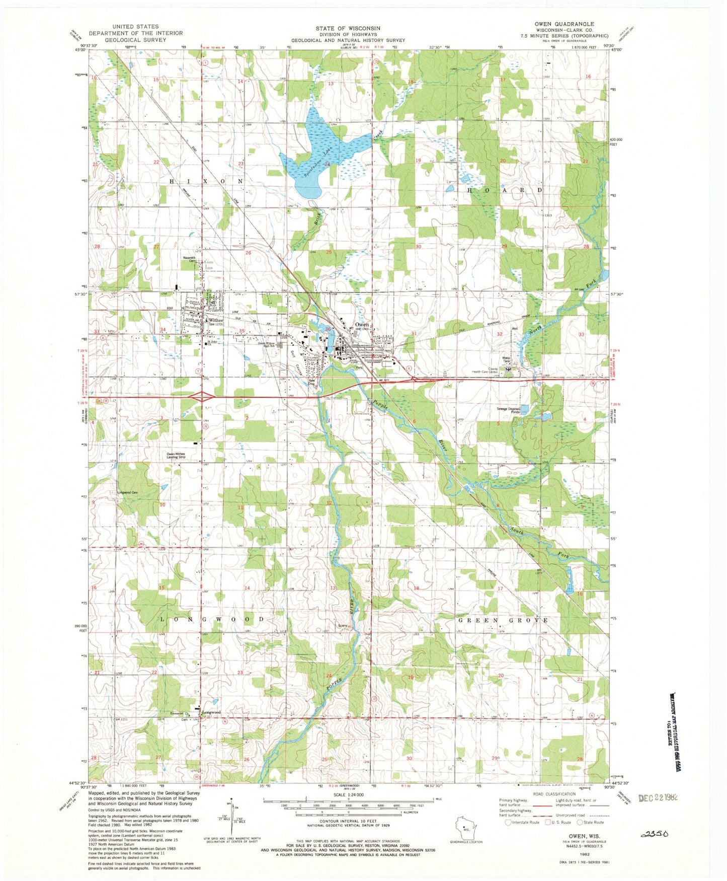
Historical USGS topographic quad map of Owen in the state of Wisconsin. Map scale may vary for some years, but is generally around 1:24,000. Print size is approximately 24" x 27"
This quadrangle is in the following counties: Clark.
The map contains contour lines, roads, rivers, towns, and lakes. Printed on high-quality waterproof paper with UV fade-resistant inks, and shipped rolled.
Contains the following named places: 1 Reservoir, 12 Reservoir, 54460, Brick Creek, Bright, City of Owen, Emanuel Lutheran Cemetery, Emmanuel Church, Hixon Heights School, Hoard Center School, Lloyd Kalepp 3WC77875a Dam, Longwood, Longwood Cemetery, Moody School, Nazareth Cemetery, North Bright School, North Fork Popple River, Owen, Owen - Withee - Curtiss Fire and Emergency Medical Services District, Owen - Withee Elementary School, Owen - Withee High School, Owen - Withee Middle School, Owen City Dam, Owen Police Department, Owen Pond 5, Owen Post Office, Owen-Withee Airport, Poplar River Number 1 H-119 Dam, Saint John Church, South Bright School, South Fork Popple River, Sportsman Lake, Spring Valley School, Town of Hixon, Town of Longwood, Village of Withee, Withee, Withee Post Office