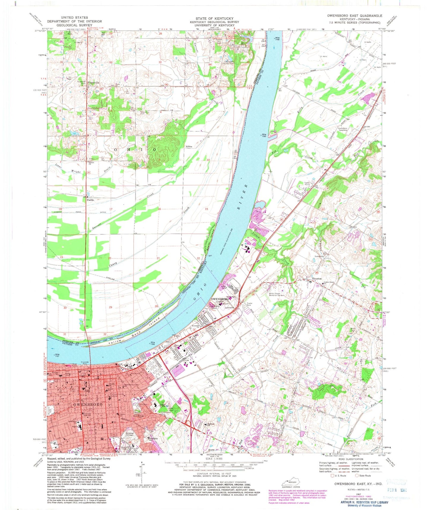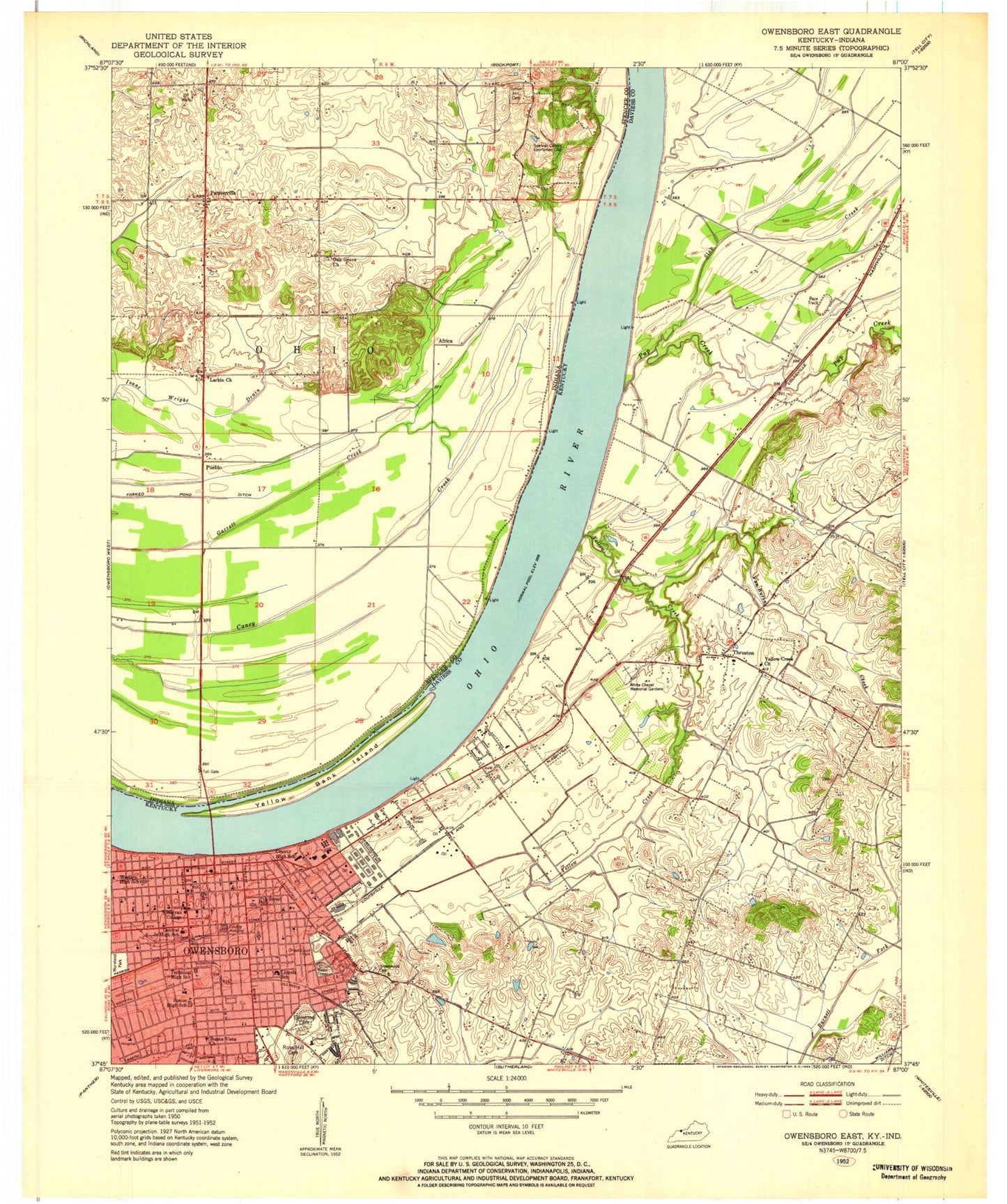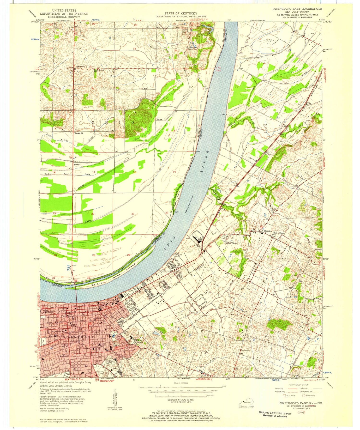
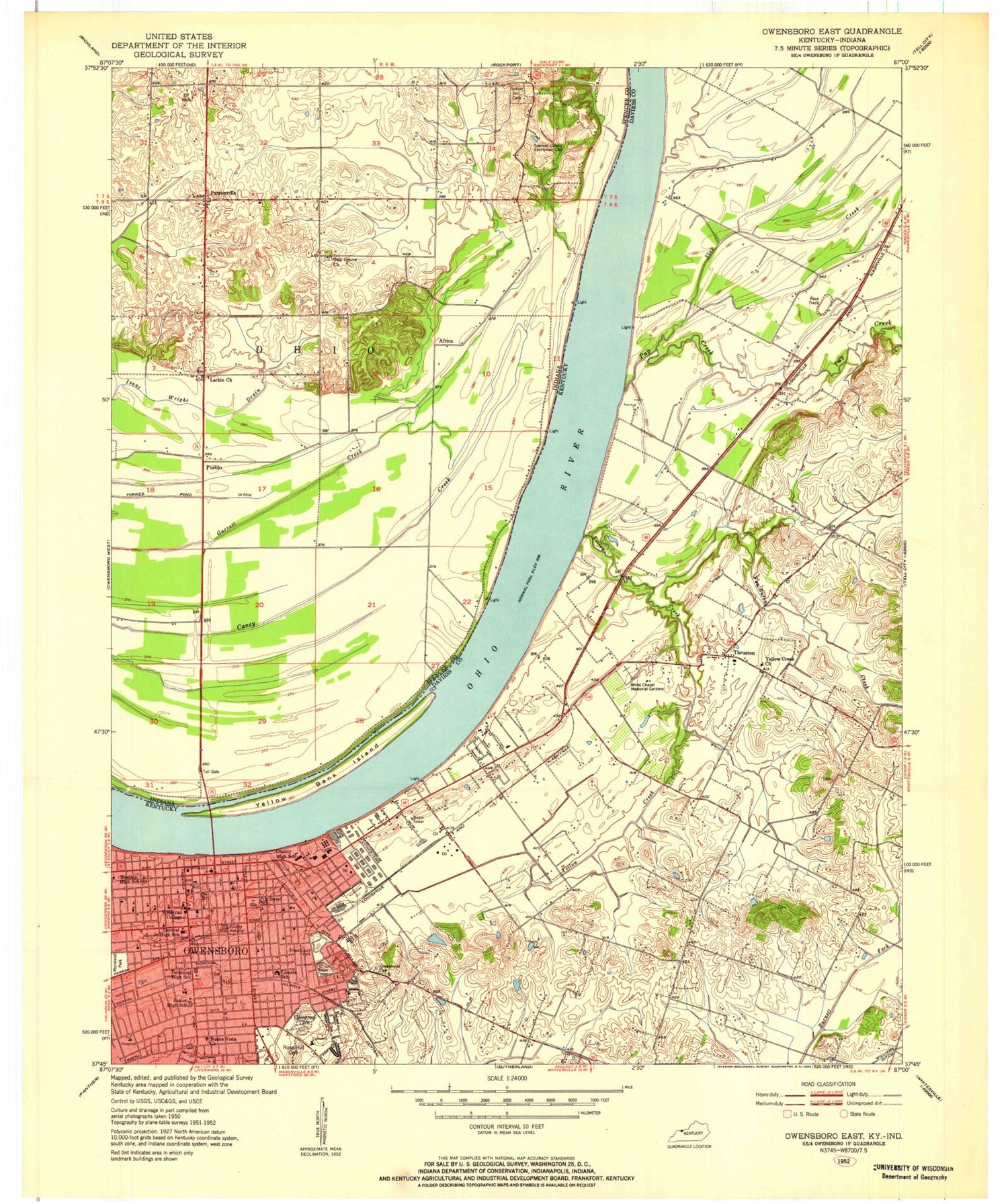
MyTopo
Classic USGS Owensboro East Kentucky 7.5'x7.5' Topo Map
Couldn't load pickup availability
Historical USGS topographic quad map of Owensboro East in the states of Kentucky, Indiana. Map scale may vary for some years, but is generally around 1:24,000. Print size is approximately 24" x 27"
This quadrangle is in the following counties: Daviess, Spencer.
The map contains contour lines, roads, rivers, towns, and lakes. Printed on high-quality waterproof paper with UV fade-resistant inks, and shipped rolled.
Contains the following named places: Africa, Beaverpond Slough, Beeler Island, Brescia University, Brownwood Manor, Buffalo Road Historical Marker, Burned Courthouses Historical Marker, Chautauqua Park, City of Owensboro, Colonial Mobile Estates, Cornland Historical Marker, Covent Gardens, Daviess County Fire Department Thruston Philpot 1, Daviess County Sheriff's Department, Douglas Park, Eastern Junior High School, Ellis-Smeathere Ferry, First World War Enlistees Historical Marker, Forked Pond Ditch, Franklin School, George Graham Vest Historical Marker, Greenwood Cemetery, Hazen A Dean Historical Marker, Highland School, Home Of Thomas Clay Historical Marker, Kelly Creek, Lakewood Country Club, Larkin Church, Larkins Ferry Post Light, Levy Memorial Home, Lincoln School, Locust Hills, Longfellow School, Miller Lake, Miller Lake Dam, Moneta J Sleet Junior Historical Marker, Normandy Heights, Oak Grove Cemetery, Old Trinity Church Historical Marker, Opportunity Center School, Owensboro, Owensboro Bridge, Owensboro Division, Owensboro Fire Department - Station 2, Owensboro Fire Department Station 1, Owensboro Fire Department Station 4, Owensboro Health Regional Hospital, Owensboro Memorial Gardens, Owensboro Police Department, Owensboro Speedway, Pates, Patronville, Postal Store Post Office, Pueblo, Pup Creek, Pup Creek Bar, Riverside Church, Riverside Park, Rose Hill, Rosehill - Elmwood Cemetery and Mausoleum North, Rosehill - Elmwood Cemetery and Mausoleum South, Sassafras Tree Historical Marker, Seven Hills Church, Seven Hills School, Spastic School, Spencer County Farm, Stirmans Folly Historical Marker, Sunset Hill Cemetery, The Confederate Congressional Medal Of Honour Historical Marker, The Downs, Thomas McCreery Home Historical Marker, Thruston, Thruston Census Designated Place, Union Station Historical Marker, VanBuren Creek, Western School, William Smeathers Home Historical Marker, Williams Ditch, Woodcrest, Yellow Bank Island, Yellow Creek, Yellow Creek Baptist Church, ZIP Code: 42303