MyTopo
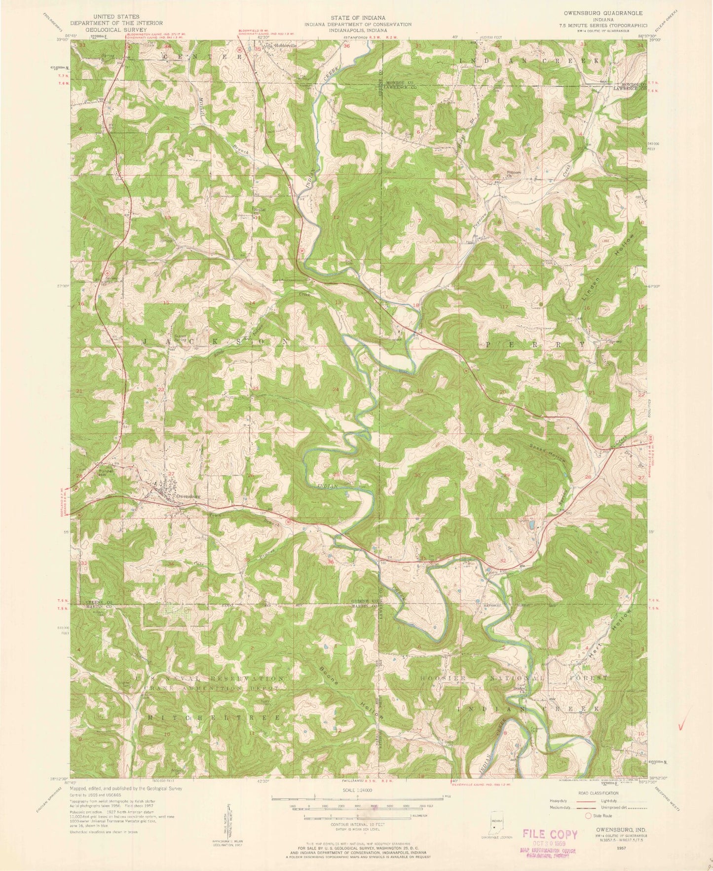
Classic USGS Owensburg Indiana 7.5'x7.5' Topo Map
Couldn't load pickup availability
Historical USGS topographic quad map of Owensburg in the state of Indiana. Map scale may vary for some years, but is generally around 1:24,000. Print size is approximately 24" x 27"
This quadrangle is in the following counties: Greene, Lawrence, Martin, Monroe.
The map contains contour lines, roads, rivers, towns, and lakes. Printed on high-quality waterproof paper with UV fade-resistant inks, and shipped rolled.
Contains the following named places: Bethel Church, Beyers and Rainbolt Cemetery, Boone Cemetery, Boone Hollow, Bridge Church Cemetery, Bridges Cemetery, Cole Branch, Dishman Cemetery, Dog Trot Cemetery, Dry Branch, Ferguson Cemetery, Flynn Cemetery, Freeman Cemetery, Graves Cemetery, Hert Hollow, Hobbieville, Hodge Branch, Jackson Cemetery, Jackson Township Fire Department Owensburg Station, Linden Hollow, Little Indian Creek, Lowder Cemetery, Mitchell Branch, Mount Zion Campground, Owensburg, Owensburg Census Designated Place, Popcorn, Popcorn Creek, Rector Cemetery, Roberts Cemetery, Rush Cemetery, Sexson Spring, Speed Hollow, Spring Creek, Thomas Lake, Thomas Lake Dam, Town Branch, Township of Perry, Tunnel Hill, ZIP Code: 47462