MyTopo
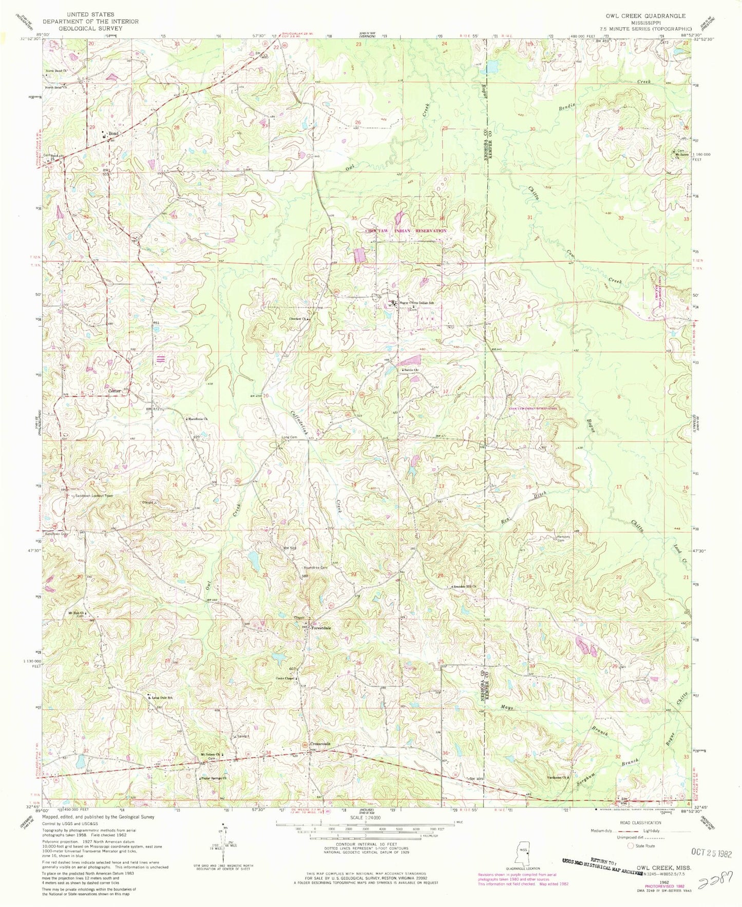
Classic USGS Owl Creek Mississippi 7.5'x7.5' Topo Map
Couldn't load pickup availability
Historical USGS topographic quad map of Owl Creek in the state of Mississippi. Map scale may vary for some years, but is generally around 1:24,000. Print size is approximately 24" x 27"
This quadrangle is in the following counties: Kemper, Neshoba.
The map contains contour lines, roads, rivers, towns, and lakes. Printed on high-quality waterproof paper with UV fade-resistant inks, and shipped rolled.
Contains the following named places: Bendix Creek, Bogue Chitto, Bogue Chitto Census Designated Place, Bogue Chitto Indian School, Bond, Bond Church, Brandon Hill Church, Center, Choctaw Church, Choctaw Fire Department Station 3, Coffadeliah, Coffadeliah Creek, Cooks Chapel, Cooks Store, Cow Creek, Crossroads, East Neshoba Volunteer Fire Department Station 1 Headquarters, East Neshoba Volunteer Fire Department Station 4, Forestdale, Guy Gray Lake Dam, Hensons Cemetery, Indian Reservation Lake Dam, Land Creek, Long Cemetery, Long Dale School, Macedonia Church, Mayo Branch, Mount Nelson Cemetery, Mount Nelson Church, Mount Salem Church, Mount Zion Church, New Hope, North Bend, North Bend Cemetery, North Bend Church, North Bend Volunteer Fire Department, Pat McDonald Lake Dam, Poplar Springs Church, Rea Ditch, Red Bud, Roundtree Cemetery, Sandtown Lookout Tower, Sardis Church, Sorghum Branch, Vardaman Church, W W Farms