MyTopo
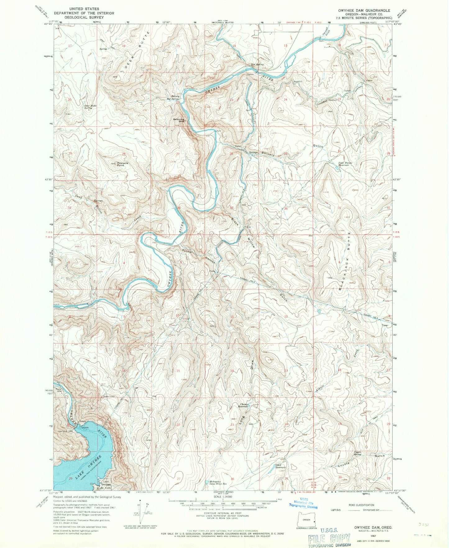
Classic USGS Owyhee Dam Oregon 7.5'x7.5' Topo Map
Couldn't load pickup availability
Historical USGS topographic quad map of Owyhee Dam in the state of Oregon. Map scale may vary for some years, but is generally around 1:24,000. Print size is approximately 24" x 27"
This quadrangle is in the following counties: Malheur.
The map contains contour lines, roads, rivers, towns, and lakes. Printed on high-quality waterproof paper with UV fade-resistant inks, and shipped rolled.
Contains the following named places: Balancing Rock, Black Willow Gulch, Black Willow Siphon, Blackjack Butte, Blackjack Butte Reservoir, Chaney Reservoir, Coyote Spring, Deer Butte, Deer Butte Spring, Four Points Reservoir, Hot Spring, Kingman Lateral, Long Draw, Mahogany Long Draw Reservoir, Oke Reservoir, Owyhee Dam, Owyhee Dam Park, Owyhee Lake Dam Boat Ramp, Owyhee Siphon, Pinnacle Point, Sand Hollow Creek, Snively Gulch, Snively Hot Spring, Snively Siphon, Tunnel Canyon, Tunnel Number 1, Tunnel Number 3, Tunnel Number 5