MyTopo
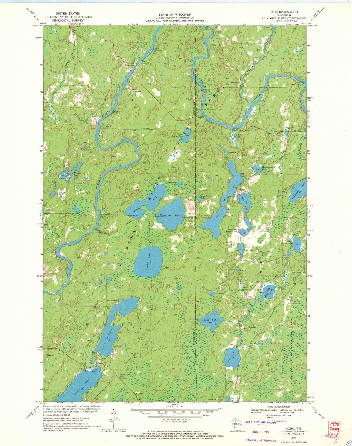
Classic USGS Oxbo Wisconsin 7.5'x7.5' Topo Map
Couldn't load pickup availability
Historical USGS topographic quad map of Oxbo in the state of Wisconsin. Typical map scale is 1:24,000, but may vary for certain years, if available. Print size: 24" x 27"
This quadrangle is in the following counties: Price, Sawyer.
The map contains contour lines, roads, rivers, towns, and lakes. Printed on high-quality waterproof paper with UV fade-resistant inks, and shipped rolled.
Contains the following named places: Barnaby Rapids, Bass Lake, Bass Lake, Bear Creek, Beaver Creek, Carp Lake, Cat Lake, Champagne Lake, Connors Lake, Constellation Lake, Dave Lake, Deadman Slough, Dog Lake, Evergreen Lake, Hanson Lake, Homestead Lake, Jackson Springs, Le Tourneau Lake, Long Lake, Mason Creek, Mason Lake, Middle Price Lake, Mud Lake, Oxbo, Pelican Lake, Lake of the Pines, Pot Lake, Price Lake, Swamp Lake, Upper Price Lake, Butternut Creek, Log Creek, Oxbo Lake, Connors Lake Lookout Tower, Lake of the Pines Conifer-Hardwoods State Natural Area, Berends Quarry