MyTopo
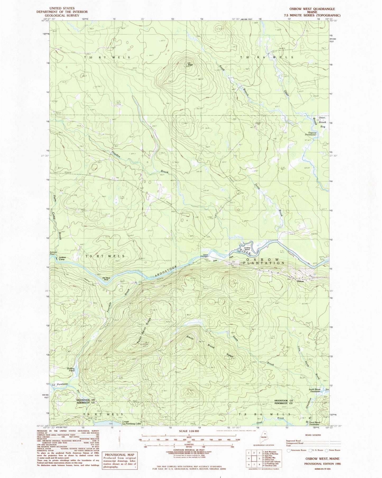
Classic USGS Oxbow West Maine 7.5'x7.5' Topo Map
Couldn't load pickup availability
Historical USGS topographic quad map of Oxbow West in the state of Maine. Typical map scale is 1:24,000, but may vary for certain years, if available. Print size: 24" x 27"
This quadrangle is in the following counties: Aroostook, Penobscot.
The map contains contour lines, roads, rivers, towns, and lakes. Printed on high-quality waterproof paper with UV fade-resistant inks, and shipped rolled.
Contains the following named places: Arbo Flats, Bastc Rips, Botting Pond, Dead Brook, Farm Camp Brook, Fourmile Brook, Hayden Brook, Junkins Camp, Junkins Island, Little Smith Brook, Old Maid Rock, Orr Ridge, Osgood Deadwater, Smith Brook, Smith Brook Deadwater, Smith Brook Ridge, South Branch Otter Brook, Sugar Berth Ridge, Turtle Brook, Plantation of Oxbow, Oxbow Checkpoint Building, Botting Cemetery