MyTopo
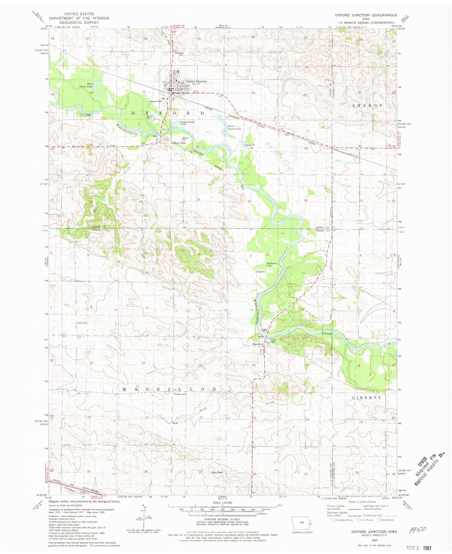
Classic USGS Oxford Junction Iowa 7.5'x7.5' Topo Map
Couldn't load pickup availability
Historical USGS topographic quad map of Oxford Junction in the state of Iowa. Map scale may vary for some years, but is generally around 1:24,000. Print size is approximately 24" x 27"
This quadrangle is in the following counties: Cedar, Clinton, Jones.
The map contains contour lines, roads, rivers, towns, and lakes. Printed on high-quality waterproof paper with UV fade-resistant inks, and shipped rolled.
Contains the following named places: Assembly of God Church, Benjamin Fraseur Log Cabin, Bennet Lake, Bennet Lake Dam, Brink Cemetery, Bryan Creek, Bullhead Lake, Center Cemetery, City of Oxford Junction, Diamond Community Church, East Goose Lake, Massillon, Massillon Area Park, Massillon Cemetery, Massillon Post Office, Mayflower Cemetery, Midland Elementary School, Midland Intermediate School, Mill Creek, Oxford Junction, Oxford Junction Cemetery, Oxford Junction City Hall, Oxford Junction Post Office, Oxford Junction Volunteer Fire Department, Oxford Mills, Oxford Mills Post Office, Plum Creek, Saint Marks Lutheran Church, Township of Massillon, Township of Oxford, United Methodist Church, Wapsie Park, West Goose Lake, Wregie Memorial Library, ZIP Code: 52323