MyTopo
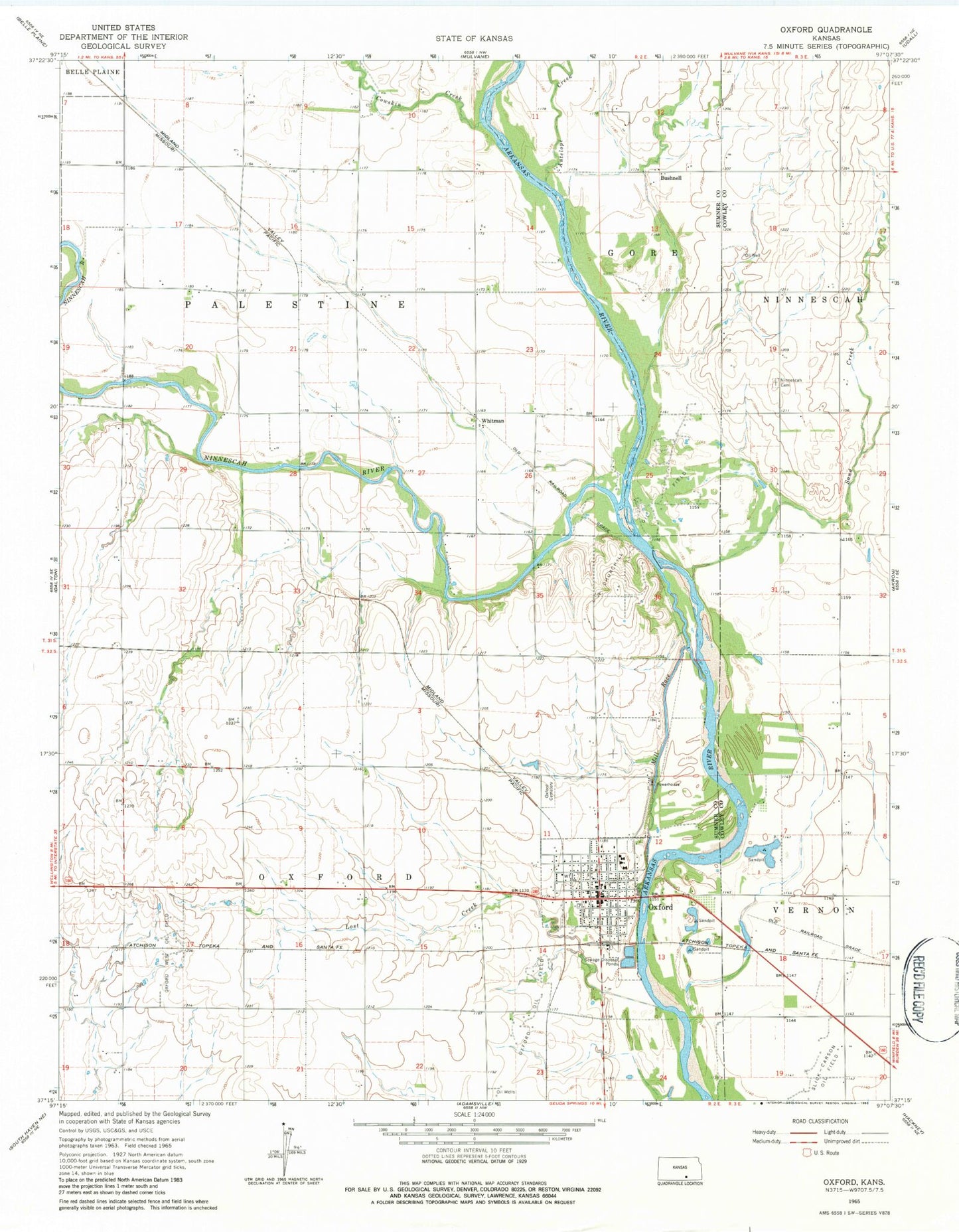
Classic USGS Oxford Kansas 7.5'x7.5' Topo Map
Couldn't load pickup availability
Historical USGS topographic quad map of Oxford in the state of Kansas. Map scale may vary for some years, but is generally around 1:24,000. Print size is approximately 24" x 27"
This quadrangle is in the following counties: Cowley, Sumner.
The map contains contour lines, roads, rivers, towns, and lakes. Printed on high-quality waterproof paper with UV fade-resistant inks, and shipped rolled.
Contains the following named places: Albright, Bushnell, Church of Christ, Churchill Oil Field, City of Oxford, Cowskin Creek, First Baptist Church, Jackson School, Lost Creek, Maple Street Baptist Church, Mill Race, Ninnescah Cemetery, Ninnescah River, Ninnescah School, Oxford, Oxford Cemetery, Oxford Christian Church, Oxford City Hall, Oxford Elementary School, Oxford Friendship Center, Oxford Junior / Senior High School, Oxford Oil Field, Oxford Police Department, Oxford Post Office, Oxford Public Library, Oxford Sewer Treatment Plant, Oxford United Methodist Church, Oxford West Oil Field, Saint Mary's Catholic Church, Sand Creek School, Slick-Carson Oil Field, Sumner County Fire District 3 Oxford, Township of Oxford, Township of Palestine, Whitman