

MyTopo
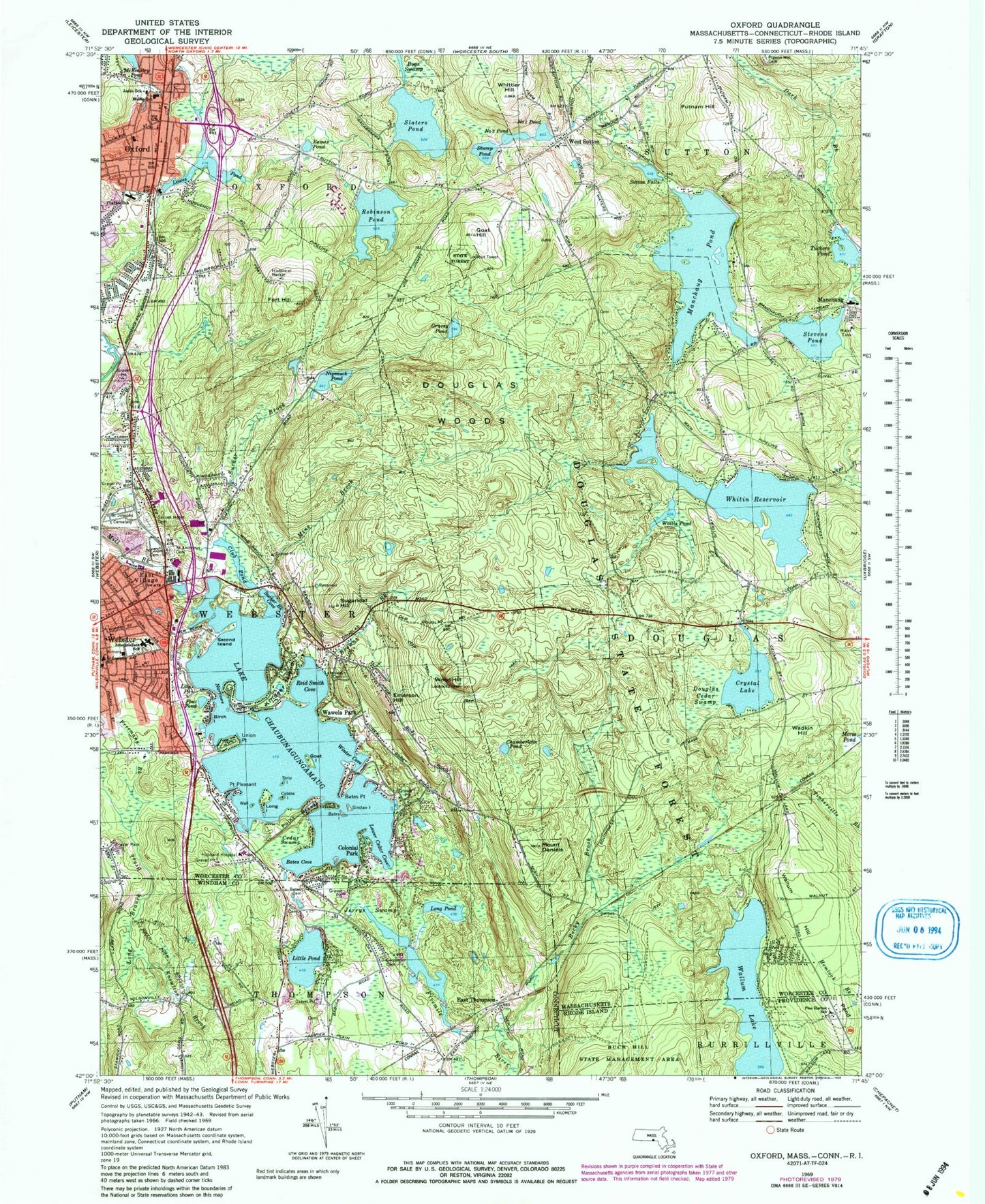
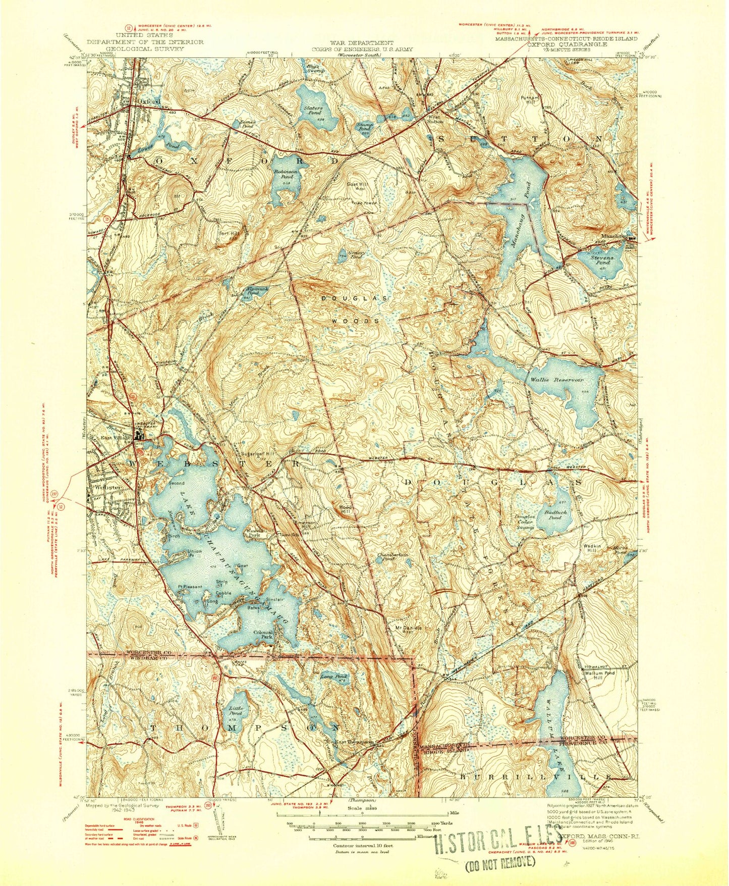
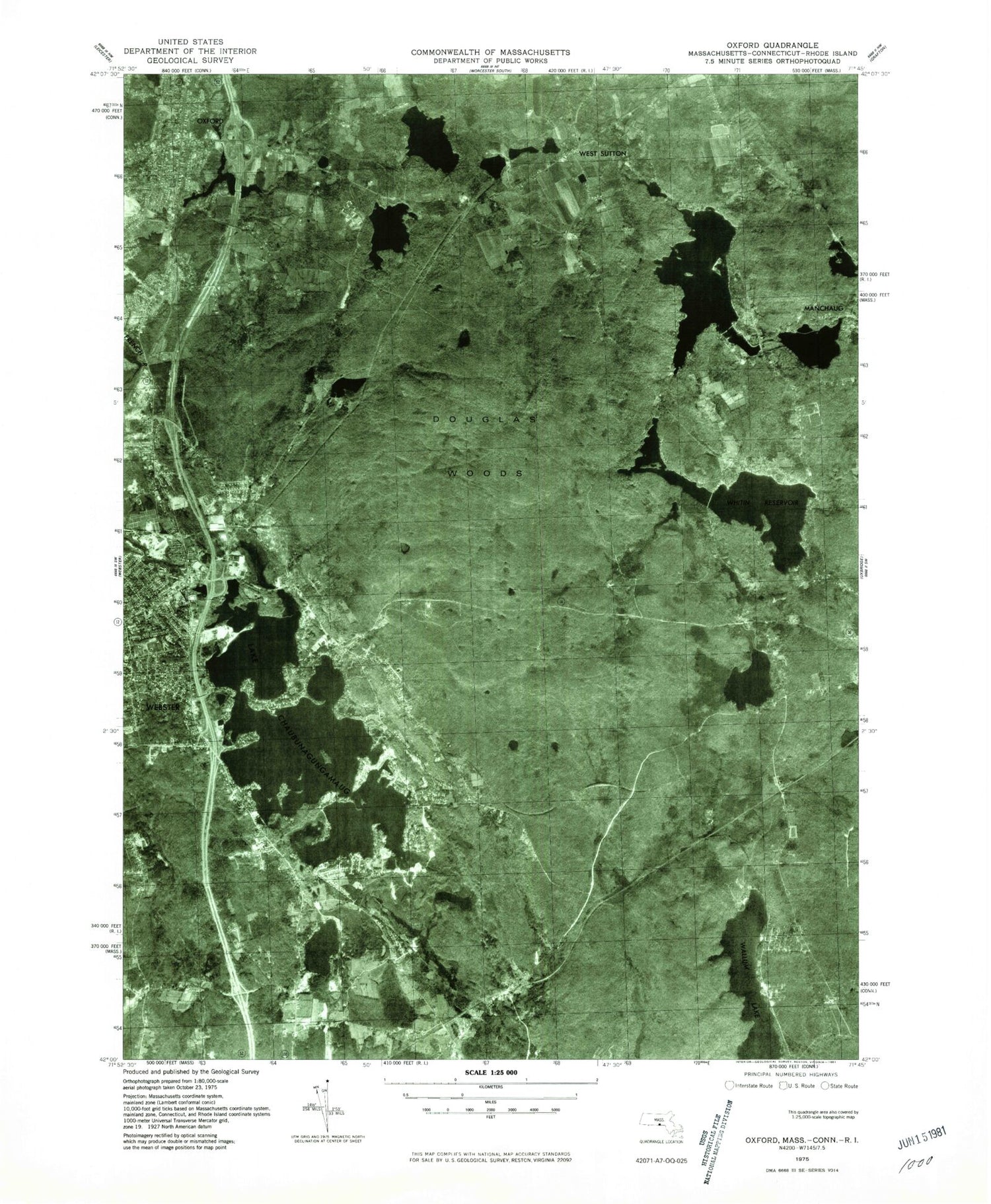
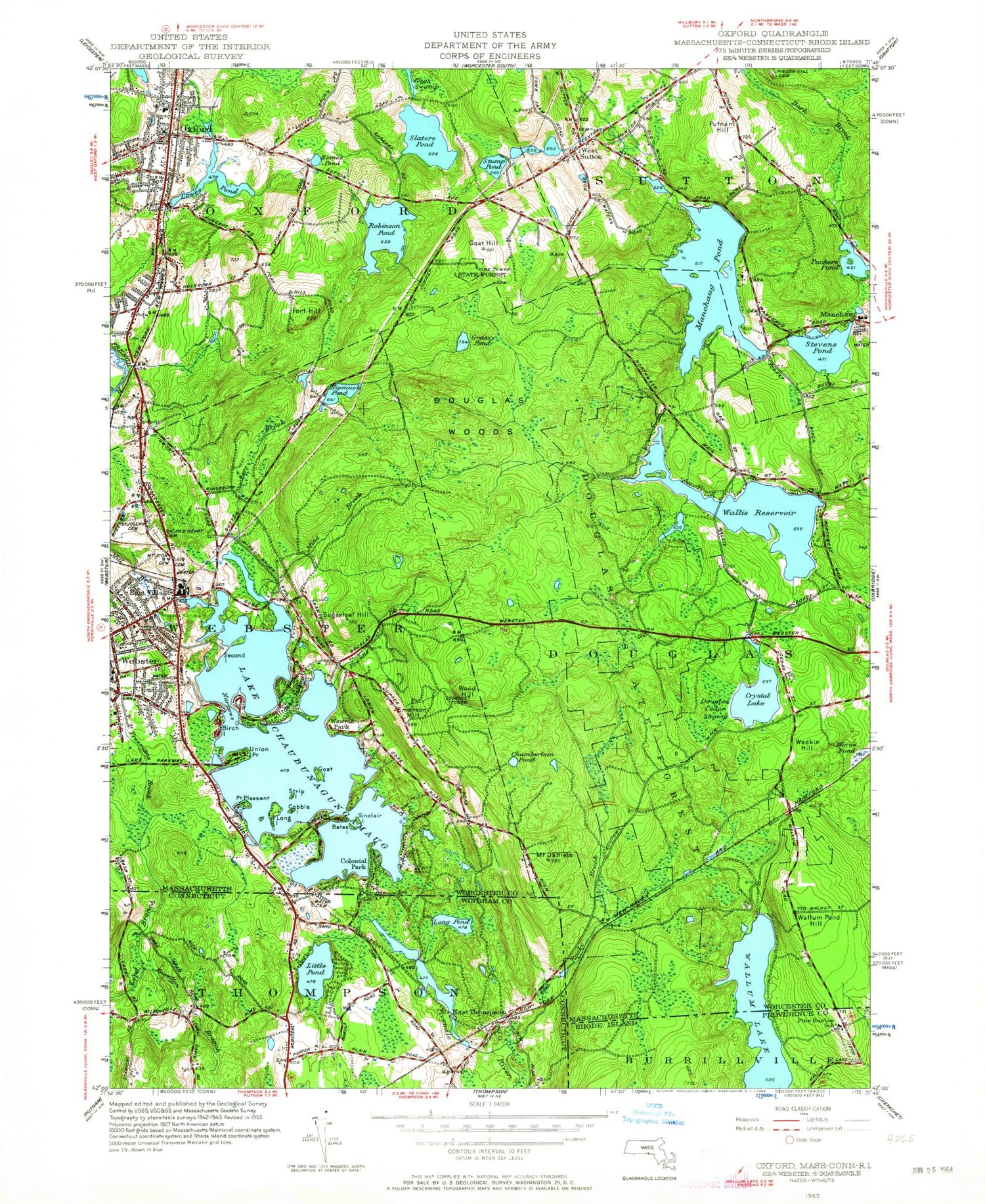
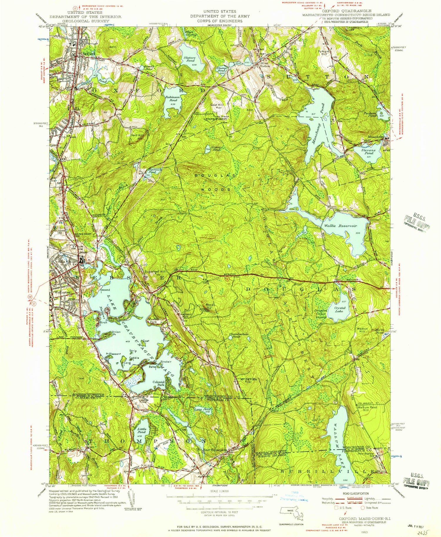
Classic USGS Oxford Massachusetts 7.5'x7.5' Topo Map
Couldn't load pickup availability
Historical USGS topographic quad map of Oxford in the states of Massachusetts, Rhode Island, Connecticut. Typical map scale is 1:24,000, but may vary for certain years, if available. Print size: 24" x 27"
This quadrangle is in the following counties: Providence, Windham, Worcester.
The map contains contour lines, roads, rivers, towns, and lakes. Printed on high-quality waterproof paper with UV fade-resistant inks, and shipped rolled.
Contains the following named places: Emerson Hill, Harrington HealthCare at Webster, Allen Joslin School, Alfred M Chafee School, Saint Josephs School, Mount Zion Cemetery, Lakeside Cemetery, Saint Josephs Cemetery, Sacred Heart of Jesus Cemetery, Douglass State Forest, Freemans Brook, Webster Shopping Plaza, Mammoth Mart Shopping Center, Pigeon Hill Cemetery, Lake Chaugunagungamaug Dam, Club Pond Dam, Whitin Reservoir Dam, Nipmuck Pond Dam, Manchaug Pond Dam, Stevens Pond Dam, Robinson Pond Dam, Lowes Pond Dam, Sutton Pond, Sutton Falls Dam, Stump Pond, Stump Pond Dam, Camp Hill, Saccarappa (historical), Bare Hill, Bates Island, Bates Point, Point Breeze, Browns Brook, Cedar Swamp, Chamberlain Pond, Club Pond, Cobble Island, Colonial Park, Badluck Lake, Mount Daniels, Dark Brook, Douglas Cedar Swamp, Eames Pond, East Village, Fort Hill, Goat Hill, Goat Island, Grassy Pond, Killdeer Island, Lily Pond, Lowes Pond, Long Island, Manchaug Pond, Mine Brook, Narrows, Nipmuck Pond, Number One Pond, Number Two Pond, Oxford, Point Pleasant, Pout Pond, Putnam Hill, Robinson Pond, Second Island, Little Island, Sacarrappa Pond, Stevens Pond, Strip Island, Sucker Brook, Sugarloaf Hill, Sutton Falls, Tuckers Pond, Union Point, Wadkin Hill, Wallis Pond, Wallum Pond Hill, Wawela Park, Well Island, West Sutton, Whitin Reservoir, Whittier Hill, Wood Hill, Kingsburys Pond, Town of Webster, Kingsbury Pond (historical), Bates Cove, Lower Cedar Cove, Reid Smith Cove, Sucker Brook Cove, Winter Cove, Hubbard Regional Hospital Heliport, Oxford Middle School, Saint Anthony Cemetery, Lake Chaubunagungamaug, Town of Douglas, WGFP-AM (Webster), Beacon Pakr, Checkerberry Island, Faith Assembly of God Church, Huguenot Monument, Lakeview Heights, Landmark Baptist Church, Loveland, Memorial Beach Park, Oak Hill Church, Orchard Hills Estates, Oxford Free Library, Oxford Post Office, Oxford Town Hall, Oxford United Methodist Church, Saint Joseph Church, Treasure Island, Webster Transfer Station, South Cemetery, Saint Joseph Schoool, Webster Census Designated Place, Oxford Census Designated Place, Oxford Fire and EMS Headquarters, Webster Fire Department Station 1 Headquarters, Webster Emergency Medical Services, Webster Police Department, Wallum Lake, Buck Hill State Management Area, Pine Harbor School, Bates Cemetery, Carpenter Cemetery, East Thompson, Jerrys Swamp, Knowlton Brook, Little Pond, Long Pond, Rocky Brook, Mavis Pond Dam Number 1, Mavis Pond Number 1, Tourtellotte Cemetery, East Thompson Fire Department Station 85, Emerson Hill, Harrington HealthCare at Webster, Allen Joslin School, Alfred M Chafee School, Saint Josephs School, Mount Zion Cemetery, Lakeside Cemetery, Saint Josephs Cemetery, Sacred Heart of Jesus Cemetery, Douglass State Forest, Freemans Brook, Webster Shopping Plaza, Mammoth Mart Shopping Center, Pigeon Hill Cemetery, Lake Chaugunagungamaug Dam, Club Pond Dam, Whitin Reservoir Dam, Nipmuck Pond Dam, Manchaug Pond Dam, Stevens Pond Dam, Robinson Pond Dam, Lowes Pond Dam, Sutton Pond, Sutton Falls Dam, Stump Pond, Stump Pond Dam, Camp Hill, Saccarappa (historical), Bare Hill, Bates Island, Bates Point, Point Breeze, Browns Brook, Cedar Swamp, Chamberlain Pond, Club Pond, Cobble Island, Colonial Park, Badluck Lake, Mount Daniels, Dark Brook, Douglas Cedar Swamp, Eames Pond, East Village, Fort Hill, Goat Hill, Goat Island, Grassy Pond, Killdeer Island, Lily Pond, Lowes Pond, Long Island, Manchaug Pond, Mine Brook, Narrows, Nipmuck Pond, Number One Pond, Number Two Pond, Oxford, Point Pleasant, Pout Pond, Putnam Hill, Robinson Pond, Second Island, Little Island, Sacarrappa Pond, Stevens Pond, Strip Island, Sucker Brook, Sugarloaf Hill, Sutton Falls, Tuckers Pond, Union Point, Wadkin Hill, Wallis Pond, Wallum Pond Hill, Wawela Park, Well Island, West Sutton, Whitin Reservoir, Whittier Hill, Wood Hill, Kingsburys Pond, Town of Webster, Kingsbury Pond (historical), Bates Cove, Lower Cedar Cove, Reid Smith Cove, Sucker Brook Cove, Winter Cove, Hubbard Regional Hospital Heliport, Oxford Middle School, Saint Anthony Cemetery, Lake Chaubunagungamaug, Town of Douglas, WGFP-AM (Webster), Beacon Pakr, Checkerberry Island, Faith Assembly of God Church, Huguenot Monument