
MyTopo
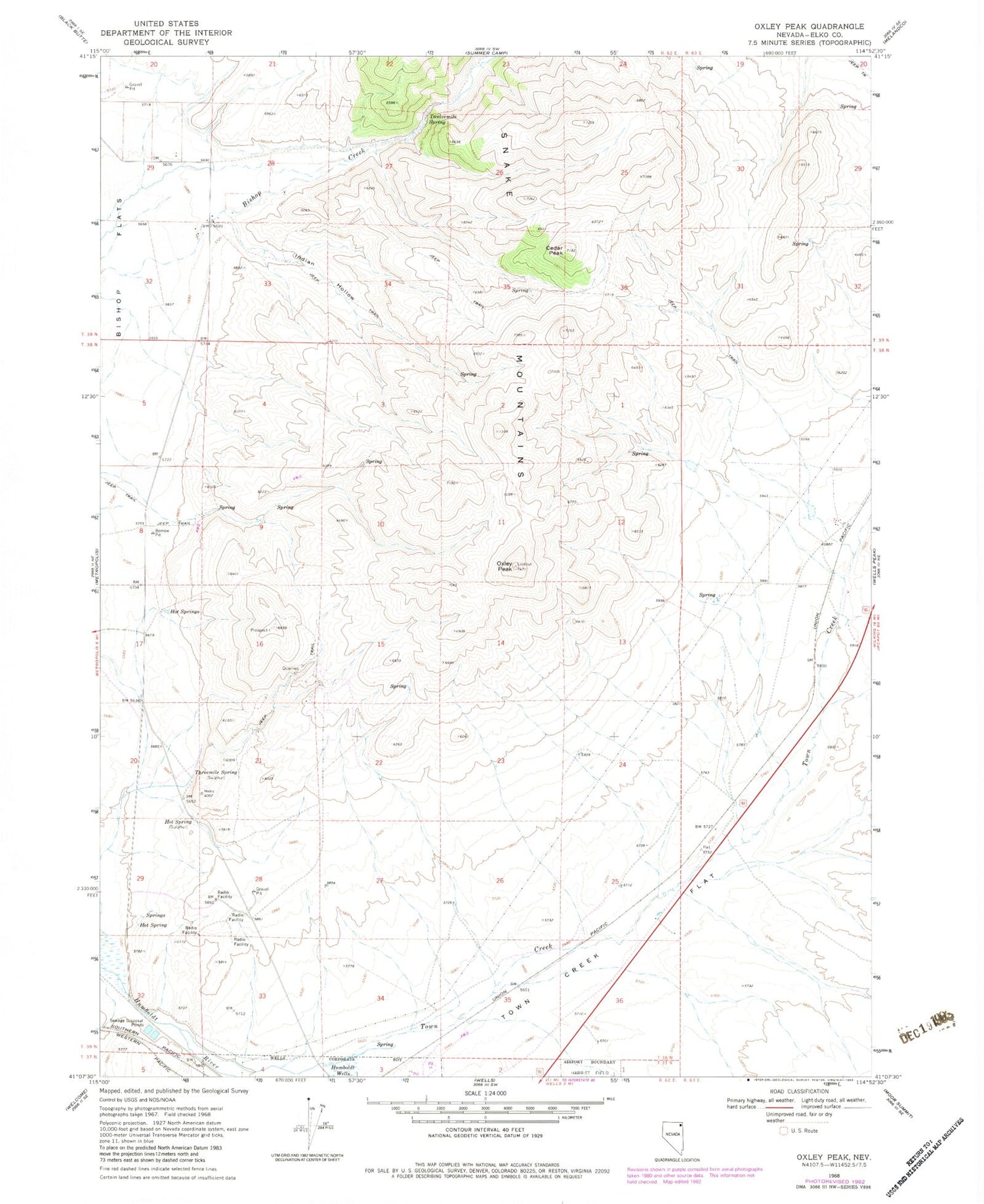
Classic USGS Oxley Peak Nevada 7.5'x7.5' Topo Map
Couldn't load pickup availability
Historical USGS topographic quad map of Oxley Peak in the state of Nevada. Map scale may vary for some years, but is generally around 1:24,000. Print size is approximately 24" x 27"
This quadrangle is in the following counties: Elko.
The map contains contour lines, roads, rivers, towns, and lakes. Printed on high-quality waterproof paper with UV fade-resistant inks, and shipped rolled.
Contains the following named places: Bishop Creek Canyon, Bishop Flat Spring Number Forty, Cedar Peak, Chicken Seep Spring, Chicken Spring, Cottonwood Spring, Hopkins Ranch, Hot Spring, Hot Springs, Indian Hollow, Oxley Peak, Single Tree Ranch, Threemile Spring, Town Creek, Town Creek Flat, Town Creek Spring, Town Creek Well, Twelvemile Spring, Weeks Well, Winchell Spring, Wood Ranch Well Number Fifty Three


