MyTopo
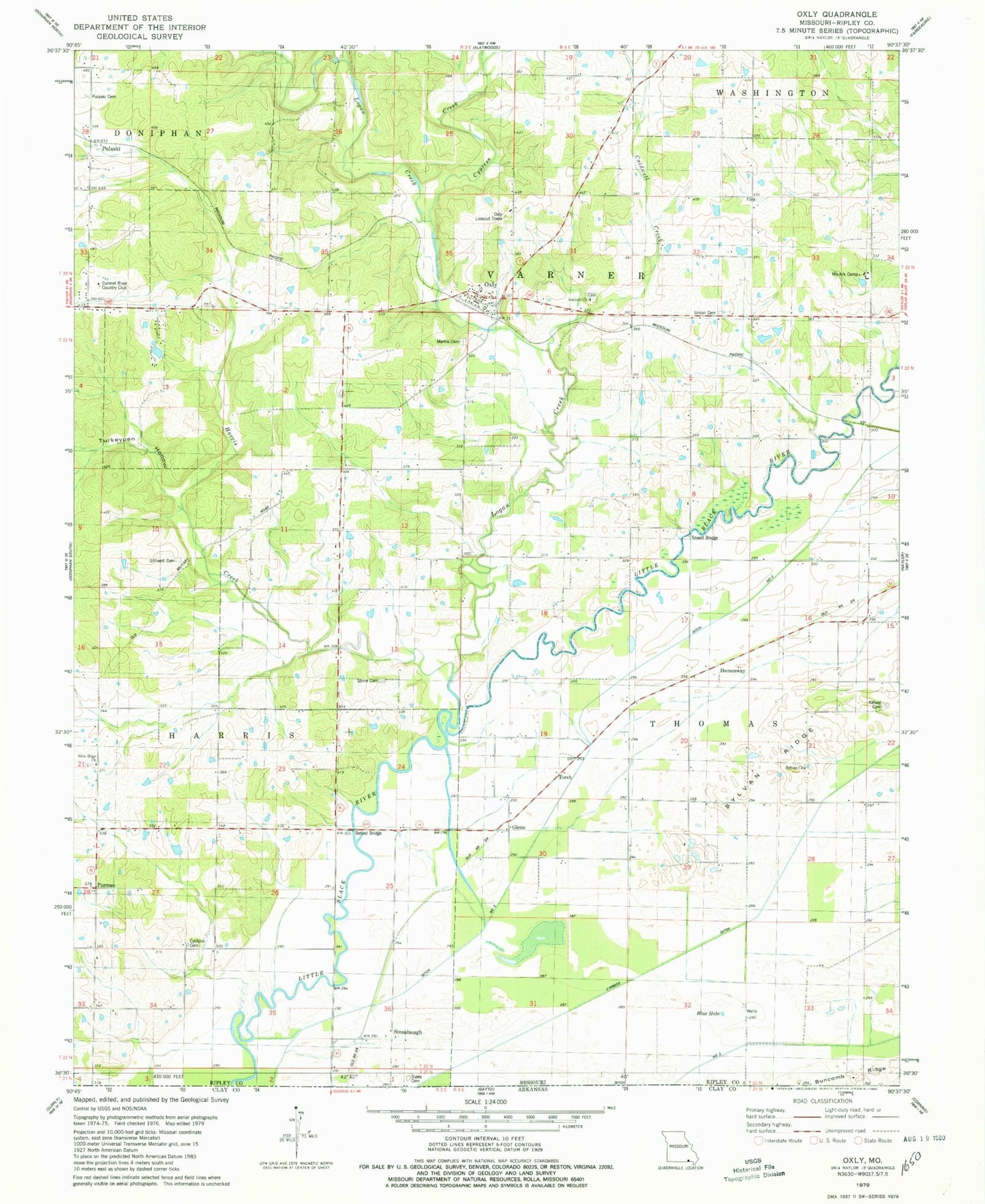
Classic USGS Oxly Missouri 7.5'x7.5' Topo Map
Couldn't load pickup availability
Historical USGS topographic quad map of Oxly in the state of Missouri. Map scale may vary for some years, but is generally around 1:24,000. Print size is approximately 24" x 27"
This quadrangle is in the following counties: Ripley.
The map contains contour lines, roads, rivers, towns, and lakes. Printed on high-quality waterproof paper with UV fade-resistant inks, and shipped rolled.
Contains the following named places: Acorn Post Office, Acorn School, Antioch Cemetery, Antioch Church, Bethel Bridge, Blue Hole, Caldwell Creek, Cardwell Cemetery, Crossroads School, Current River Country Club, Cyclone Cemetery, Cyclone School, Cypress Creek, Cypress Ditch, Deer Lick Creek, Ditch Number 2, Glenn, Harris Creek, Hemenway, Kelsey Cemetery, Logan Creek, Martin Cemetery, Martinsburg, Mo-Ark Camp, New Hope Cemetery, New Hope Church, Oxly, Oxly Census Designated Place, Oxly Lookout Tower, Oxly Post Office, Oxly Volunteer Fire Department, Poe School, Powell School, Pulaski, Purman, Riga, Sewell Bridge, Sewell School, Sheehan, Sinsabaugh, Smith Dam, Smith Lake Dam, Southeastern Ridge and Basin, Stillwell Cemetery, Stone Cemetery, Sylvan Church, Sylvan Ridge, Sylvan School, Taylor School, Torch, Township of Thomas, Township of Varner, Tucker School, Turkeypen Hollow, Union Cemetery, Venerable School, ZIP Codes: 63953, 63955