MyTopo
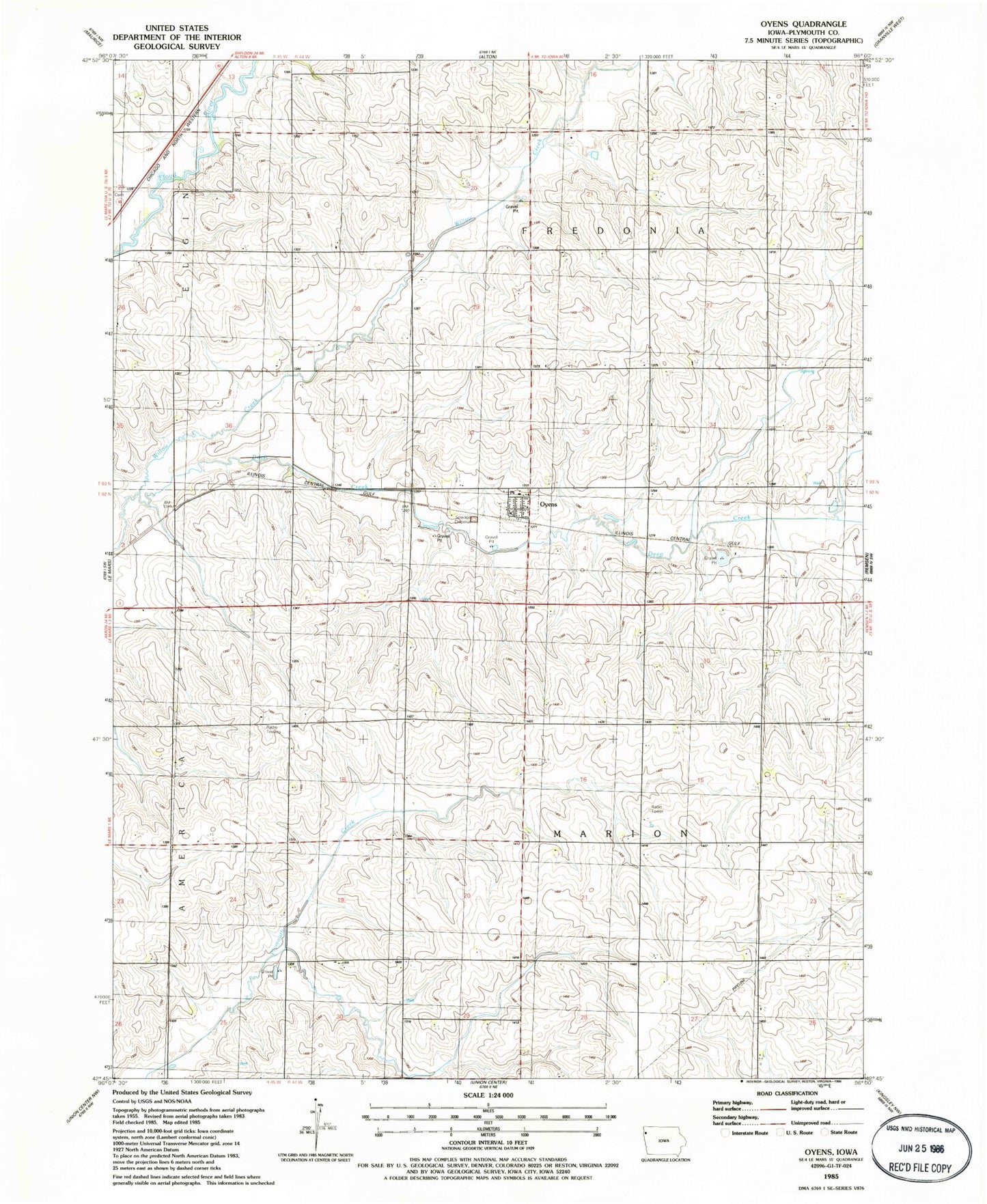
Classic USGS Oyens Iowa 7.5'x7.5' Topo Map
Couldn't load pickup availability
Historical USGS topographic quad map of Oyens in the state of Iowa. Map scale may vary for some years, but is generally around 1:24,000. Print size is approximately 24" x 27"
This quadrangle is in the following counties: Plymouth.
The map contains contour lines, roads, rivers, towns, and lakes. Printed on high-quality waterproof paper with UV fade-resistant inks, and shipped rolled.
Contains the following named places: Boat Farm, City of Oyens, Deep Creek, Dirksen Farm, Farmers Cooperative Elevator, K Farms, Loutsch Farms, Niehus Farms, Oyens, Oyens Post Office, Oyens Volunteer Fire and Rescue, Saint Catherine Center, Saint Catherine Church, Saint Catherines Cemetery, Township of Fredonia, Township of Marion, Willow Valley Farms