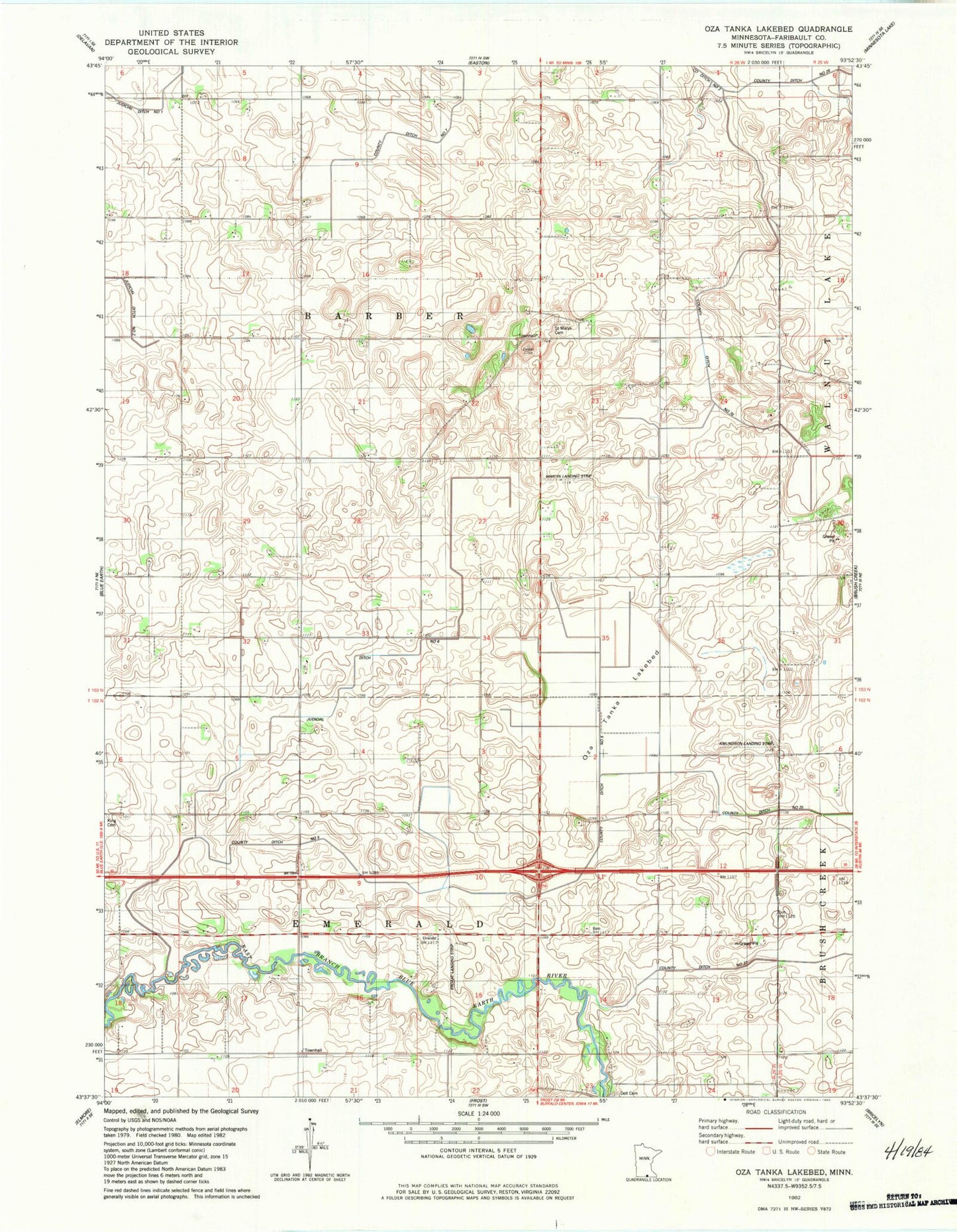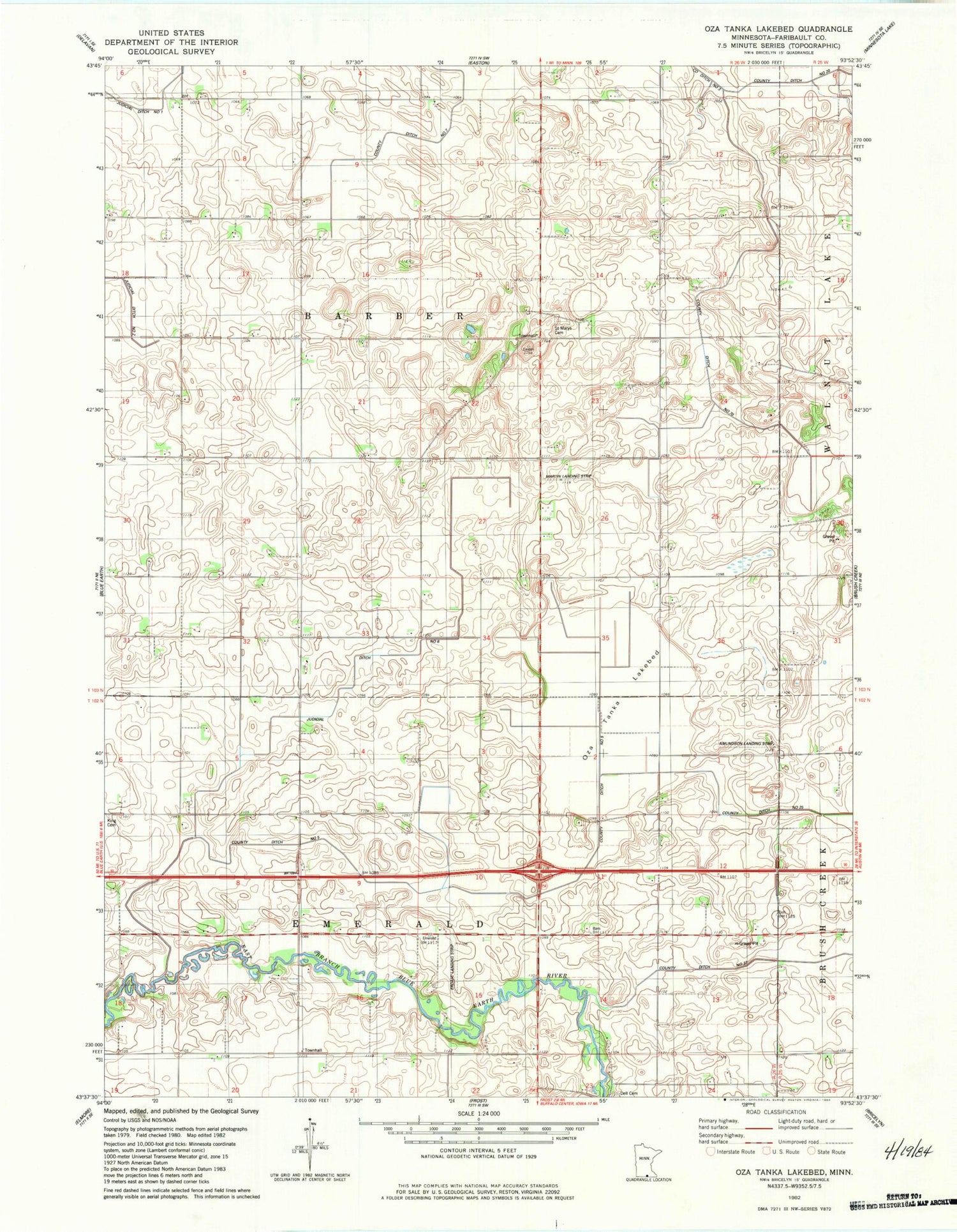
MyTopo
Classic USGS Oza Tanka Lakebed Minnesota 7.5'x7.5' Topo Map
Couldn't load pickup availability
Historical USGS topographic quad map of Oza Tanka Lakebed in the state of Minnesota. Map scale may vary for some years, but is generally around 1:24,000. Print size is approximately 24" x 27"
This quadrangle is in the following counties: Faribault.
The map contains contour lines, roads, rivers, towns, and lakes. Printed on high-quality waterproof paper with UV fade-resistant inks, and shipped rolled.
Contains the following named places: Amundson Landing Strip, County Ditch Number Five, County Ditch Number Seventy, County Ditch Number Thirtyseven, Dell Cemetery, Ellingson Family Cemetery, Erdahl Landing Strip, Faribault County, Judicial Ditch Number Six, Martin Landing Strip, Oza Tanka Lakebed, Saint Marys Cemetery, Township of Barber, Township of Emerald