MyTopo
Classic USGS P K Ranch SW Montana 7.5'x7.5' Topo Map
Regular price
$16.95
Regular price
Sale price
$16.95
Unit price
per
Couldn't load pickup availability
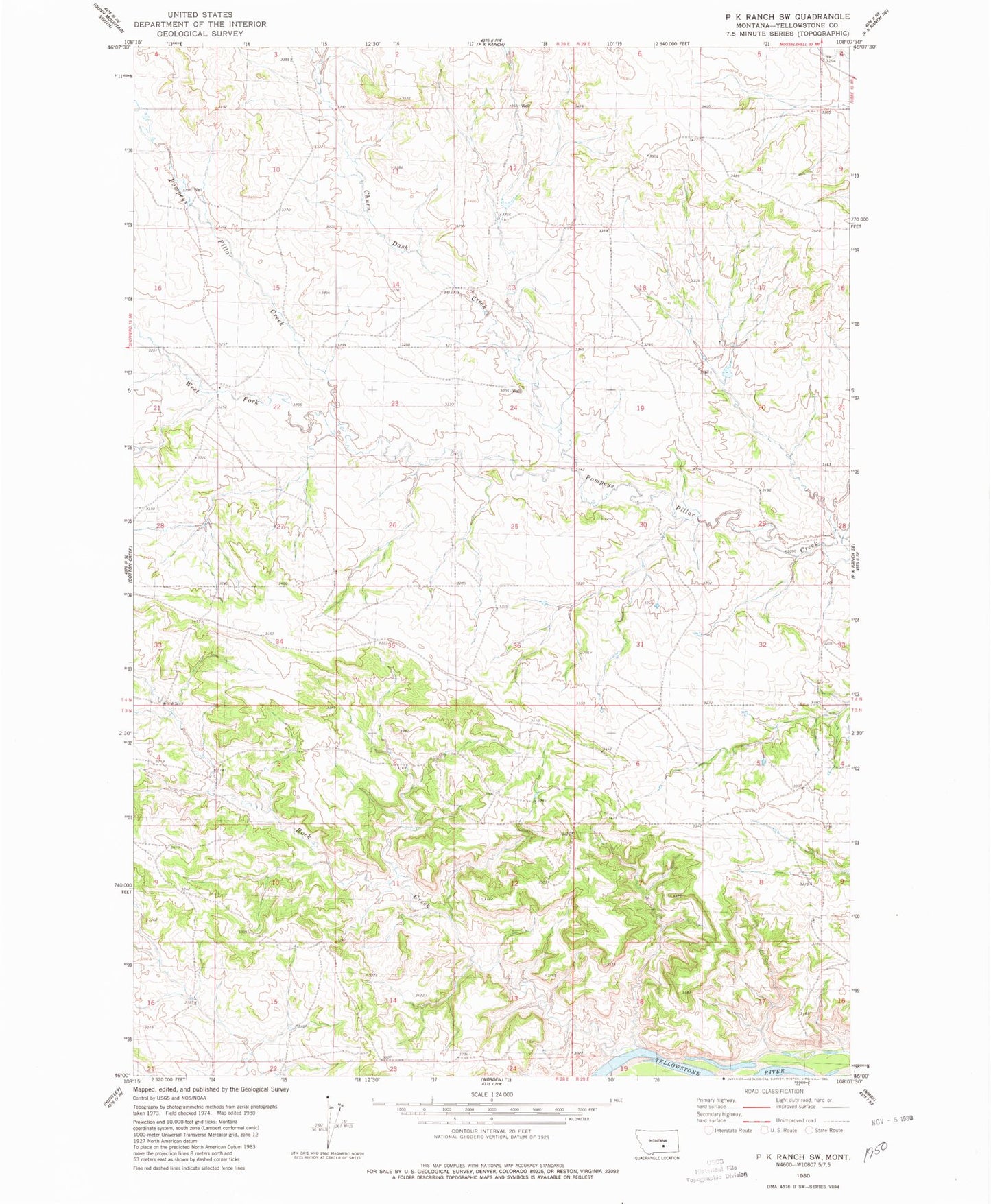
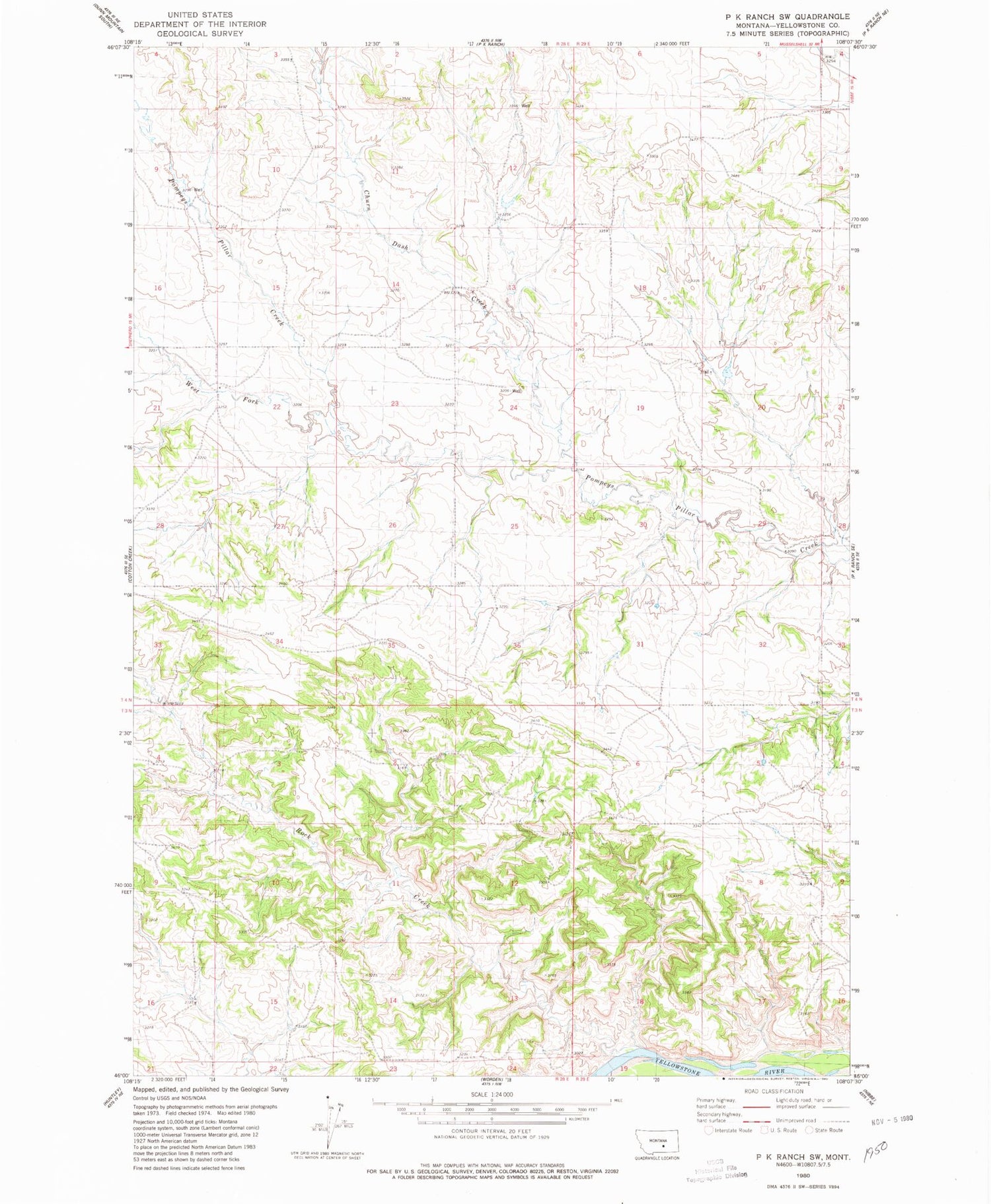
Historical USGS topographic quad map of P K Ranch SW in the state of Montana. Map scale may vary for some years, but is generally around 1:24,000. Print size is approximately 24" x 27"
This quadrangle is in the following counties: Yellowstone.
The map contains contour lines, roads, rivers, towns, and lakes. Printed on high-quality waterproof paper with UV fade-resistant inks, and shipped rolled.
Contains the following named places: 03N29E08DDAC01 Well, 04N28E12CDDB01 Well, 04N28E14DAAA01 Well, 04N28E15B___01 Well, 04N28E34BAAA01 Well, 04N29E20BBCD01 Well, Churn Dash Creek, Rock Creek, West Fork Pompeys Pillar Creek