MyTopo
Classic USGS Pace Mississippi 7.5'x7.5' Topo Map
Couldn't load pickup availability
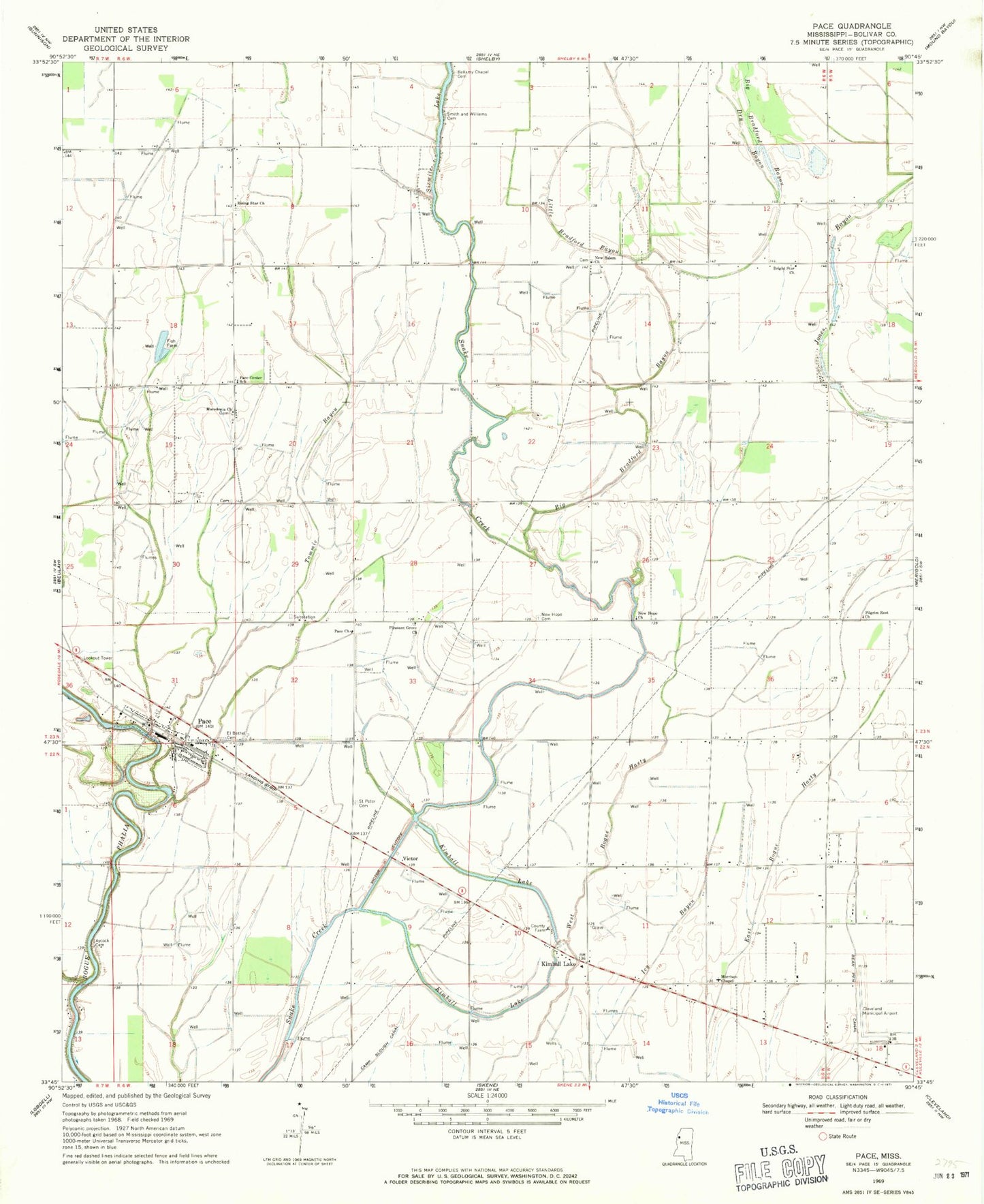
Historical USGS topographic quad map of Pace in the state of Mississippi. Map scale may vary for some years, but is generally around 1:24,000. Print size is approximately 24" x 27"
This quadrangle is in the following counties: Bolivar.
The map contains contour lines, roads, rivers, towns, and lakes. Printed on high-quality waterproof paper with UV fade-resistant inks, and shipped rolled.
Contains the following named places: Aycock Cemetery, Bellamy Chapel Cemetery, Big Bradford Bayou, Bolivar County Correctional Facility, Bolivar County Farm, Bolivar County Fire Department District 1 Station 3 Pace, Bolivar County Sheriff's Office, Bright Star Church, Cleveland Municipal Airport, Ditch Number Eight, Ditch Number Eighteen, Ditch Number Five, Ditch Number Four, Ditch Number Nine, Ditch Number One, Ditch Number Seven, Ditch Number Six, Ditch Number Three, Ditch Number Two, Dry Bayou, El Bethel Cemetery, Howarth Farm, J R Taylor Catfish Ponds Dam, Kimball Lake, Laban Bayou, Little Bradford Bayou, Macedonia Church, Merigold Brake, Morrison Chapel Baptist Church, New Hope Cemetery, New Hope Church, New Salem Church, Pace, Pace Center School, Pace Church, Pace Elementary School, Pace Post Office, Pilgrim Rest Church, Pleasant Grove Church, Rising Star Church, Saint Peter Cemetery, Sixmile Lake, Smith and Williams Cemetery, Supervisor District 2, Sutter Pond Dam, Tommie Bayou, Town of Pace, Victor, Victor Cutoff, ZIP Code: 38764