MyTopo
Classic USGS Packwood Washington 7.5'x7.5' Topo Map
Couldn't load pickup availability
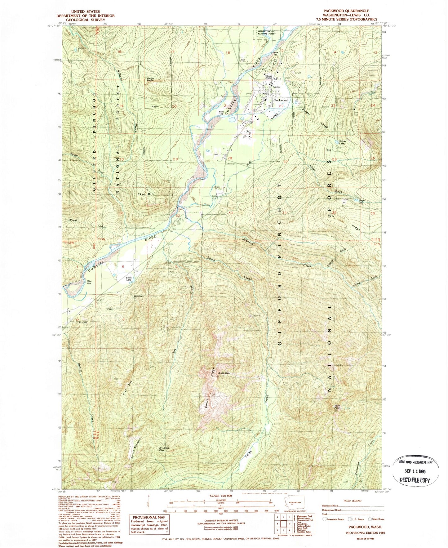
Historical USGS topographic quad map of Packwood in the state of Washington. Map scale may vary for some years, but is generally around 1:24,000. Print size is approximately 24" x 27"
This quadrangle is in the following counties: Lewis.
The map contains contour lines, roads, rivers, towns, and lakes. Printed on high-quality waterproof paper with UV fade-resistant inks, and shipped rolled.
Contains the following named places: Big Bottom Division, Bivin Lake, Brownie Creek, Burton Meadows, Cougar Rocks, Dry Creek, Dry Creek Lookout, Dry Creek Lookout Tower, Dry Creek Pass, Dry Creek Trail, Goat Dike, Hager Creek, Hager Lake, Hall Creek, Jennings Falls, Johnson Creek, Jonathan Creek, Lewis County Fire District 10 Station 1, Lewis County Fire District 10 Station 3, Packwood, Packwood Airport, Packwood Census Designated Place, Packwood Elementary School, Packwood Post Office, Packwood Ranger Station, Pompey Peak Trail, Skate Creek, Skyo Mountain, Smith Creek, Smith Ridge, Snyder Creek, Snyder Lake, South Fork Willame Creek, South Point, South Point Lookout, South Point Trail, Tail Race, Wesel Creek, Willame Creek, Zone I Engineering Station