MyTopo
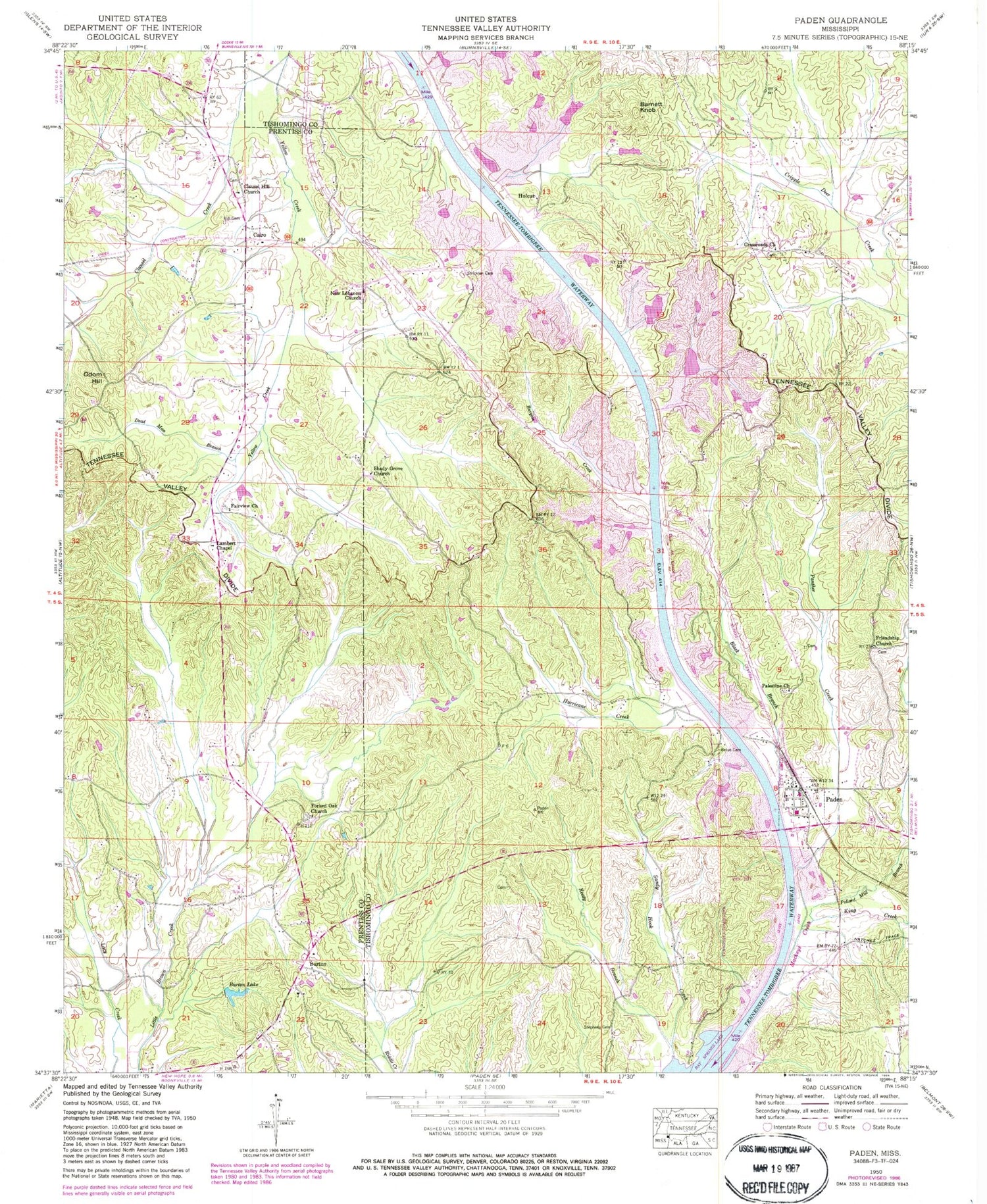
Classic USGS Paden Mississippi 7.5'x7.5' Topo Map
Couldn't load pickup availability
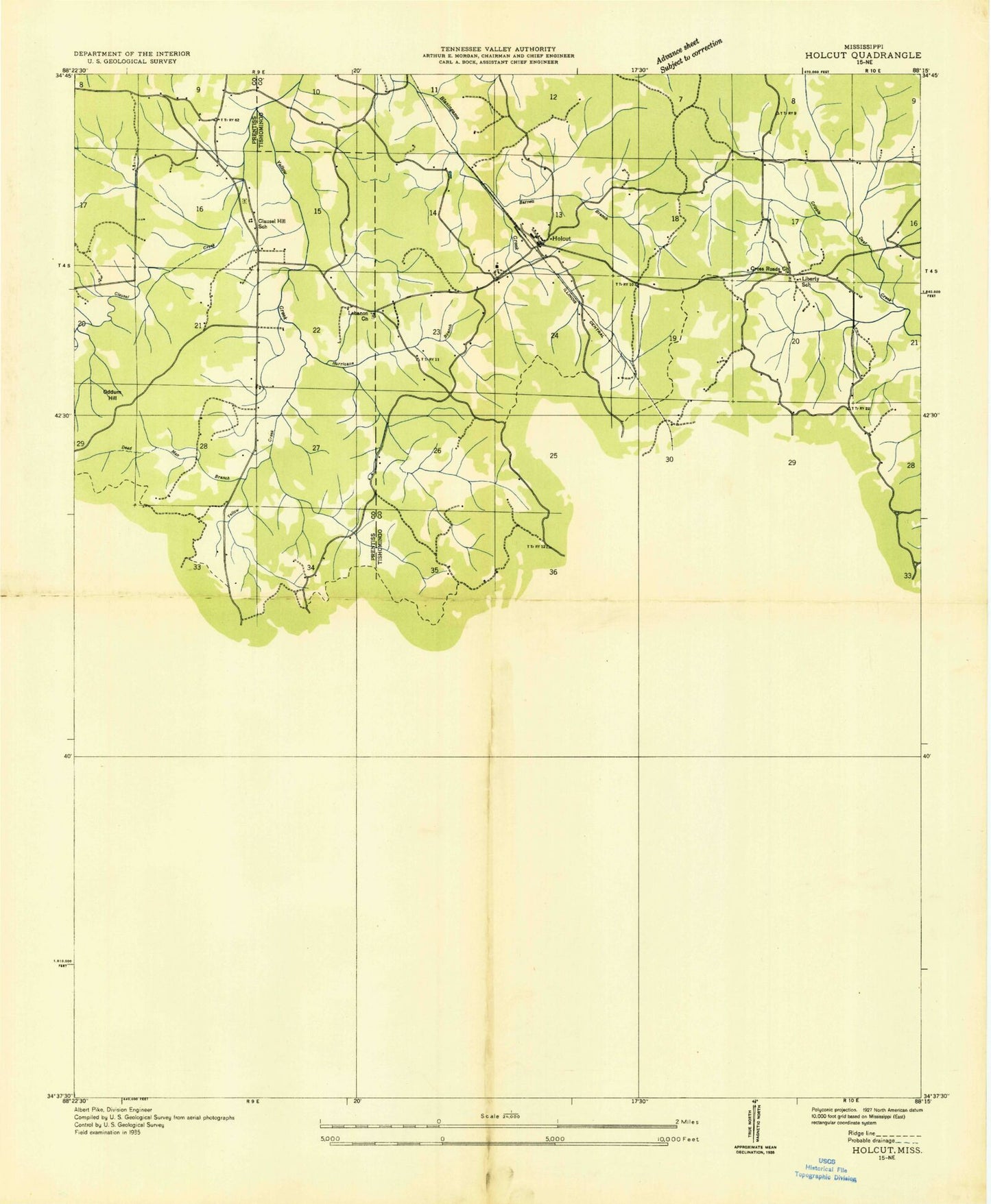
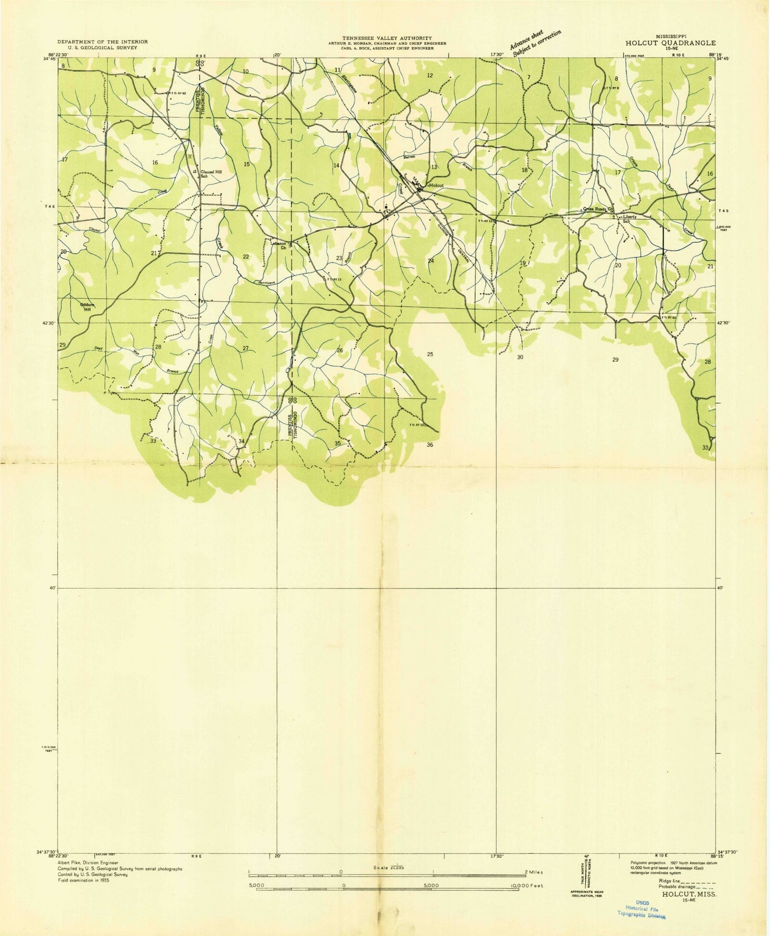
Historical USGS topographic quad map of Paden in the state of Mississippi. Map scale may vary for some years, but is generally around 1:24,000. Print size is approximately 24" x 27"
This quadrangle is in the following counties: Prentiss, Tishomingo.
The map contains contour lines, roads, rivers, towns, and lakes. Printed on high-quality waterproof paper with UV fade-resistant inks, and shipped rolled.
Contains the following named places: Barnett Branch, Barnett Knob, Belue Cemetery, Black Branch, Burgess Creek, Burgess Creek Church, Burnt Mills Post Office, Burton, Burton Lake, Burton Volunteer Fire Department, Burton-New Hope Grammar School, Cairo, Cairo Volunteer Fire Department, Clausel Creek, Clausel Hill Bottom, Clausel Hill Cemetery, Clausel Hill Church, Clausel Hill School, Crossroads Church, Dead Man Branch, Divide Overlook Area, Fairview Cemetery, Fairview Church, Forked Oak Cemetery, Forked Oak Church, Friendship Church, Hill Cemetery, Holcut, Holcut School, Hurrican Branch, Hurricane Creek, King Creek, Lambert Chapel, Liberty School, Mackys Creek Canal, New Lebanon Cemetery, New Lebanon Church, Odom Hill, Paden, Paden Fire Department, Paden High School, Paden Overlook Area, Palestine Cemetery, Palestine Church, Panther Creek, Pollard Mill Branch, Reedy Branch, Shady Grove Church, South Crossroads Cemetery, Stephens Cemetery, Stricklen Cemetery, Village of Paden