MyTopo
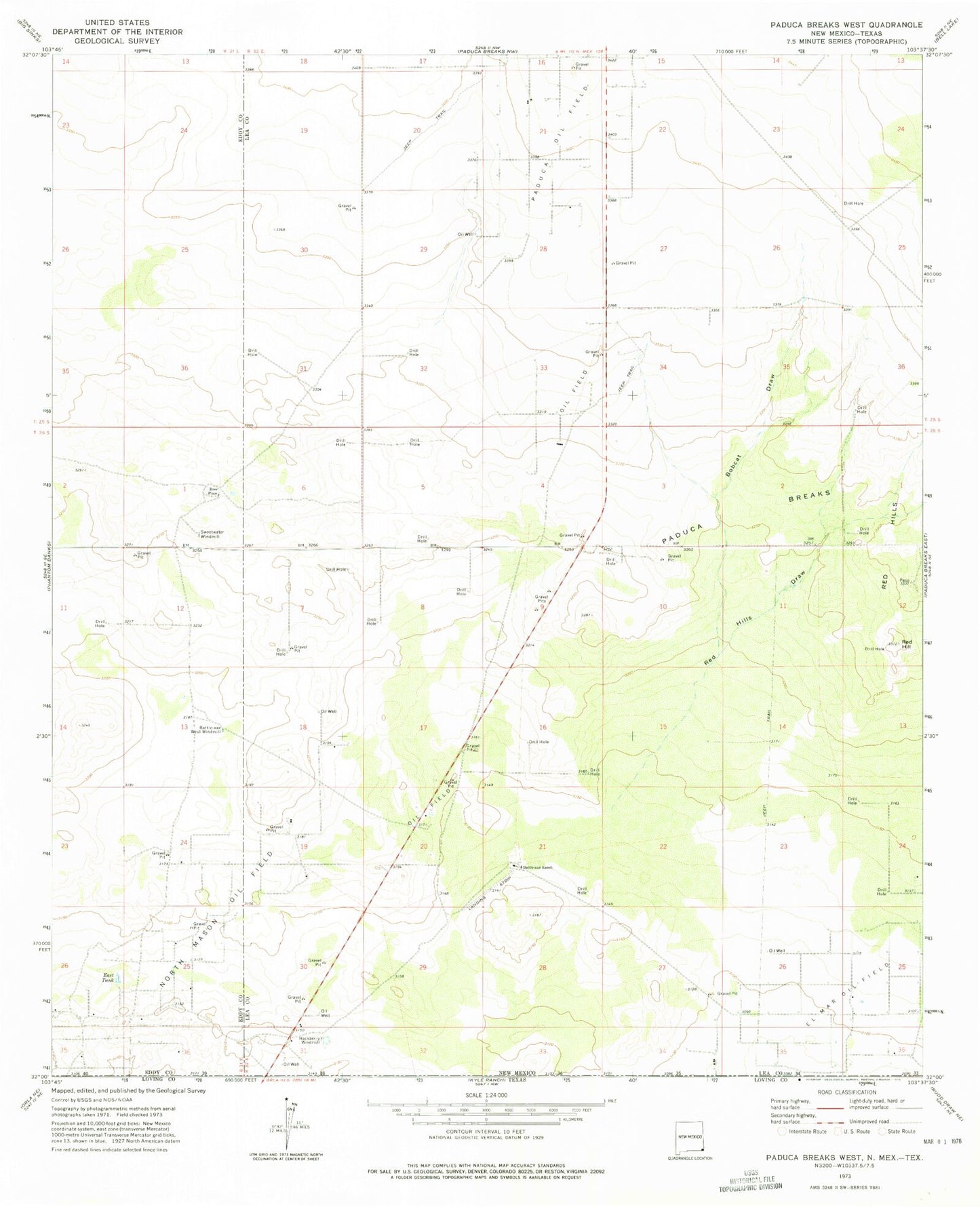
Classic USGS Paduca Breaks West New Mexico 7.5'x7.5' Topo Map
Couldn't load pickup availability
Historical USGS topographic quad map of Paduca Breaks West in the state of New Mexico. Map scale may vary for some years, but is generally around 1:24,000. Print size is approximately 24" x 27"
This quadrangle is in the following counties: Eddy, Lea, Loving.
The map contains contour lines, roads, rivers, towns, and lakes. Printed on high-quality waterproof paper with UV fade-resistant inks, and shipped rolled.
Contains the following named places: 08039 Water Well, 08040 Water Well, 08044 Water Well, 08045 Water Well, Battle-axe Ranch, Battle-axe West Windmill, Bobcat Draw, East Tank, El Mar Oil Field, Hackberry Windmill, North Mason Oil Field, Paduca Breaks, Red Hill, Red Hills Draw, Ross Place, Sweetwater Windmill