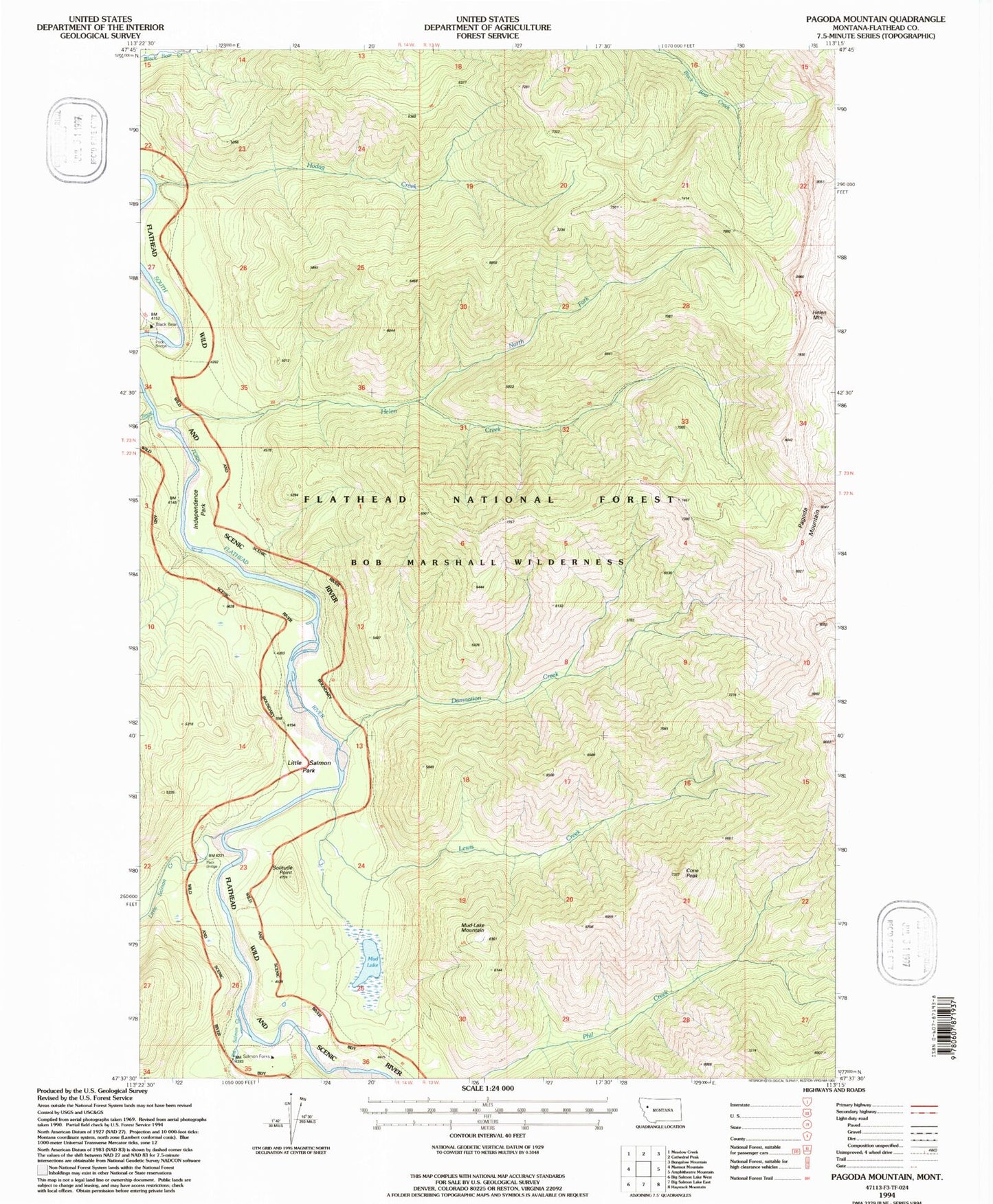
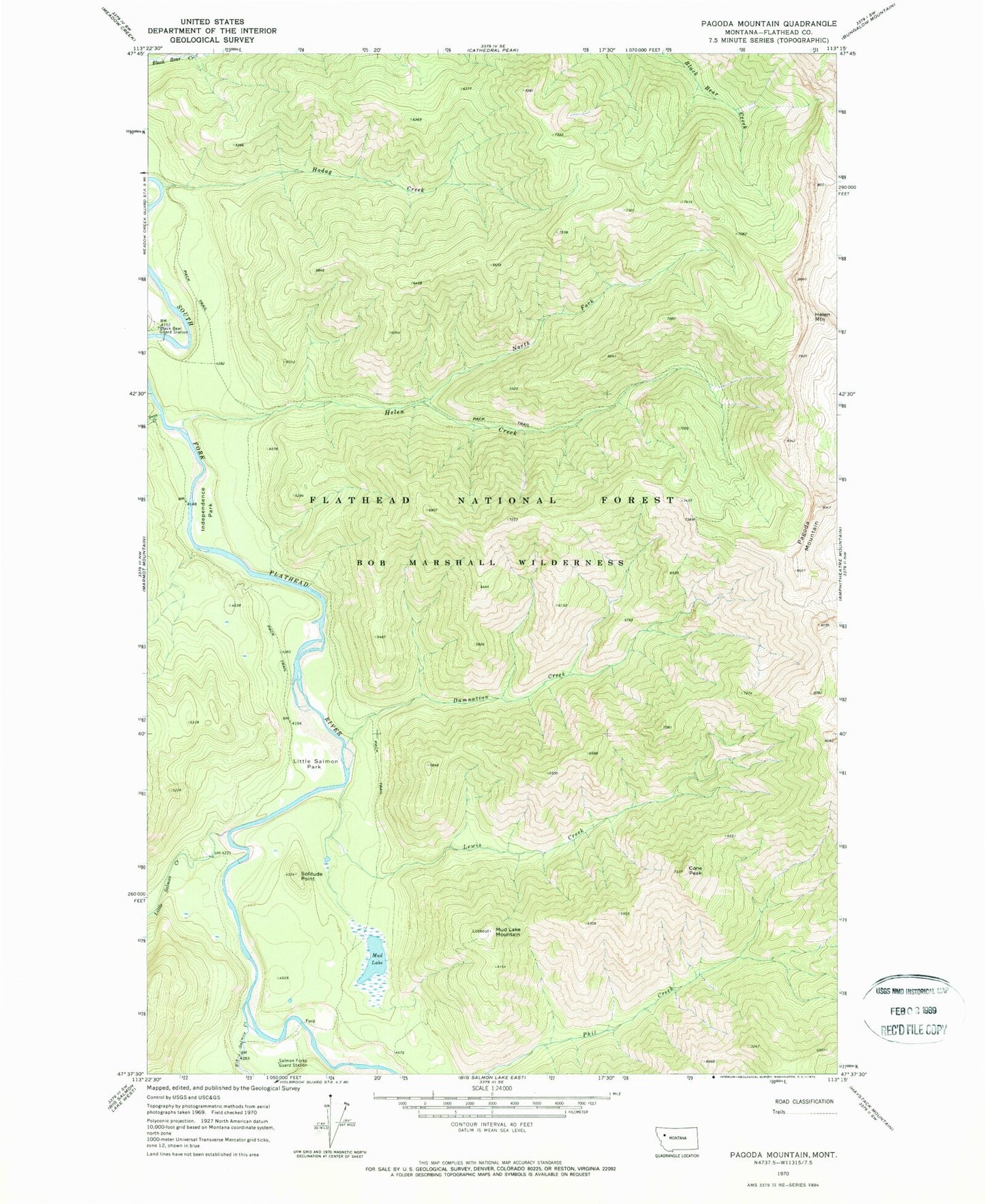
MyTopo
Classic USGS Pagoda Mountain Montana 7.5'x7.5' Topo Map
Couldn't load pickup availability
Historical USGS topographic quad map of Pagoda Mountain in the state of Montana. Typical map scale is 1:24,000, but may vary for certain years, if available. Print size: 24" x 27"
This quadrangle is in the following counties: Flathead.
The map contains contour lines, roads, rivers, towns, and lakes. Printed on high-quality waterproof paper with UV fade-resistant inks, and shipped rolled.
Contains the following named places: Big Salmon Creek, Black Bear Guard Station, Cone Peak, Damnation Creek, Helen Creek, Helen Mountain, Hodag Creek, Independence Park, Lewis Creek, Little Salmon Creek, Little Salmon Park, Mud Lake, Mud Lake Mountain, North Fork Helen Creek, Pagoda Mountain, Salmon Forks Guard Station, Snow Creek, Solitude Point, Turtlehead Mountain, Pagoda Mountain Lookout