MyTopo
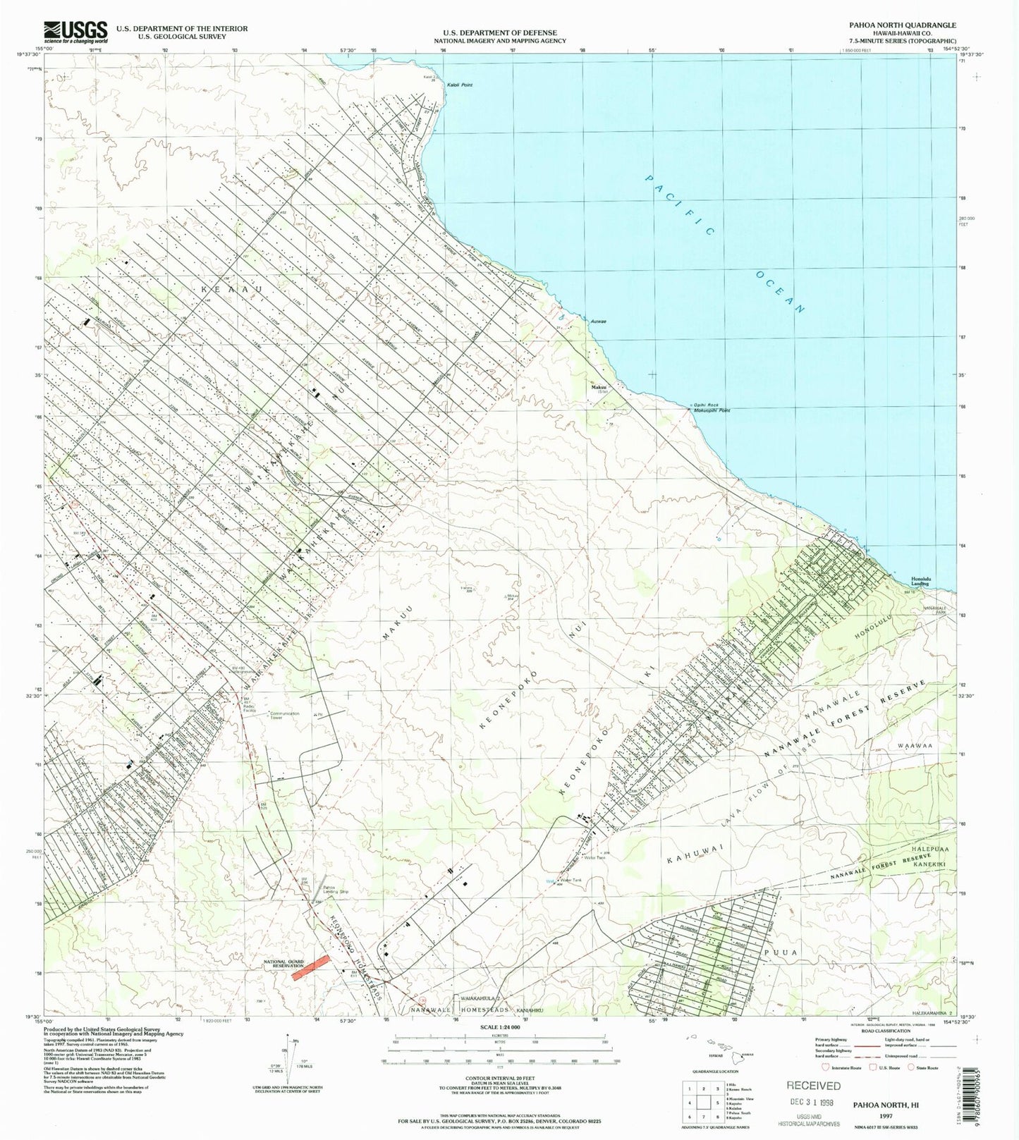
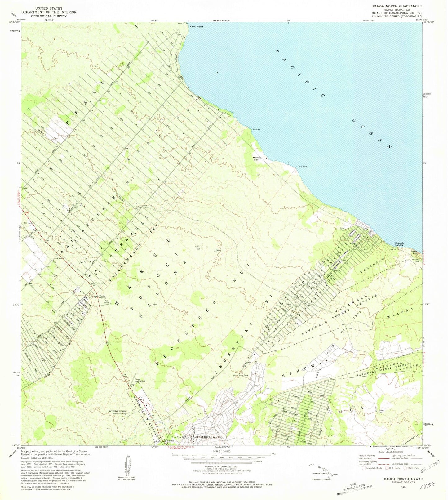
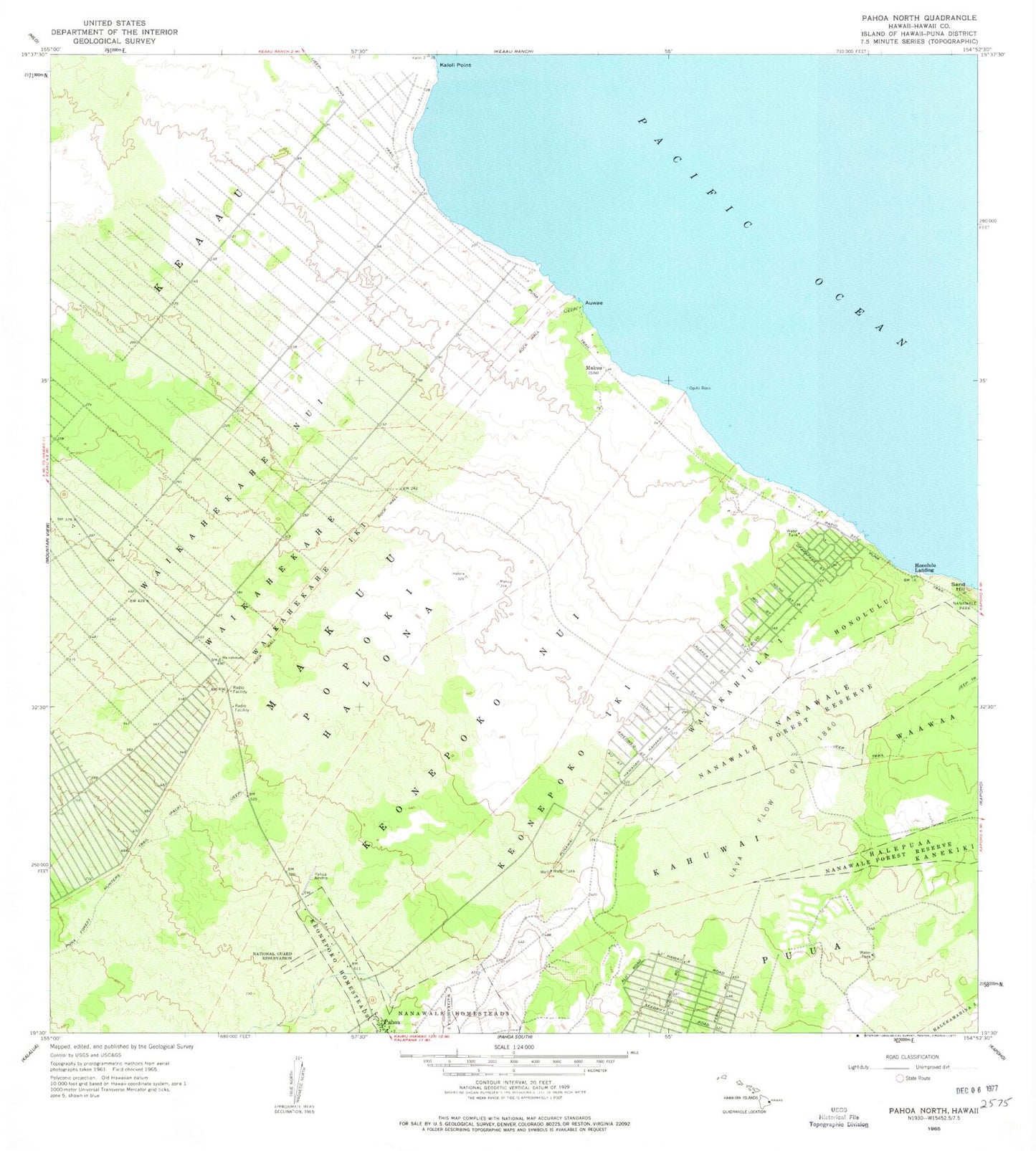
Classic USGS Pahoa North Hawaii 7.5'x7.5' Topo Map
Couldn't load pickup availability
Historical USGS topographic quad map of Pahoa North in the state of Hawaii. Map scale may vary for some years, but is generally around 1:24,000. Print size is approximately 24" x 27"
This quadrangle is in the following counties: Hawaii.
The map contains contour lines, roads, rivers, towns, and lakes. Printed on high-quality waterproof paper with UV fade-resistant inks, and shipped rolled.
Contains the following named places: Ainaloa, Ainaloa Census Designated Place, 'Auwae, Hawai'i Beaches Estates, Hawaii County Fire Department Station 10 Pahoa, Hawaii County Fire Department Station 18 Paradise Park, Hawaiian Beaches, Hawaiian Beaches Census Designated Place, Hawaiian Beaches Park, Hawaiian Beaches Volunteer Fire Station 10A, Hawaiian Paradise Park, Hawaiian Paradise Park Census Designated Place, Honolulu, Honolulu Landing, Hui Hanalike Park, Kahuwai, Kaloli Point, Keauhou Bay, Keonepoko Homesteads, Keonepoko Iki, Keonepoko Nui, Lava Flow of 1840, Maku'u, Maku'u Hawaiian Home Land, Makuu Station, Moku'opihi Point, Nanawale, Nanawale Estates, Nanawale Estates Census Designated Place, Nanawale Forest Reserve, Nanawale Homesteads, National Guard Reservation, 'Opihi Rock, Pahoa Landing Strip, Pahoa Police Station, Paradise Park Volunteer Fire Station 18A, Puna Forest Hunters Trail, Puna Hawaiian Home Land, Puna Trail, Puua, Tiki Gardens, Twentymile Station, Twentyone Mile Station, Twentytwo Mile Station, Waiakahiula, Waiakahiula One, Waikahekahe, Waikahekahe Nui, ZIP Code: 96749