MyTopo
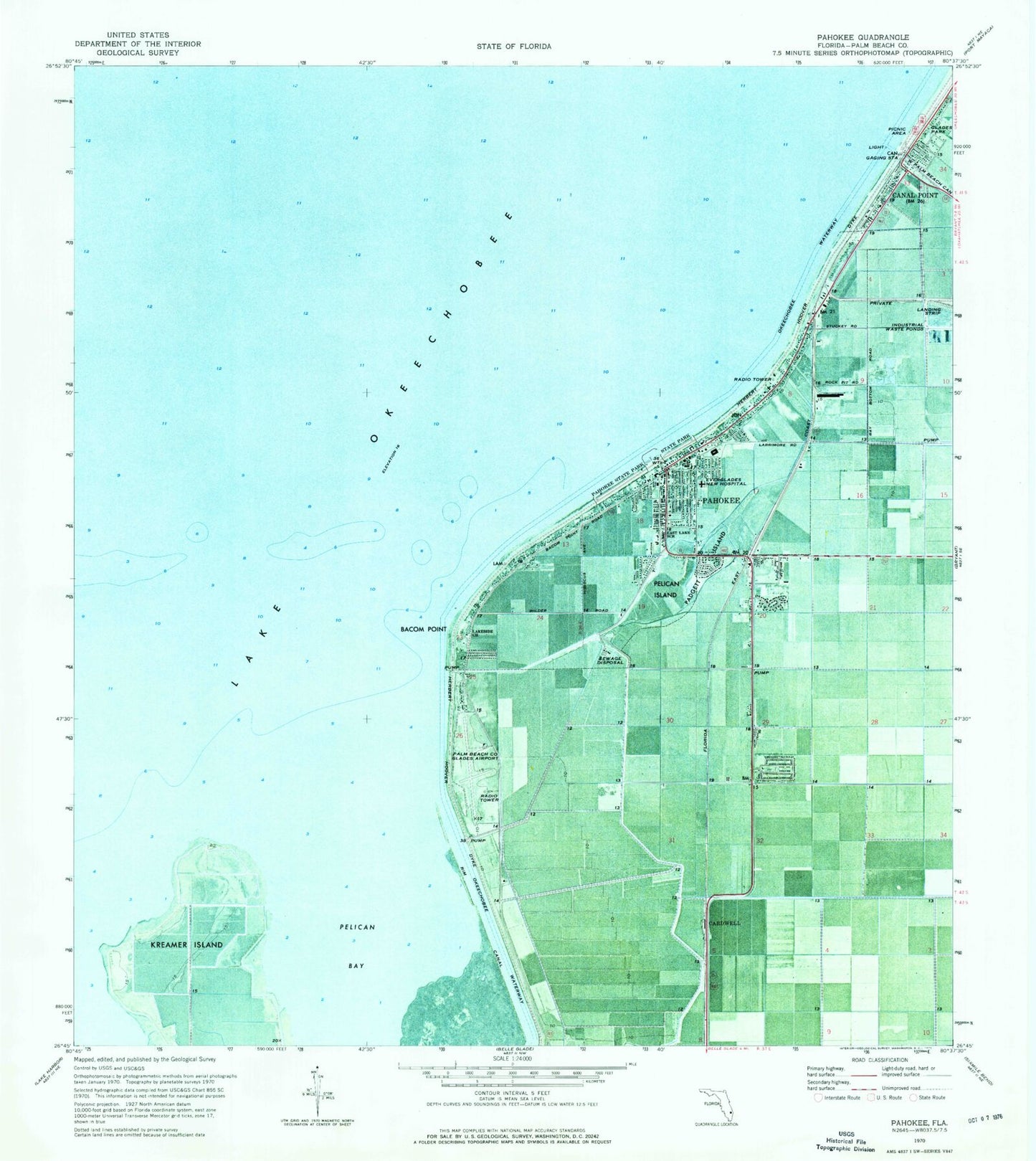
Classic USGS Pahokee Florida 7.5'x7.5' Topo Map
Couldn't load pickup availability
Historical USGS topographic quad map of Pahokee in the state of Florida. Map scale may vary for some years, but is generally around 1:24,000. Print size is approximately 24" x 27"
This quadrangle is in the following counties: Palm Beach.
The map contains contour lines, roads, rivers, towns, and lakes. Printed on high-quality waterproof paper with UV fade-resistant inks, and shipped rolled.
Contains the following named places: Bacom Point, Barfield Mobile Home Park, Belle Glade-Pahokee Division, Canal Point, Canal Point Elementary School, Canal Point Post Office, Cardwell, City of Pahokee, Duncan Padgett Mobile Home Park, East Lake School, Everglades Regional Medical Center, Fremd Village, Fremd Village-Padgett Island Census Designated Place, Glades Park, Hanson Mobile Home Park, Herring Mobile Home Park, Keen Mobile Home Park, King Bee Trailer Park, Kreamer Island, Lakeshore Trailer Park, Lakeside Church, May's Mobile Home Park, Moss Mobile Home Park, Murphy's Mobile Home Park, Padgett Island, Pahokee, Pahokee Breakwater Park Marina, Pahokee Community Police, Pahokee Elementary School, Pahokee Junior-Senior High School, Pahokee Police Department, Pahokee Post Office, Pahokee State Park, Pahokee Trailer Park, Palm Beach County Fire Rescue Department Station 72, Palm Beach County Glades Airport, Palm Beach County Library System Loula V York Branch Library, Palm Beach County Sheriff's Office District 12 City of Pahokee, Pelican Bay, Pelican Island, Pelican Lake Railroad Station, Pelican River Mobile Home Park, Shirley's Trailer Park, Ushers Trailer Park