MyTopo
Classic USGS Pahroc Summit Pass Nevada 7.5'x7.5' Topo Map
Regular price
$16.95
Regular price
Sale price
$16.95
Unit price
per
Couldn't load pickup availability
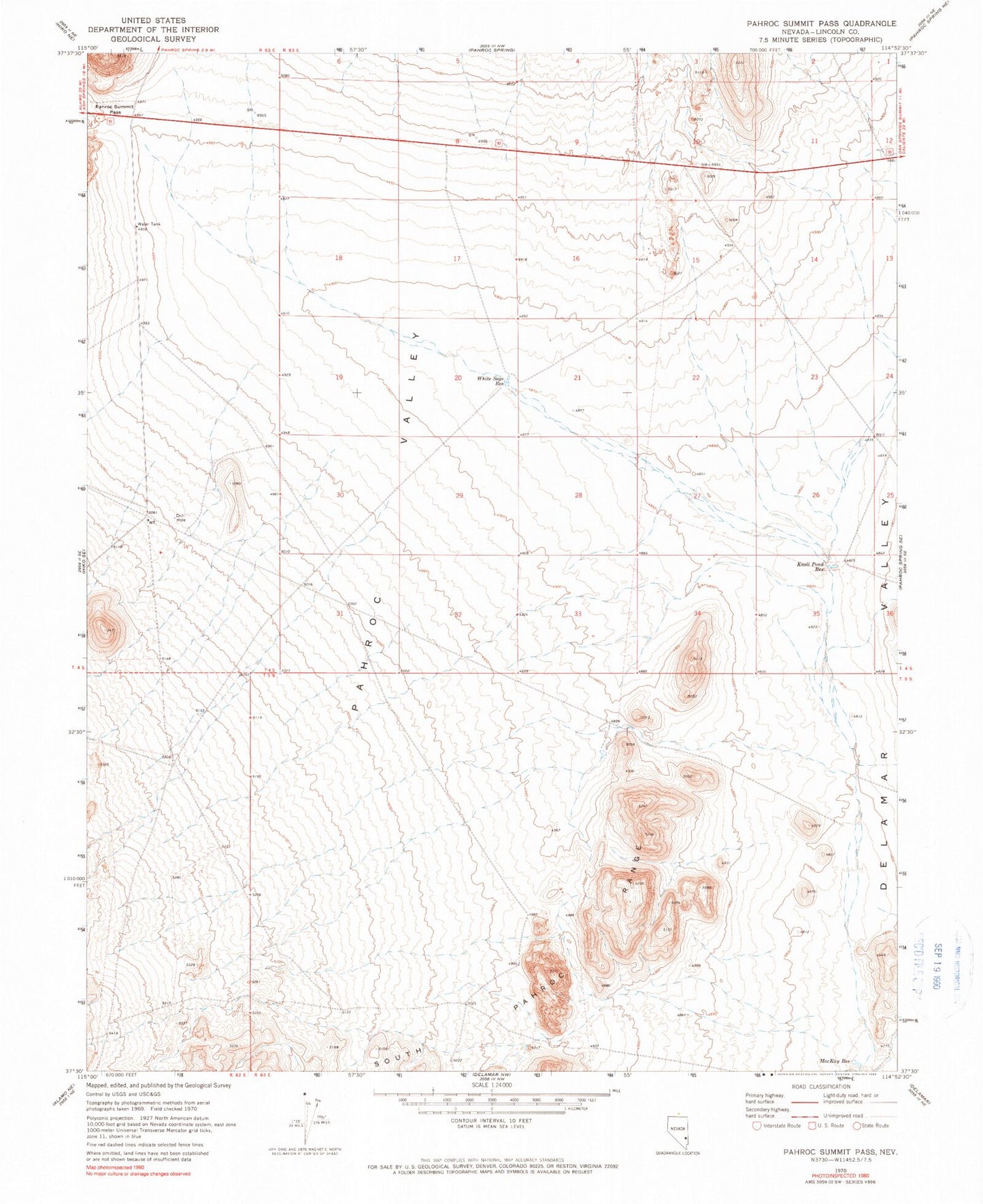
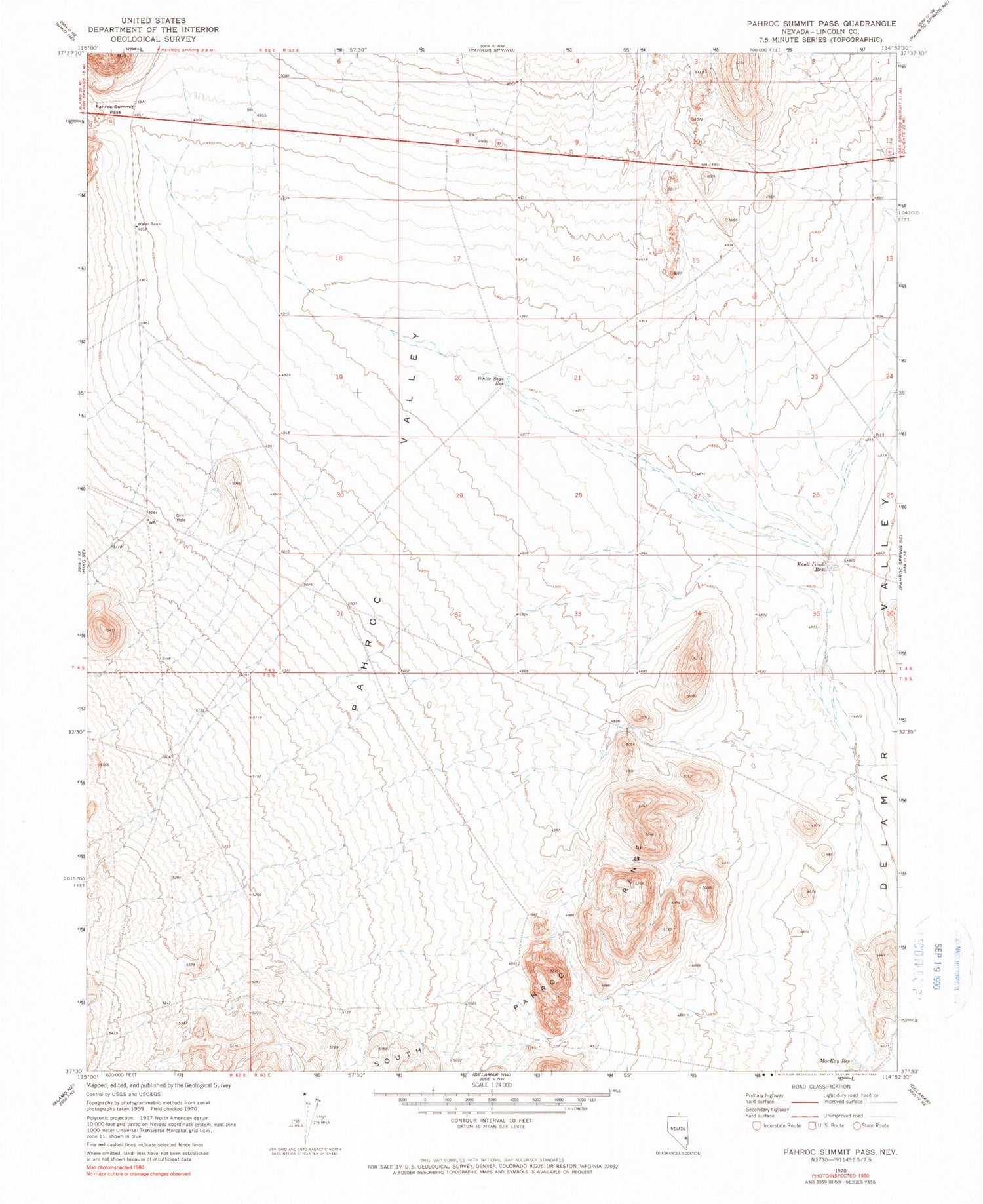
Historical USGS topographic quad map of Pahroc Summit Pass in the state of Nevada. Map scale may vary for some years, but is generally around 1:24,000. Print size is approximately 24" x 27"
This quadrangle is in the following counties: Lincoln.
The map contains contour lines, roads, rivers, towns, and lakes. Printed on high-quality waterproof paper with UV fade-resistant inks, and shipped rolled.
Contains the following named places: Cottonwood Wash, East Boulder Spring, Knoll Pond Reservoir, MacKay Reservoir, Pahroc Valley, Six Mile Spring, Southside Reservoir, Thiriot Reservoir, White Sage Reservoir