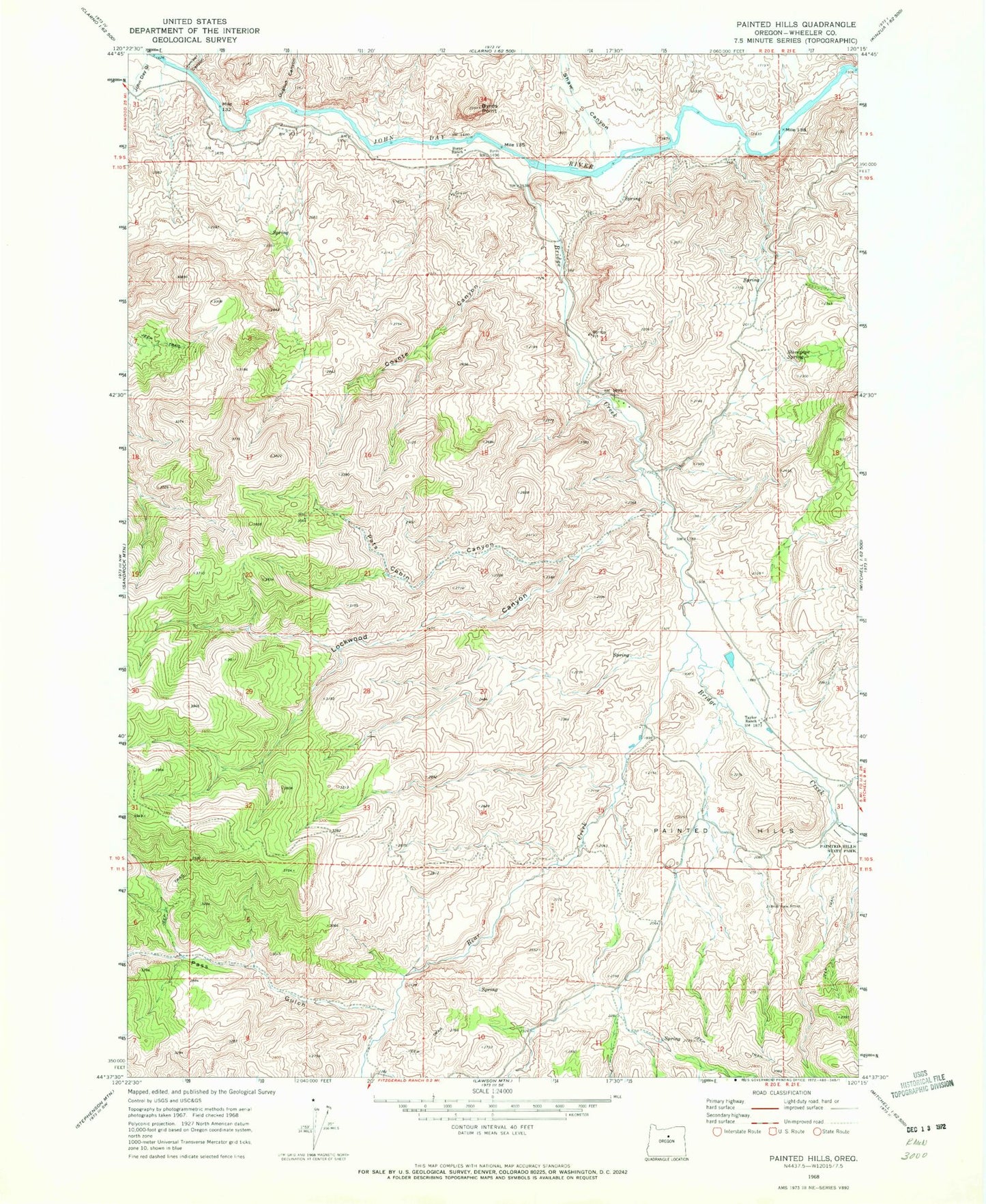
MyTopo
Classic USGS Painted Hills Oregon 7.5'x7.5' Topo Map
Couldn't load pickup availability
Historical USGS topographic quad map of Painted Hills in the state of Oregon. Map scale may vary for some years, but is generally around 1:24,000. Print size is approximately 24" x 27"
This quadrangle is in the following counties: Wheeler.
The map contains contour lines, roads, rivers, towns, and lakes. Printed on high-quality waterproof paper with UV fade-resistant inks, and shipped rolled.
Contains the following named places: Bear Creek, Bridge Creek, Bridge Creek Post Office, Brown Grotto, Burnt Ranch, Burnt Ranch Boat Ramp, Burnt Ranch Post Office, Byrds Point, Carroll Rim, Coyote Canyon, Dugout Canyon, John Day Gulch, Juniper Canyon, Lockwood Canyon, Painted Hills, Painted Hills Dam, Painted Hills Reservoir, Painted Hills State Park, Pass Gulch, Pats Cabin Canyon, Priest Hole Boat Launch, Rainbow Hill, Red Scar Knoll, Seward Post Office, Shaw Canyon, Stovepipe Spring, Taylor Ranch