MyTopo
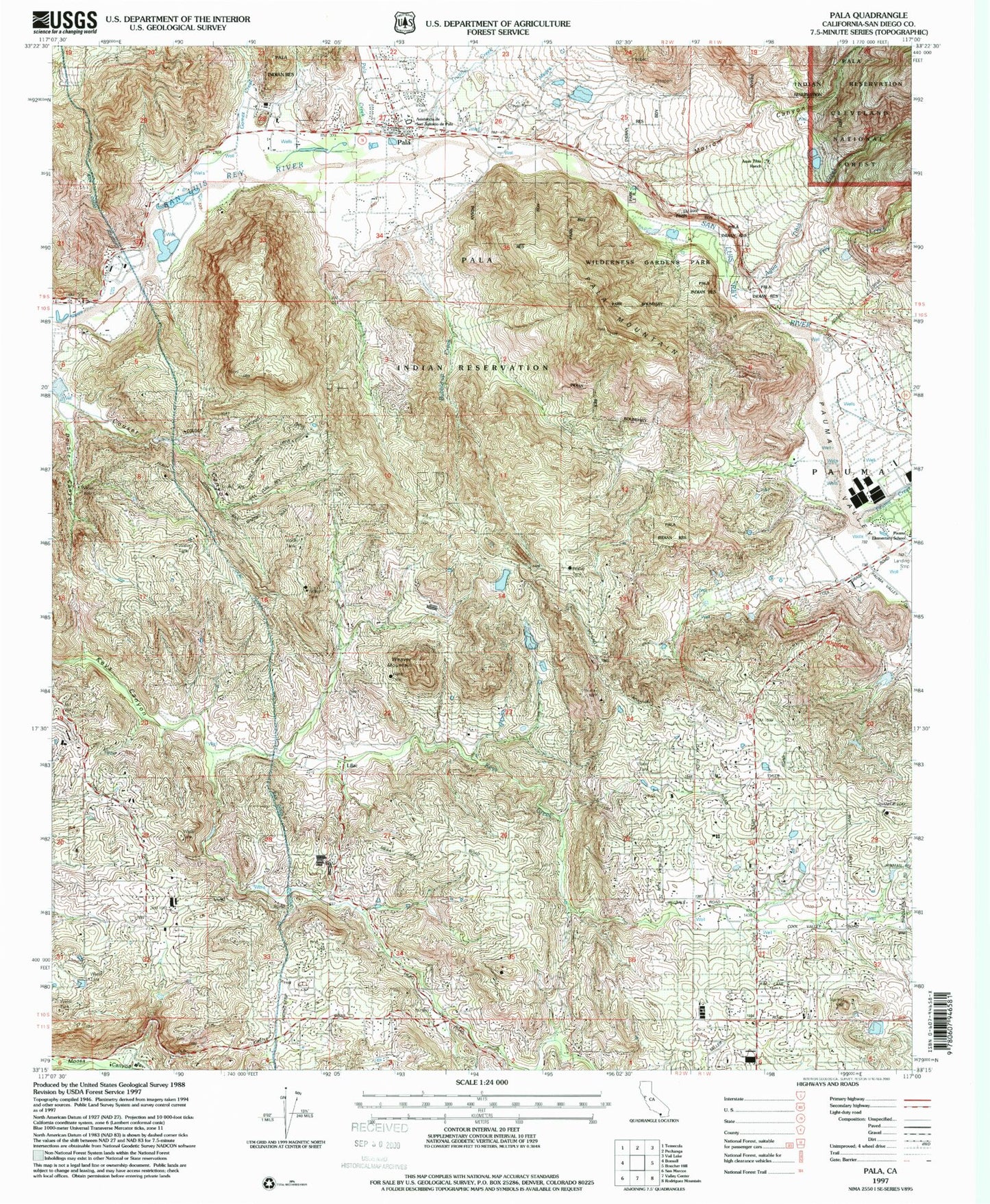
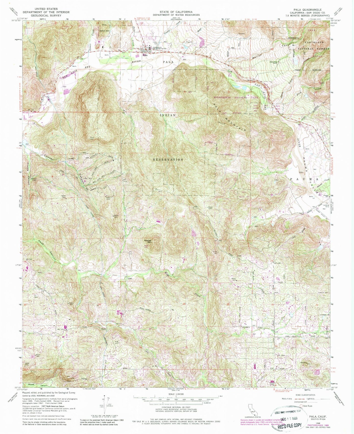
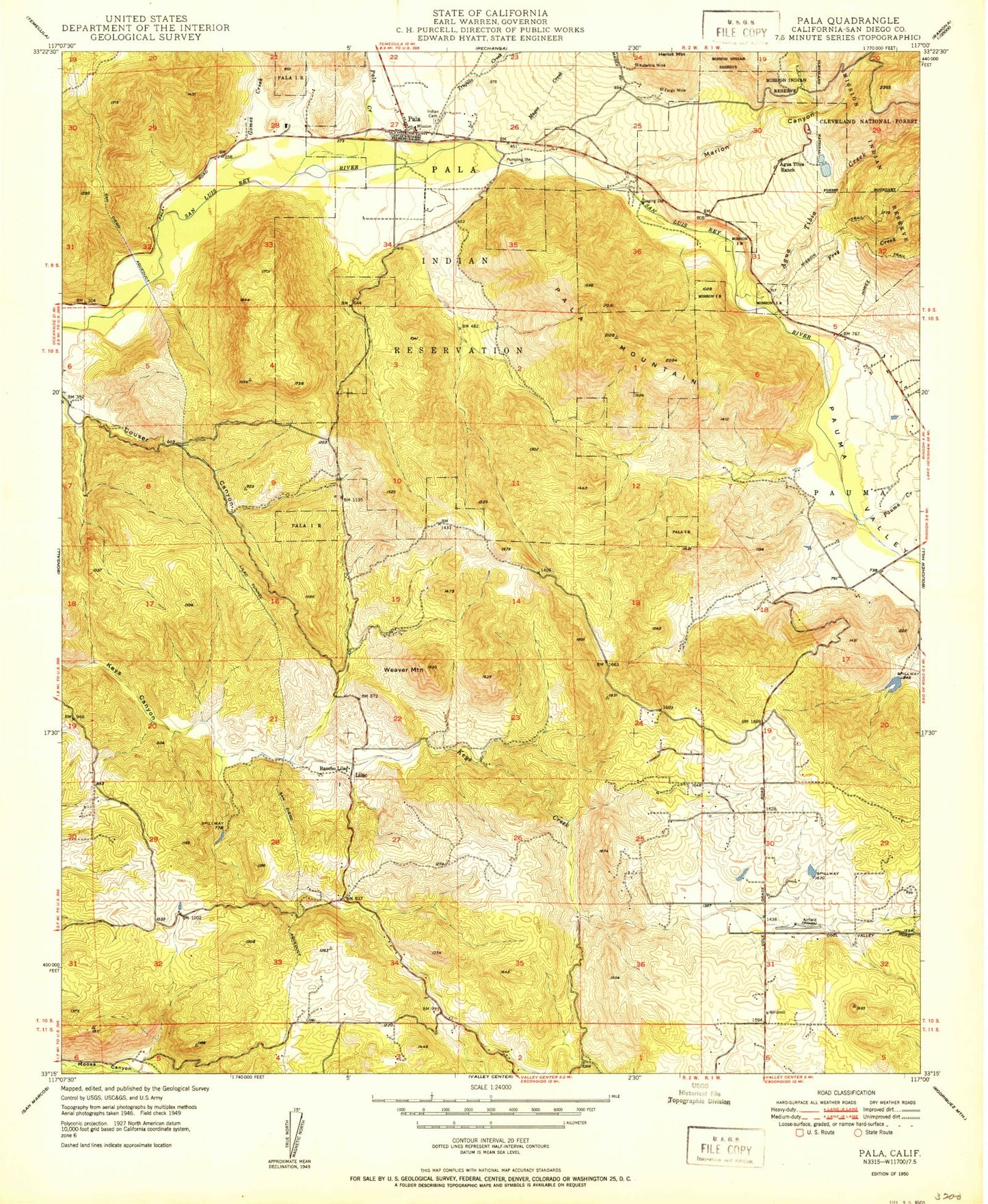
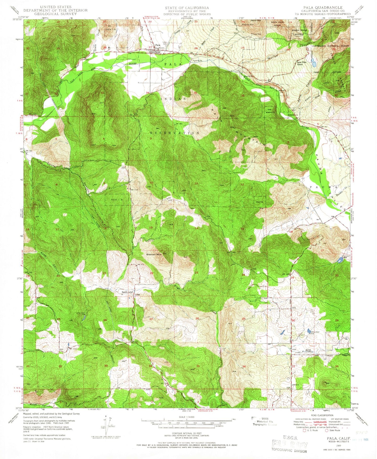
Classic USGS Pala California 7.5'x7.5' Topo Map
Couldn't load pickup availability
Historical USGS topographic quad map of Pala in the state of California. Map scale may vary for some years, but is generally around 1:24,000. Print size is approximately 24" x 27"
This quadrangle is in the following counties: San Diego.
The map contains contour lines, roads, rivers, towns, and lakes. Printed on high-quality waterproof paper with UV fade-resistant inks, and shipped rolled.
Contains the following named places: Agua Tibia 849 Dam, Agua Tibia Creek, Agua Tibia Ranch, Asistencia de San Antonio de Pala, Blackinton Airport, Bubble-up Creek, Double Canyon, Frey Creek, Gomez Creek, Gross Egg Ranch, Lilac, Lilac Oaks Campground, Lilac Tunnel, Lilac Valley School, Magee Creek, Marion Canyon, Mission San Antonio de Pala Cemetery, Pala, Pala Census Designated Place, Pala Creek, Pala Guard Station, Pala Indian Reservation Cemetery, Pala Mountain, Pala Post Office, Pala Reservation, Pala Reservation Fire Department, Pauma Creek, Pauma Elementary School, Pauma Valley, Pauma Valley Air Park, Pauma Valley Division, Pauma Valley School, San Diego Aqueduct, Trujillo Creek, Weaver Mountain, Wilderness Gardens Park, ZIP Code: 92082