MyTopo
Classic USGS Palacios NE Texas 7.5'x7.5' Topo Map
Couldn't load pickup availability
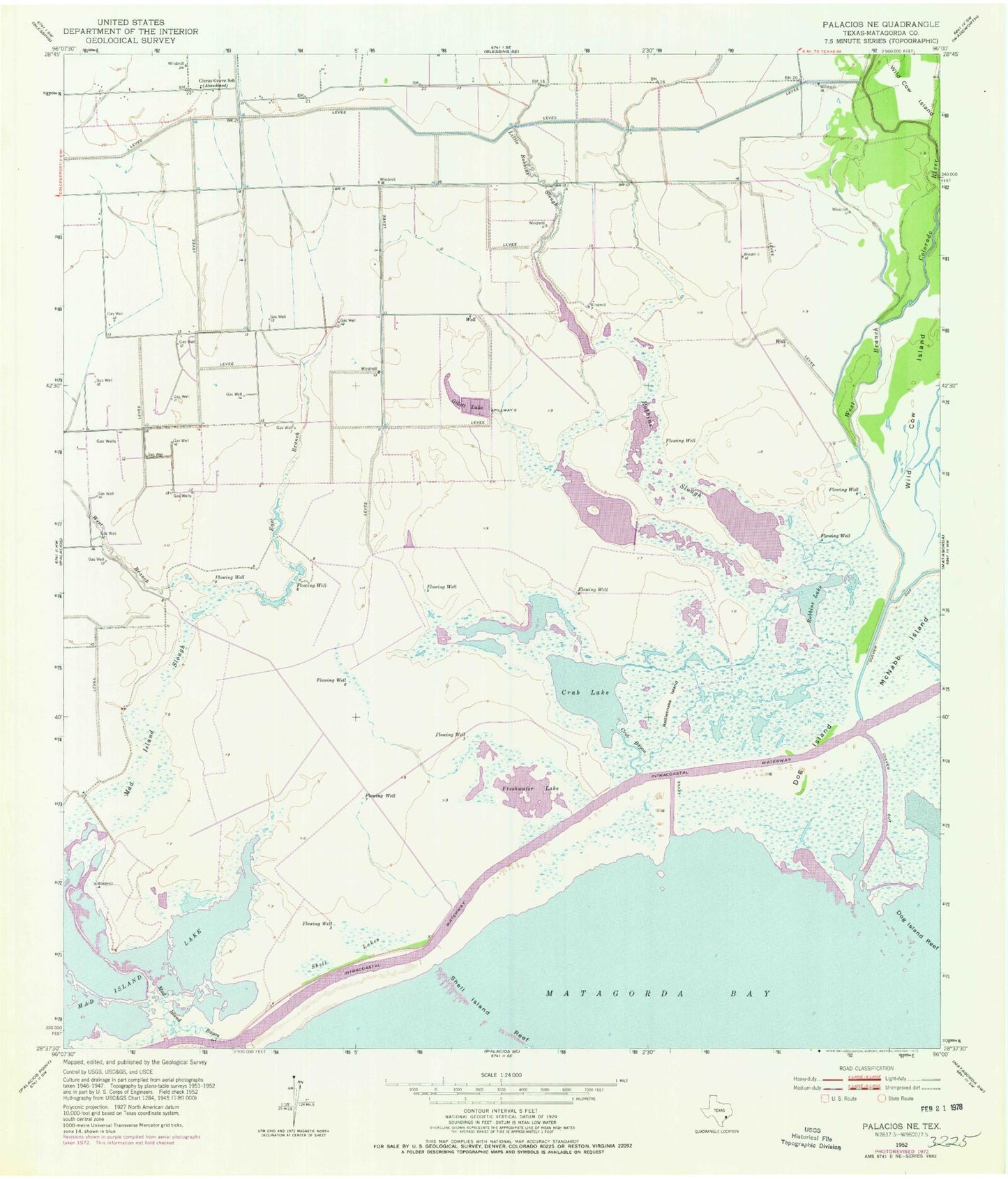
Historical USGS topographic quad map of Palacios NE in the state of Texas. Map scale may vary for some years, but is generally around 1:24,000. Print size is approximately 24" x 27"
This quadrangle is in the following counties: Matagorda.
The map contains contour lines, roads, rivers, towns, and lakes. Printed on high-quality waterproof paper with UV fade-resistant inks, and shipped rolled.
Contains the following named places: Citrus Grove, Citrus Grove School, Cooling Water Reservoir Dam, Crab Bayou, Crab Lake, Culver Cut, Dog Island, East Branch Mad Island Slough, Freshwater Lake, Gillett Lake, Little Robbins Slough, Mad Island Bayou, Mad Island Lake, Mad Island Slough, Mad Island Wildlife Management Area, McNabb Island, Rattlesnake Island, Robbins Lake, Robbins Slough, Shell Island Reef, Shell Lakes, West Branch Mad Island Slough