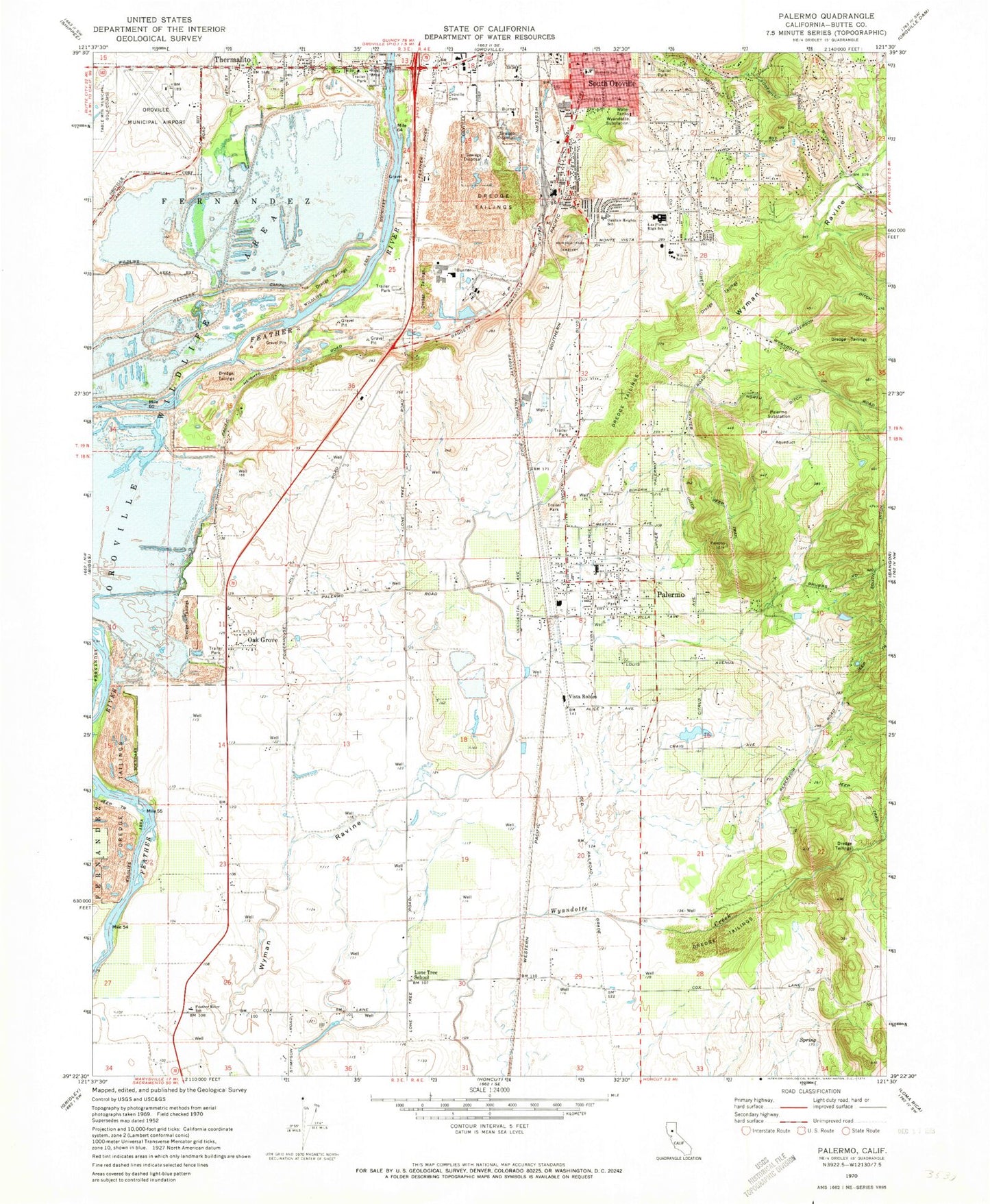
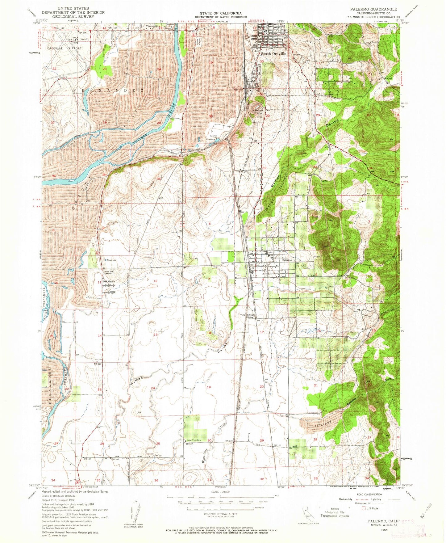
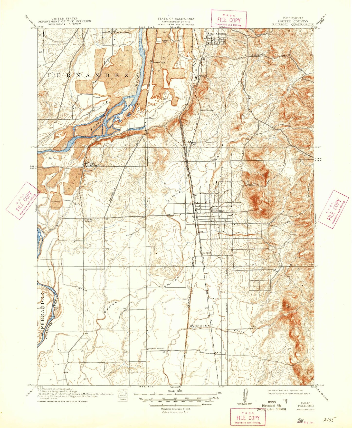
MyTopo
Classic USGS Palermo California 7.5'x7.5' Topo Map
Couldn't load pickup availability
Historical USGS topographic quad map of Palermo in the state of California. Map scale may vary for some years, but is generally around 1:24,000. Print size is approximately 24" x 27"
This quadrangle is in the following counties: Butte.
The map contains contour lines, roads, rivers, towns, and lakes. Printed on high-quality waterproof paper with UV fade-resistant inks, and shipped rolled.
Contains the following named places: Apostolic Church, Burbank School, Burts Ferry, Butte County Fire Department Station 72, Center Ditch, Church of God in Christ, City of Oroville, Clay Pit State Vehicular Recreation Area, El Medio Fire Department, Feather River Adventist School, First Christian Church, First Responder Emergency Medical Services Station 21, Garden Ranch, Grace Baptist Church, Helen M Wilcox Elementary School, Henderson Ditch, Holy Church of God, Las Plumas High School, Lava Beds, Lone Tree School, Memorial Park Cemetery, Mooretown Rancheria, Natomas 100 Pit, North Ditch, Oak Grove, Oakdale Heights Elementary School, Oroville Army Air Field, Oroville Cemetery, Oroville Municipal Airport, Oroville Wildlife Area, Pacific Heights Pit, Palermo, Palermo Census Designated Place, Palermo Division, Palermo Park, Palermo Post Office, Palermo School, Palermo Substation, Pentecostal Church of God, Siller Bros Inc Airport, South Ditch, South Oroville, South Oroville Census Designated Place, The Church of Jesus Christ of Latter Day Saints, Thermalito Census Designated Place, Union School, Vista Robles, Western Canal, Wyandotte Substation, ZIP Code: 95968