MyTopo
Classic USGS Palermo Maine 7.5'x7.5' Topo Map
Couldn't load pickup availability
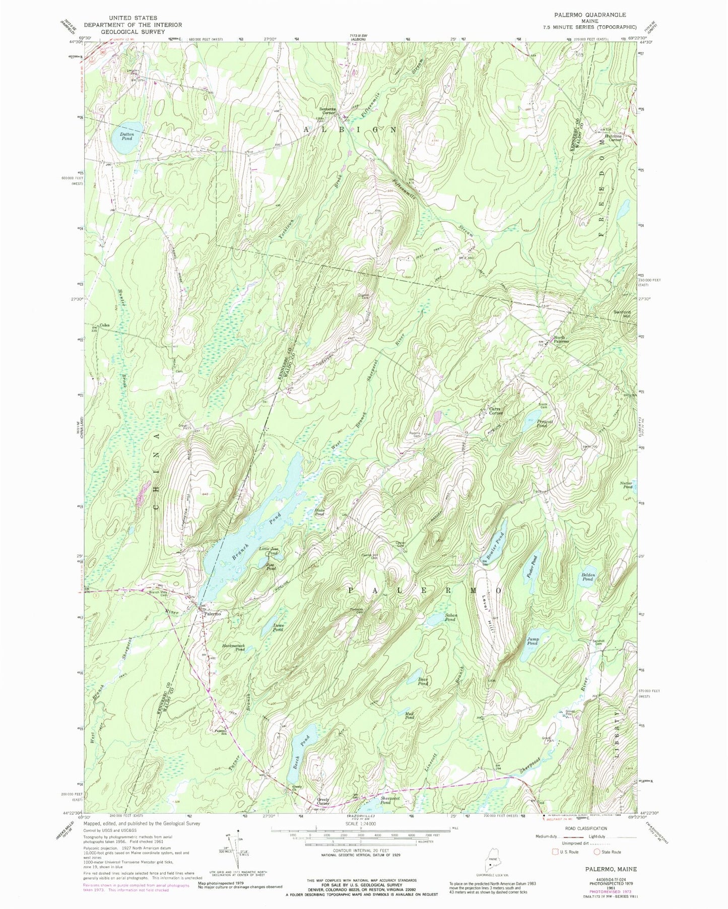
Historical USGS topographic quad map of Palermo in the state of Maine. Map scale may vary for some years, but is generally around 1:24,000. Print size is approximately 24" x 27"
This quadrangle is in the following counties: Kennebec, Waldo.
The map contains contour lines, roads, rivers, towns, and lakes. Printed on high-quality waterproof paper with UV fade-resistant inks, and shipped rolled.
Contains the following named places: Bear Pond, Beech Pond, Belden Pond, Blake Pond, Bowler Pond, Branch Mills Cemetery, Branch Pond, Carrs Corner, Center Cemetery, Coles, Dennis Hill Cemetery, Dowe Pond, Dutton Pond, Foster Pond, Greely Church, Greely Corner, Hackmatack Pond, Hutchins Corner, Jose Pond, Jump Pond, Level Hill, Libby Hill Cemetery, Lincoln Cemetery, Little Jose Pond, Mill Dam, Mud Pond, New Greeley Corner Cemetery, North Palermo, Old Greeley Corner Cemetery, Osgood Cemetery, Palermo, Palermo Consolidated School, Palermo First Respond Ambulance Service, Palermo Post Office, Palermo Volunteer Fire Department Central Station, Parmeter Cemetery, Perkins Cemetery, Pleasant Ridge Cemetery, Prescott Pond, Saban Pond, Sanford Hill, Sennetts Corner, Smith Cemetery, Town of Palermo, Yorktown Brook, ZIP Code: 04354