MyTopo
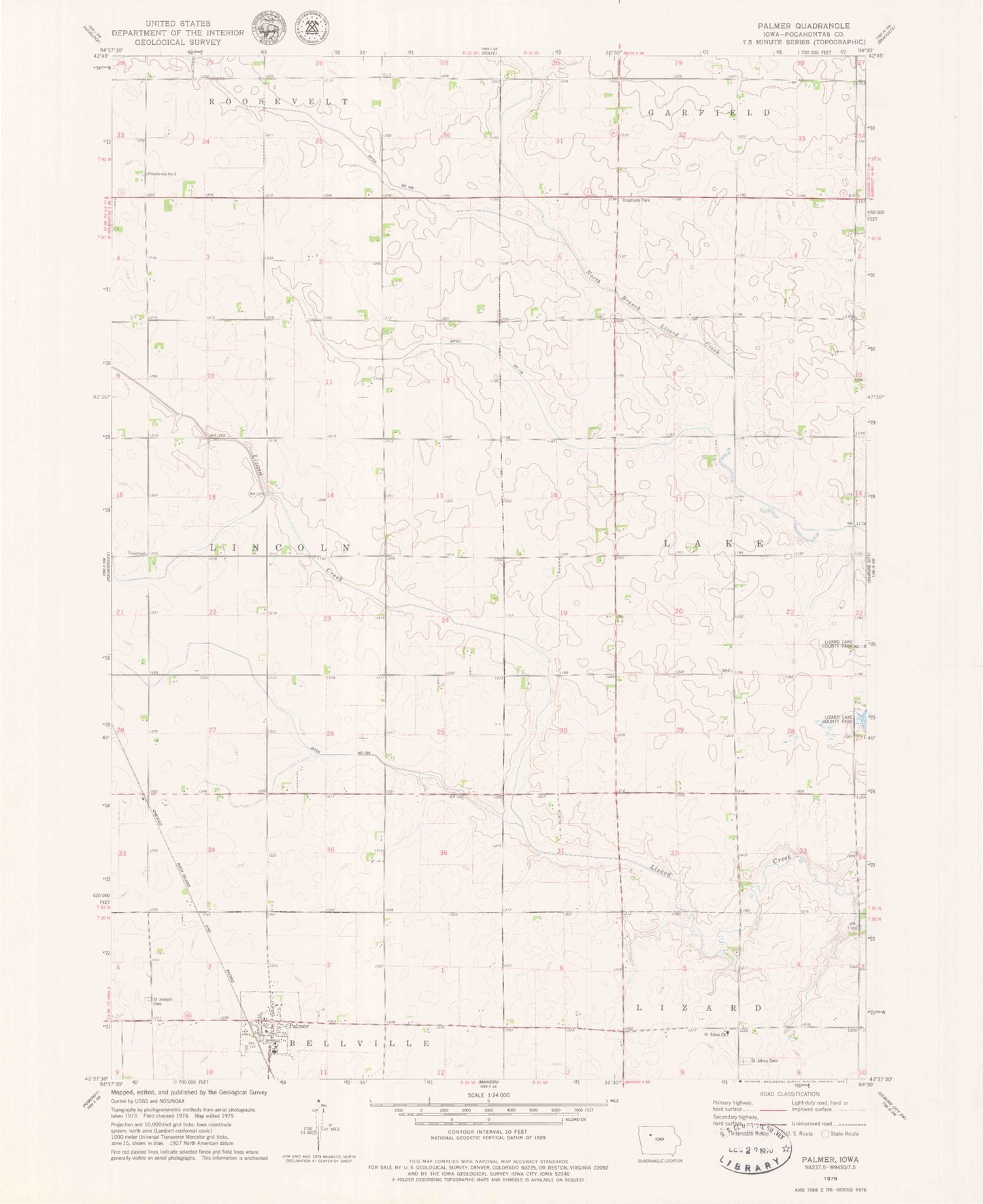
Classic USGS Palmer Iowa 7.5'x7.5' Topo Map
Couldn't load pickup availability
Historical USGS topographic quad map of Palmer in the state of Iowa. Map scale may vary for some years, but is generally around 1:24,000. Print size is approximately 24" x 27"
This quadrangle is in the following counties: Pocahontas.
The map contains contour lines, roads, rivers, towns, and lakes. Printed on high-quality waterproof paper with UV fade-resistant inks, and shipped rolled.
Contains the following named places: Buda, Buda Post Office, City of Palmer, Drainage Ditch Number 116, Drainage Ditch Number 164, Drainage Ditch Number 169, Faith Lutheran Church, Lizard, New Co-op Elevator, Palmer, Palmer Fire Department, Palmer Post Office, Palmer Public Library, Palmer-Pomeroy Middle School, Saint Johns Church, Saint Johns Lutheran Cemetery, Saint Josephs Cemetery, Toben Wildlife Preserve, Township of Lake, Township of Lincoln, ZIP Code: 50571