MyTopo
Classic USGS Palmerton Pennsylvania 7.5'x7.5' Topo Map
Couldn't load pickup availability
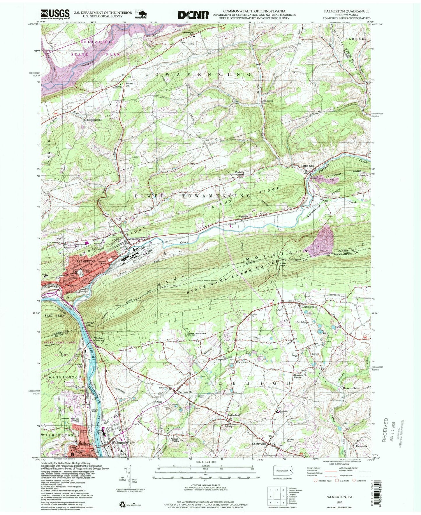
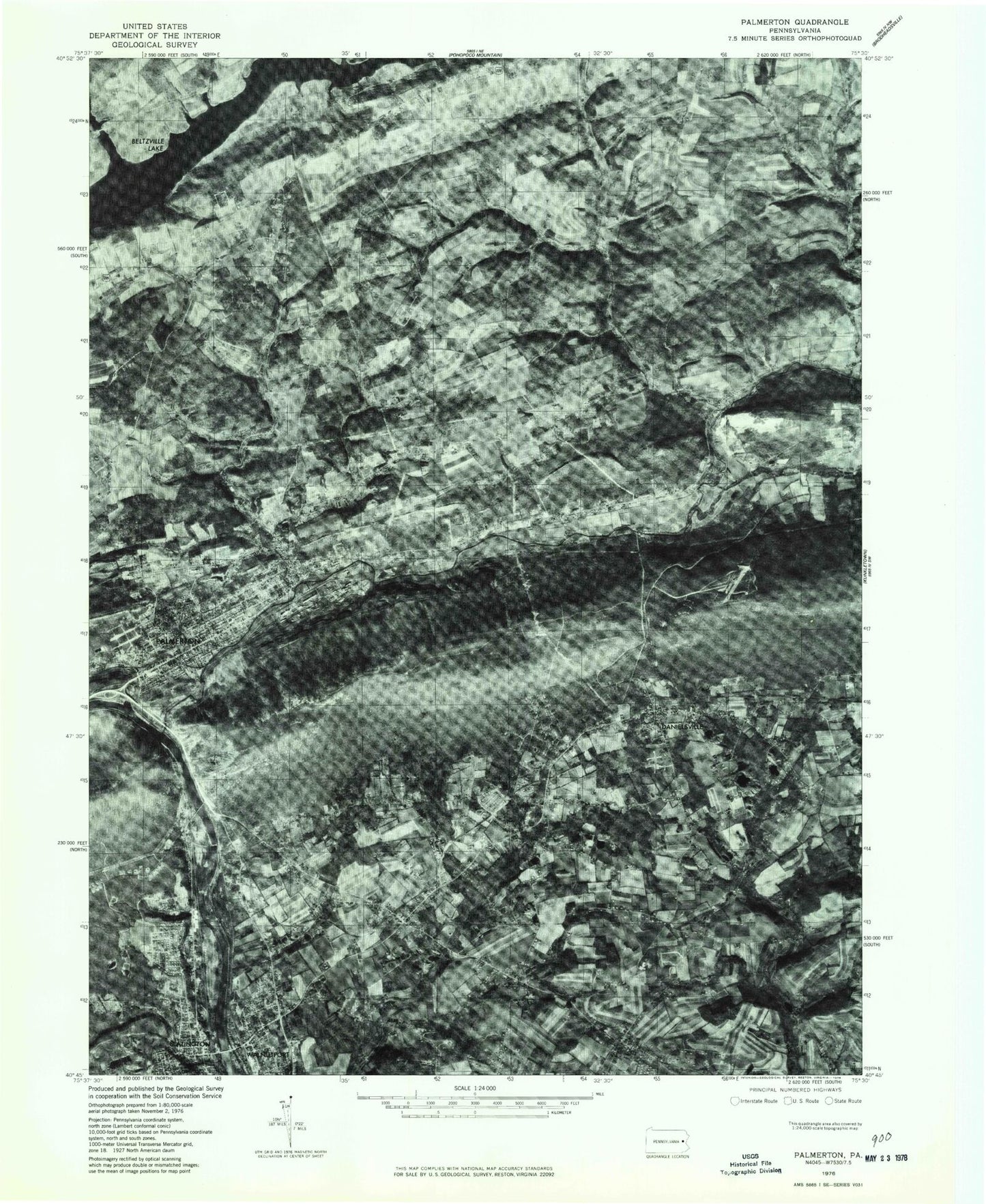
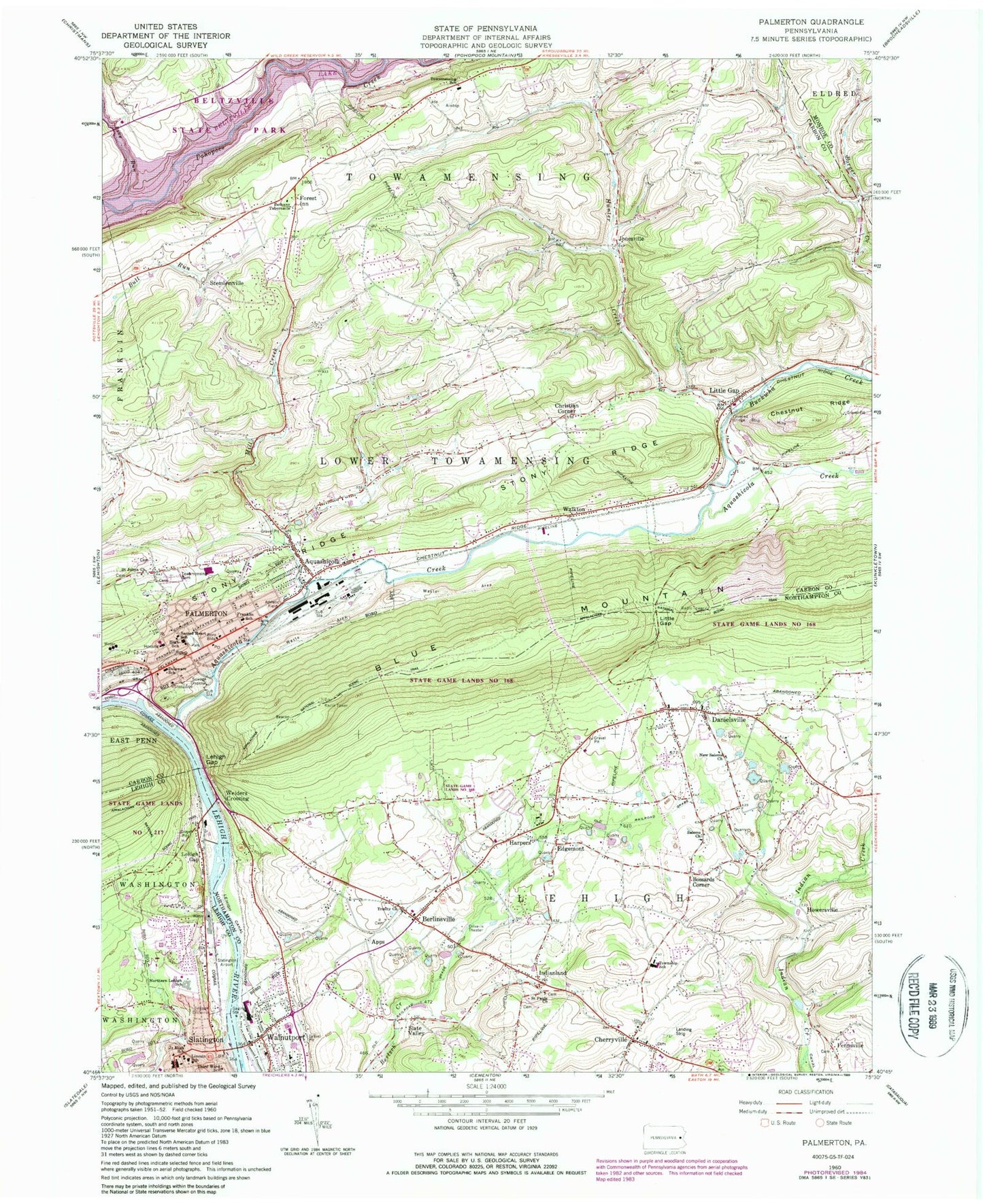
Historical USGS topographic quad map of Palmerton in the state of Pennsylvania. Typical map scale is 1:24,000, but may vary for certain years, if available. Print size: 24" x 27"
This quadrangle is in the following counties: Carbon, Lehigh, Monroe, Northampton.
The map contains contour lines, roads, rivers, towns, and lakes. Printed on high-quality waterproof paper with UV fade-resistant inks, and shipped rolled.
Contains the following named places: Aquashicola, Aquashicola Creek, Berlinsville, Bethany Tabernacle, Borger Creek, Bossards Corner, Cherryville, Danielsville, Edgemont, Franklin School, Harpers, Hunter Creek, Indianland, Lincoln School, Little Gap, Mill Creek, New Salems Church, Palmerton, Sacred Heart School, Saint Johns Church Cemetery, Saint Pauls Church, Salems Church, Slate Valley, Third Ward School, Towamensing Cemetery, Trinity Church, Trout Creek, Walnutport, Beltzville Lake, Forest Inn, Lehigh Canal (historical), Lehigh Gap, Lehigh Gap, Little Gap, Stony Ridge, Dieters Airport (historical), Slatington Airport, Palmerton East, Slate Valley School, Lehigh Gap School, Strohls School, Ray School (historical), Pierce School (historical), Lower Pine Run School, Lentz School, Greenzweig School, Eckhardt School, Ash School, Craigs Island (historical), Buckwha Creek, Beltzville State Park, Devils Potato Patch, Trinity Gorge, Indianola Lake, Howersville, Apps, Christian Corner, Jonesville, Stemlersville, Walkton, Weiders Crossing, Little Gap Ski Area, Preachers Camp Area, Kerns Dam, Constantini Dam, Number One Dam, Number Four Dam, Delaware Elementary School, Northern Lehigh Senior High School, Towamensing Elementary School, Stephen S Palmer Middle School, Welshtown, Devils Pulpit, Northern Lehigh Junior High School, Lehigh Township Elementary School, Palmerton Area High School, Walnutport Elementary School, Slatington Elementary School, Palmerton East Station, Lehigh Gap Station, Borough of Palmerton, Borough of Slatington, Borough of Walnutport, Township of Lower Towamensing, Township of Towamensing, Township of Lehigh, Cherryville Census Designated Place, Palmerton Fire Company District 7, Aquashicola Volunteer Fire Company District 1, Lehigh Township Volunteer Fire Company Station 47, Diamond Fire Company Station 29, Saint Luke's Hospital - Palmerton Campus, Palmerton Community Ambulance, Linda Egg Farm, Danielsville Post Office, Palmerton Post Office, Slatington Post Office, Walnutport Post Office, Aquashicola Post Office, Cherryville Post Office, Pennsylvania State Police Troop N Lehighton Station, Palmerton Borough Police Department, Walnutport Borough Police Department, Jerusalem Union Cemetery, Saint Vladimir's Lower Cemetery, Sacred Heart Roman Catholic Cemetery, Jerusalem Lutheran Cemetery, Little White Church Cemetery, Aquashicola, Aquashicola Creek, Berlinsville, Bethany Tabernacle, Borger Creek, Bossards Corner, Cherryville, Danielsville, Edgemont, Franklin School, Harpers, Hunter Creek, Indianland, Lincoln School, Little Gap, Mill Creek, New Salems Church, Palmerton, Sacred Heart School, Saint Johns Church Cemetery, Saint Pauls Church, Salems Church, Slate Valley, Third Ward School, Towamensing Cemetery, Trinity Church, Trout Creek, Walnutport, Beltzville Lake, Forest Inn, Lehigh Canal (historical), Lehigh Gap, Lehigh Gap, Little Gap, Stony Ridge, Dieters Airport (historical), Slatington Airport, Palmerton East, Slate Valley School, Lehigh Gap School, Strohls School, Ray School (historical), Pierce School (historical), Lower Pine Run School, Lentz School, Greenzweig School, Eckhardt School, Ash School, Craigs Island (historical), Buckwha Creek, Beltzville State Park, Devils Potato Patch, Trinity Gorge, Indianola Lake, Howersville, Apps, Christian Corner, Jonesville, Stemlersville, Walkton, Weiders Crossing, Little Gap Ski Area, Preachers Camp Area, Kerns Dam, Constantini Dam, Number One Dam, Number Four Dam, Delaware Elementary School, Northern Lehigh Senior High School, Towamensing Elementary School, Stephen S Palmer Middle School, Welshtown, Devils Pulpit, Northern Lehigh Junior High School, Lehigh Township Elementary School, Palmerton Area High School, Walnutport Elementary School, Slatington Elementary School, Palmerton East Station, Lehigh Gap Station, Borough of Palmerton, Borough of Slatington, Borough of Walnutport, Township of Lower Towamensing, Township of Towamensing, Township of Lehigh, Cherryville Census Designated Place, Palmerton Fire Company District 7, Aquashicola Volunteer Fire Company District 1, Lehigh Township Volunteer Fire Company Station 47, Diamond Fire Company Station 29, Saint Luke's Hospital - Palmerton Campus, Palmerton Community Ambulance, Linda Egg Farm, Danielsville Post Office, Palmerton Post Office, Slatington Post Office, Walnutport Post Office, Aquashicola Post Office, Cherryville Post Office, Pennsylvania State Police Troop N Lehighton Station, Palmerton Borough Police Department, Walnutport Borough Police Department, Jerusalem Union Cemetery, Saint Vladimir's Lower Cemetery, Sacred Heart Roman Catholic Cemetery, Jerusalem Lutheran Cemetery, Little White Church Cemetery


