MyTopo
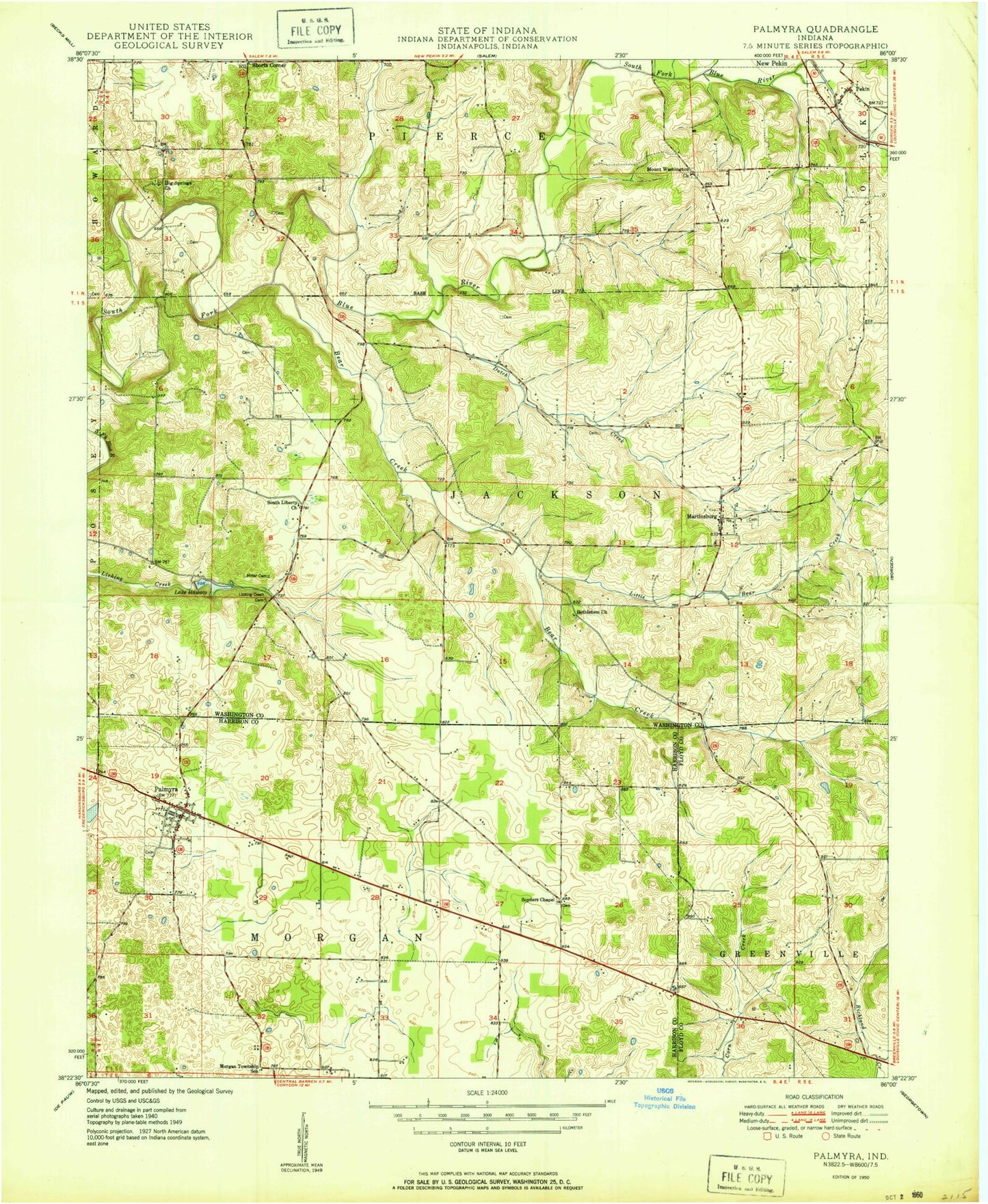
Classic USGS Palmyra Indiana 7.5'x7.5' Topo Map
Couldn't load pickup availability
Historical USGS topographic quad map of Palmyra in the state of Indiana. Map scale may vary for some years, but is generally around 1:24,000. Print size is approximately 24" x 27"
This quadrangle is in the following counties: Floyd, Harrison, Washington.
The map contains contour lines, roads, rivers, towns, and lakes. Printed on high-quality waterproof paper with UV fade-resistant inks, and shipped rolled.
Contains the following named places: Bear Creek, Bethlehem Church, Big Springs Church, Crusade School, David Voyles Cemetery, Dutch Creek, Goss Cemetery, Greenville Water Supply Dam, Hiestand Cemetery, Jackson Township Fire Department, Little Bear Creek, Martinsburg, Martinsburg Cemetery, Morgan Elementary School, Mount Washington Church, Old Pekin, Palmyra, Palmyra Cemetery, Palmyra Fire Department, Palmyra Lake, Palmyra Post Office, Palmyra Volunteer Fire Department, Punch Run, Rickard Cemetery, Shorts Corner, Snyders Chapel, South Liberty Church, Town of Palmyra, Township of Jackson, Township of Morgan, Vincennes Trail, ZIP Code: 47164