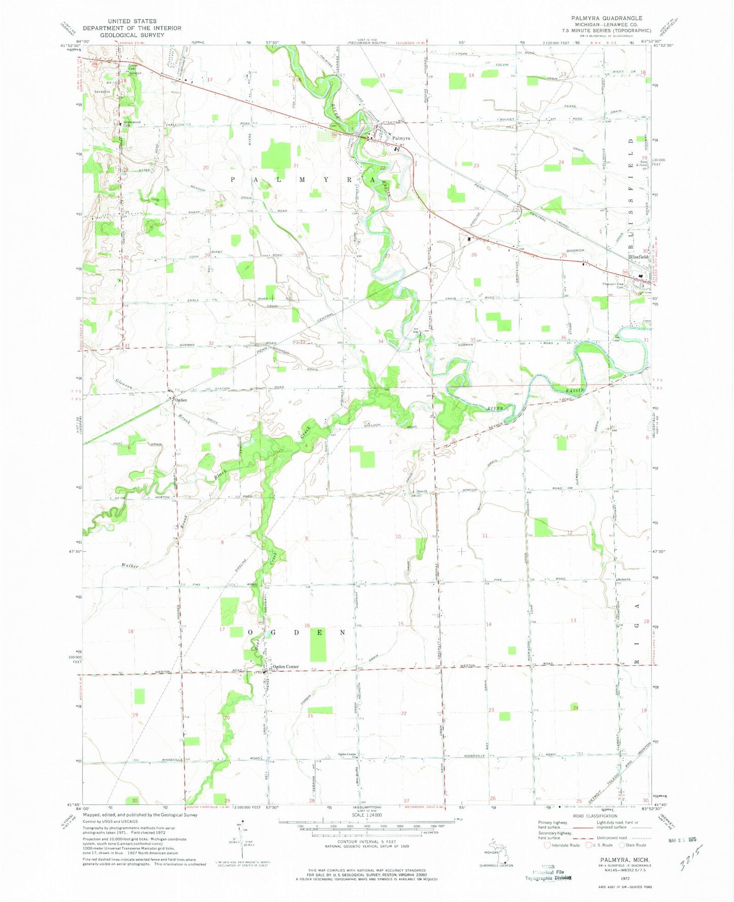
MyTopo
Classic USGS Palmyra Michigan 7.5'x7.5' Topo Map
Couldn't load pickup availability
Historical USGS topographic quad map of Palmyra in the state of Michigan. Map scale may vary for some years, but is generally around 1:24,000. Print size is approximately 24" x 27"
This quadrangle is in the following counties: Lenawee.
The map contains contour lines, roads, rivers, towns, and lakes. Printed on high-quality waterproof paper with UV fade-resistant inks, and shipped rolled.
Contains the following named places: Bay Drain, Bear Creek, Bell Drain, Big Meadow Drain, Bixby Drain, Black Creek, Blessed Savior Lutheran Church, Blissfield Health Center, Clement Drain, Coach Light Estates Mobile Home Park, Colvin Drain, Corbin Drain, Cornerstone Baptist Church, Crane Cemetery, Foot Drain, Gleason Brook, Goff Cemetery, Goodrich Drain, Grinnell Drain, Grosvenor Post Office, Hahn Drain, Luke Farm Cemetery, Malburg Drain, Mulberry Station, Ogden, Ogden Center, Ogden Center Church, Ogden Center Post Office, Ogden Post Office, Ogden Station, Ogden Town Hall, Palmyra, Palmyra Community Church, Palmyra Post Office, Palmyra Presbyterian Church Historical Marker, Palmyra School, Palmyra Station, Palmyra Township Fire Department, Palmyra Village Cemetery, Pleasant View Cemetery, Rockwood Drain, Scovell Cemetery, Township of Ogden, Township of Palmyra, Underwood Cemetery, Victorsville Post Office, Walker Brook, West Ogden Post Office, Zion Church, Zion United Brethren Cemetery, Zion United Brethren Church, ZIP Codes: 49228, 49268