MyTopo
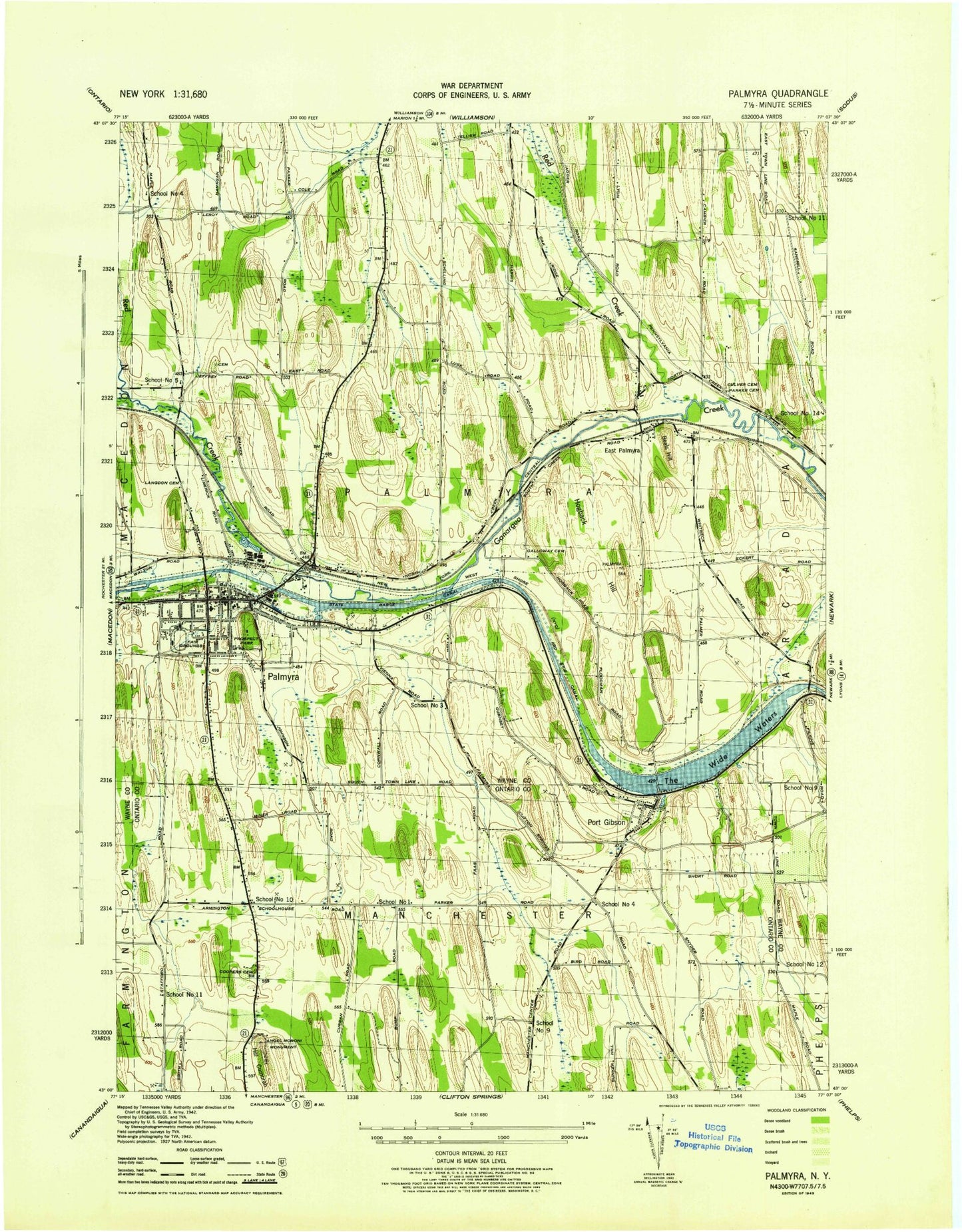
Classic USGS Palmyra New York 7.5'x7.5' Topo Map
Couldn't load pickup availability
Historical USGS topographic quad map of Palmyra in the state of New York. Map scale may vary for some years, but is generally around 1:24,000. Print size is approximately 24" x 27"
This quadrangle is in the following counties: Ontario, Wayne.
The map contains contour lines, roads, rivers, towns, and lakes. Printed on high-quality waterproof paper with UV fade-resistant inks, and shipped rolled.
Contains the following named places: Angel Moroni Monument, Beals Hill, Bear Hill, Bowes Hill, Church of God, Cobb Hill, Cooney Crossing, Coopers Cemetery, Cross Creek Church, Culver Cemetery, Cummings Family Farm, Division Street Bridge, East Palmyra, East Palmyra Cemetery, East Palmyra Christian School, East Palmyra Fire Department, First Baptist Church, Galloway Cemetery, Galloway Hill, Galloway Road Bridge, Hathaway Brook, Heritage Baptist Church, Hidden Hills Ranch Airport, Hogback Hill, Hopkins Cemetery, Hotel Selden, Huckleberry Swamp, John Swift Cemetery, Johnson Hill, Langdon Cemetery, Lemuel Durfee Cemetery, Marquart Village, Oak Ridge Airport, Oasis of Hope Community Church, Palmyra, Palmyra Airpark, Palmyra Bible Church, Palmyra Cemetery, Palmyra Elementary School, Palmyra Fire Department, Palmyra Hotel, Palmyra Kings Daughters Free Library, Palmyra Post Office, Palmyra Reformed Church, Palmyra Town Hall, Palmyra Union Agricultural Society Fair Grounds, Palmyra United Methodist Church, Palmyra Village Hall, Palmyra Water Works Pumping Station, Palmyra-Macedon High School, Palmyra-Macedon Middle School, Paragon Farm, Parker Cemetery, Port Gibson, Port Gibson Census Designated Place, Port Gibson Fire Department and Ambulance, Port Gibson Post Office, Port Gibson Road Bridge, Port Gibson Rural Cemetery, Prospect Park, Red Creek, Saint Anne's Roman Catholic Cemetery, Saint Anne's Roman Catholic Church, School Number 1, School Number 10, School Number 11, School Number 12, School Number 13, School Number 14, School Number 3, School Number 4, School Number 5, School Number 9, Seventh Day Adventist Church, South Creek Nursery of Palmyra, Strand Theatre, Taranwould Golf Course, The Church of Jesus Christ of Latter Day Saints, The Wide Waters, Town of Palmyra, Town of Palmyra Highway Department, Trolley Bed Road Park, Union Club Park, Valley View Mobile Home Park, Village of Palmyra, Walton Hill, Western Presbyterian Church, Willow Creek Estates, Zion Episcopal Church, ZIP Codes: 14522, 14537