MyTopo
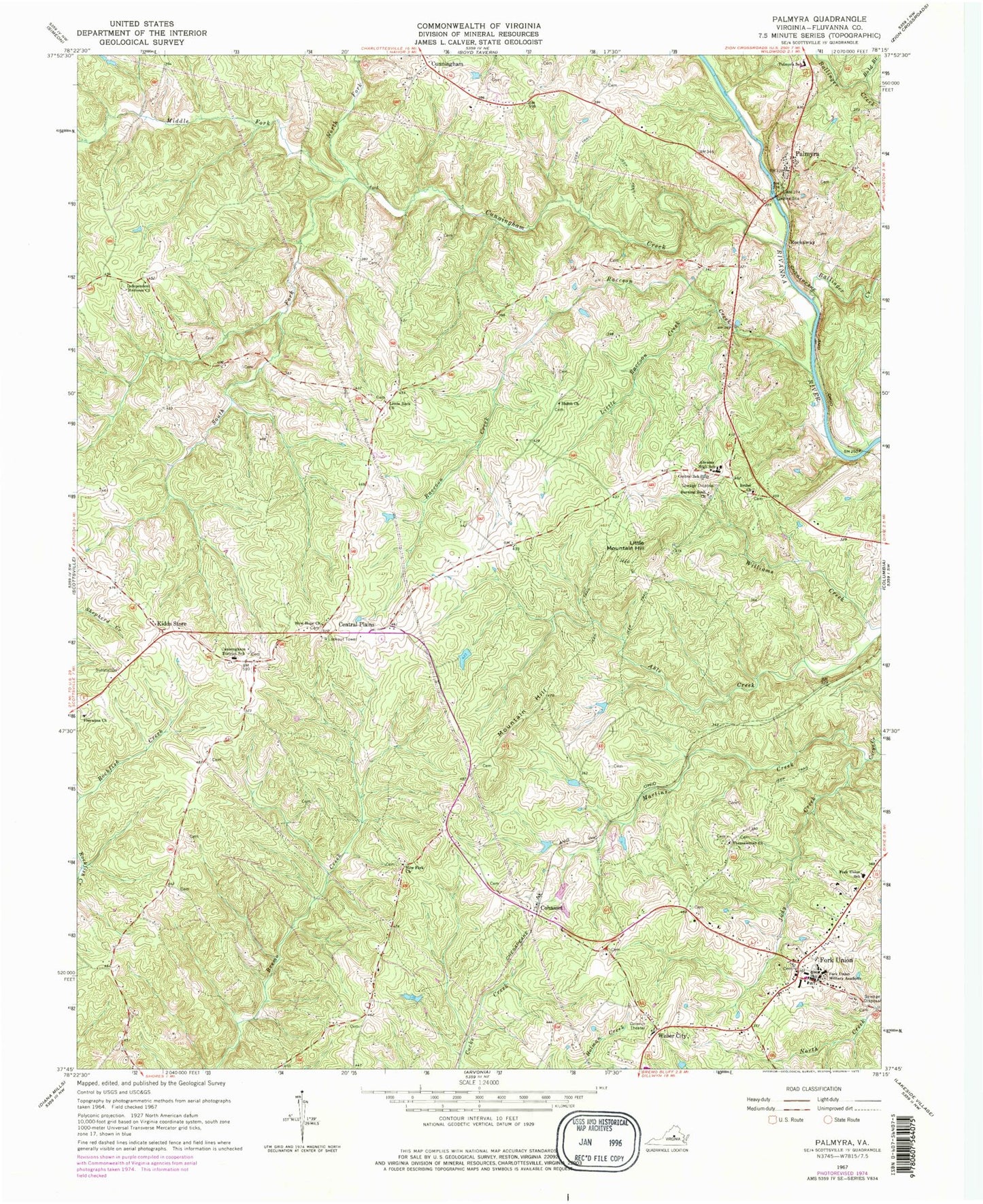
Classic USGS Palmyra Virginia 7.5'x7.5' Topo Map
Couldn't load pickup availability
Historical USGS topographic quad map of Palmyra in the state of Virginia. Typical map scale is 1:24,000, but may vary for certain years, if available. Print size: 24" x 27"
This quadrangle is in the following counties: Fluvanna.
The map contains contour lines, roads, rivers, towns, and lakes. Printed on high-quality waterproof paper with UV fade-resistant inks, and shipped rolled.
Contains the following named places: Abrams High School, Ballinger Creek, Bethel Church, Bold Branch, Burning Bush Church, Central Plains, Central Elementary School, Cunningham Creek, Cunningham Elementary School, Fluvanna Church, Fork Union Military Academy, Fluvanna Middle School, Independent Holiness Church, Judy Creek, Little Raccoon Creek, Little Rock Church, Martins Creek, Middle Fork Cunningham Creek, New Fork Church, New Hope Church, North Fork Cunningham Creek, Palmyra Elementary School, Raccoon Creek, Shiloh Church, South Fork Cunningham Creek, Thessalonian Church, Weber City, Dunbar School (historical), Fluvanna County, Fluvanna County Courthouse Historic District, Fluvanna County High School, Fork Union Presbyterian Church, Palmyra United Methodist Church, Pembroke Petit Bridge, Cohasset, Cunningham, Fork Union, Kidds Store, Little Mountain Hill, Mountain Hill, Rockaway, Palmyra, Fork Union District, Palmyra Rescue Squad, Fork Union Fire Company, Fork Union Rescue Squad, Palmyra Rescue Station, Fluvanna County Sheriff's Office, Fluvanna County Sheriff's Office, Fluvanna County Criminal Court, Palmyra Census Designated Place, Fluvanna County Office Building, Fluvanna County Public Library, Fork Union Baptist Church, Fork Union Post Office, Palmyra Post Office