MyTopo
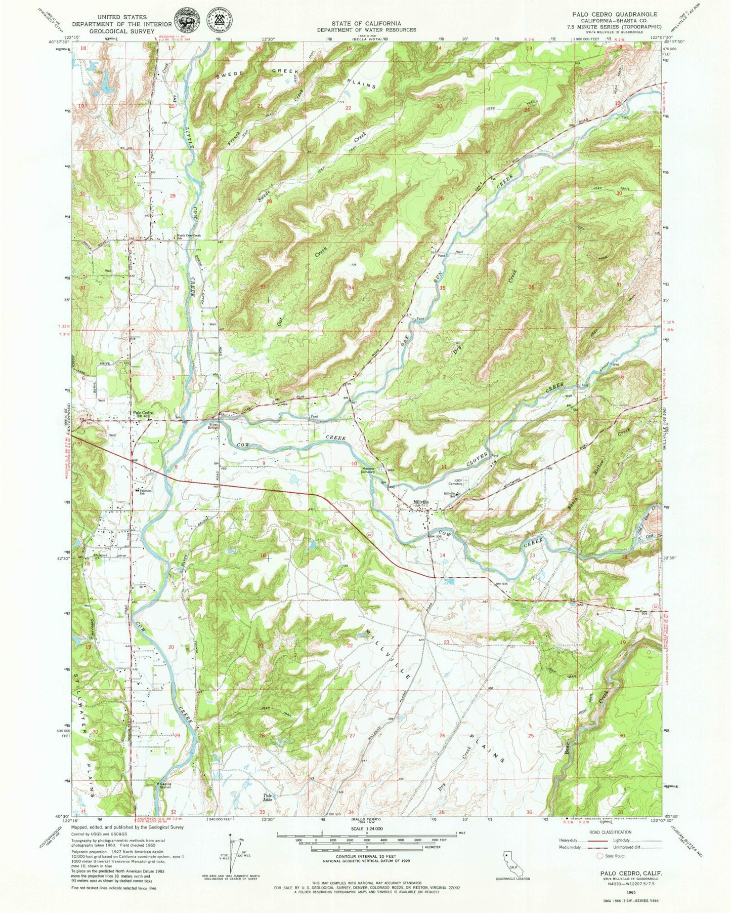
Classic USGS Palo Cedro California 7.5'x7.5' Topo Map
Couldn't load pickup availability
Historical USGS topographic quad map of Palo Cedro in the state of California. Map scale may vary for some years, but is generally around 1:24,000. Print size is approximately 24" x 27"
This quadrangle is in the following counties: Shasta.
The map contains contour lines, roads, rivers, towns, and lakes. Printed on high-quality waterproof paper with UV fade-resistant inks, and shipped rolled.
Contains the following named places: Basin Hollow Creek, Clover Creek, Dry Creek, French Creek, Henryford, Junction Elementary School, Little Cow Creek, Millville, Millville Census Designated Place, Millville Elementary School, Millville Fire Protection District, Millville Independent Order of Odd Fellows Cemetery, Millville Masonic Cemetery, Millville Plains, Millville Post Office, North Cow Creek Elementary School, Oak Run Creek, Oak Run School, Oat Creek, Old Cow Creek, Palo Cedro, Palo Cedro Census Designated Place, Palo Cedro Post Office, Palo Cedro Volunteer Fire Company Station 32, Silver Bridge, South Cow Creek, Swede Creek, Tabournel Gulch, Tule Lake, ZIP Code: 96073