MyTopo
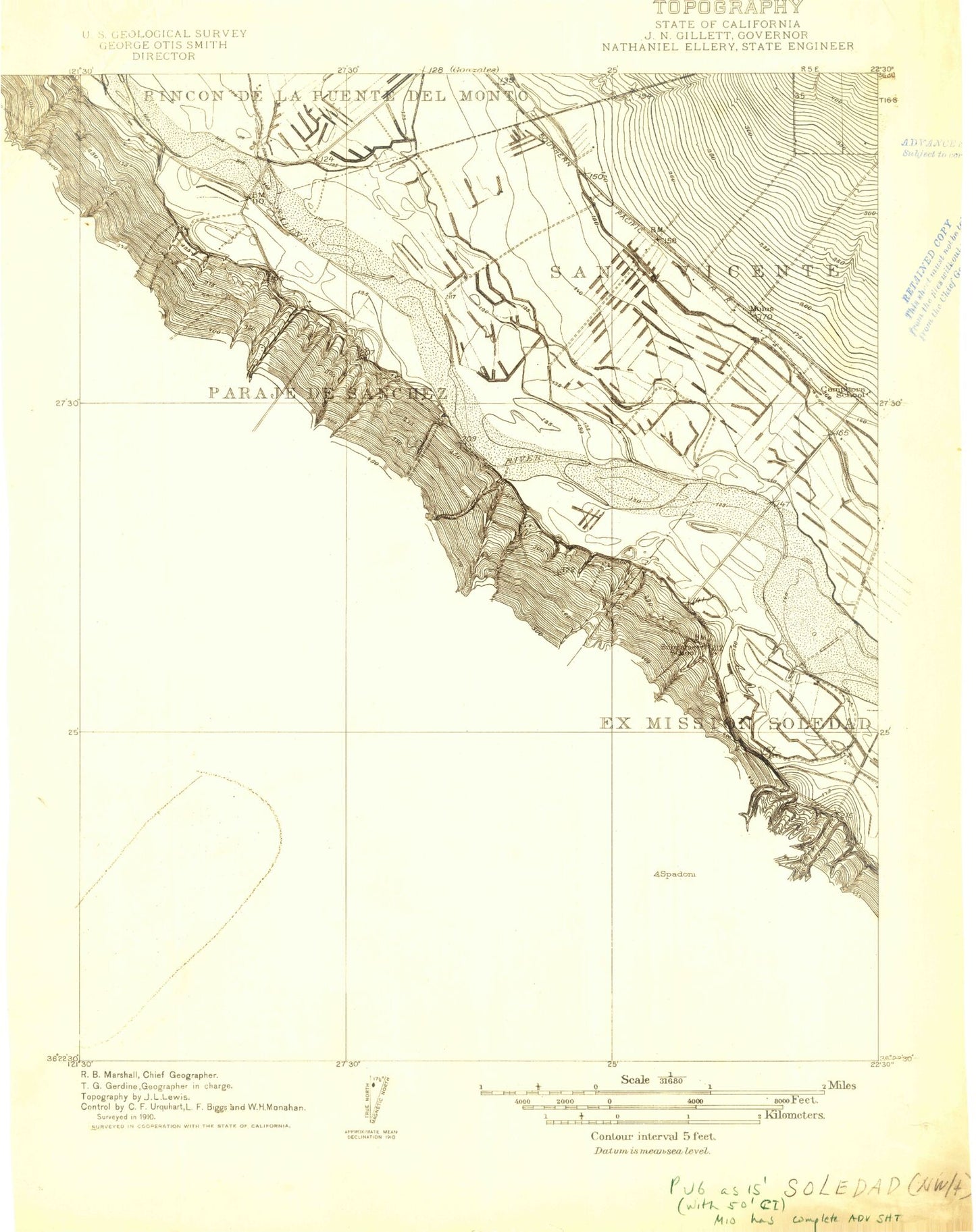
Classic USGS Palo Escrito Peak California 7.5'x7.5' Topo Map
Couldn't load pickup availability
Historical USGS topographic quad map of Palo Escrito Peak in the state of California. Map scale may vary for some years, but is generally around 1:24,000. Print size is approximately 24" x 27"
This quadrangle is in the following counties: Monterey.
The map contains contour lines, roads, rivers, towns, and lakes. Printed on high-quality waterproof paper with UV fade-resistant inks, and shipped rolled.
Contains the following named places: Camphora School, Correctional Training Facility, Correctional Training Facility Fire Department, Department of Forestry and Fire Protection Gabilan Unit, Department of Forestry and Fire Protection Gonzales Unit, Ex Mission Soledad, Fairview School, Gonzales Cemetery, Gonzales Fire Station, McCoy Creek, Molus, Palo Escrito Peak, Paloma Mountain, Paraje de Sanchez, Salinas Valley State Prison, Sierra de Salinas, Soberanes School, The Monterey Vineyard