MyTopo
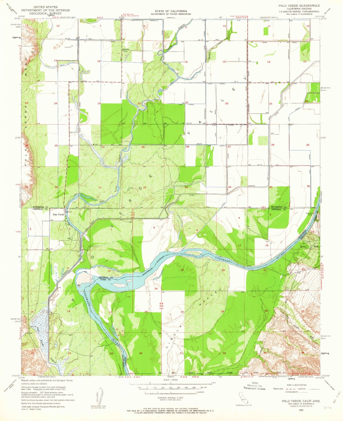
Classic USGS Palo Verde California 7.5'x7.5' Topo Map
Couldn't load pickup availability
Historical USGS topographic quad map of Palo Verde in the states of California, Arizona. Map scale may vary for some years, but is generally around 1:24,000. Print size is approximately 24" x 27"
This quadrangle is in the following counties: Imperial, La Paz, Riverside.
The map contains contour lines, roads, rivers, towns, and lakes. Printed on high-quality waterproof paper with UV fade-resistant inks, and shipped rolled.
Contains the following named places: Browns Drain, C-03-10 Canal, C-03-10-3 Canal, C-03-10-4 Canal, C-03-21 Canal, C-03-21-1 Canal, C-03-22 Canal, C-16 Canal, C-16-1 Canal, C-17 Canal, C-17-1 Canal, C-18 Canal, C-18-1 Canal, C-21 Canal, C-23 Canal, C-24 Canal, C-25 Canal, C-27 Canal, C-28 Canal, C-28-1 Canal, C-28-2 Canal, C-28-3 Canal, Cibola Bridge, Crazy Woman Wash, D-23-1 Canal, D-23-1-3 Canal, D-23-1-4 Canal, D-23-1-5 Canal, Estes Drain, Estes West Drain, Gould Wash, Hodges Drain, Imperial County Fire Department Station 5, Imperial County Sheriff's Office Palo Verde Station, Norton Drain, Palo Verde, Palo Verde Census Designated Place, Palo Verde County Park, Palo Verde Lagoon, Palo Verde Post Office, Rannells, South End Drain, South Hodges Drain, Taylor Ferry, Thirty Eighth Street County Park