MyTopo
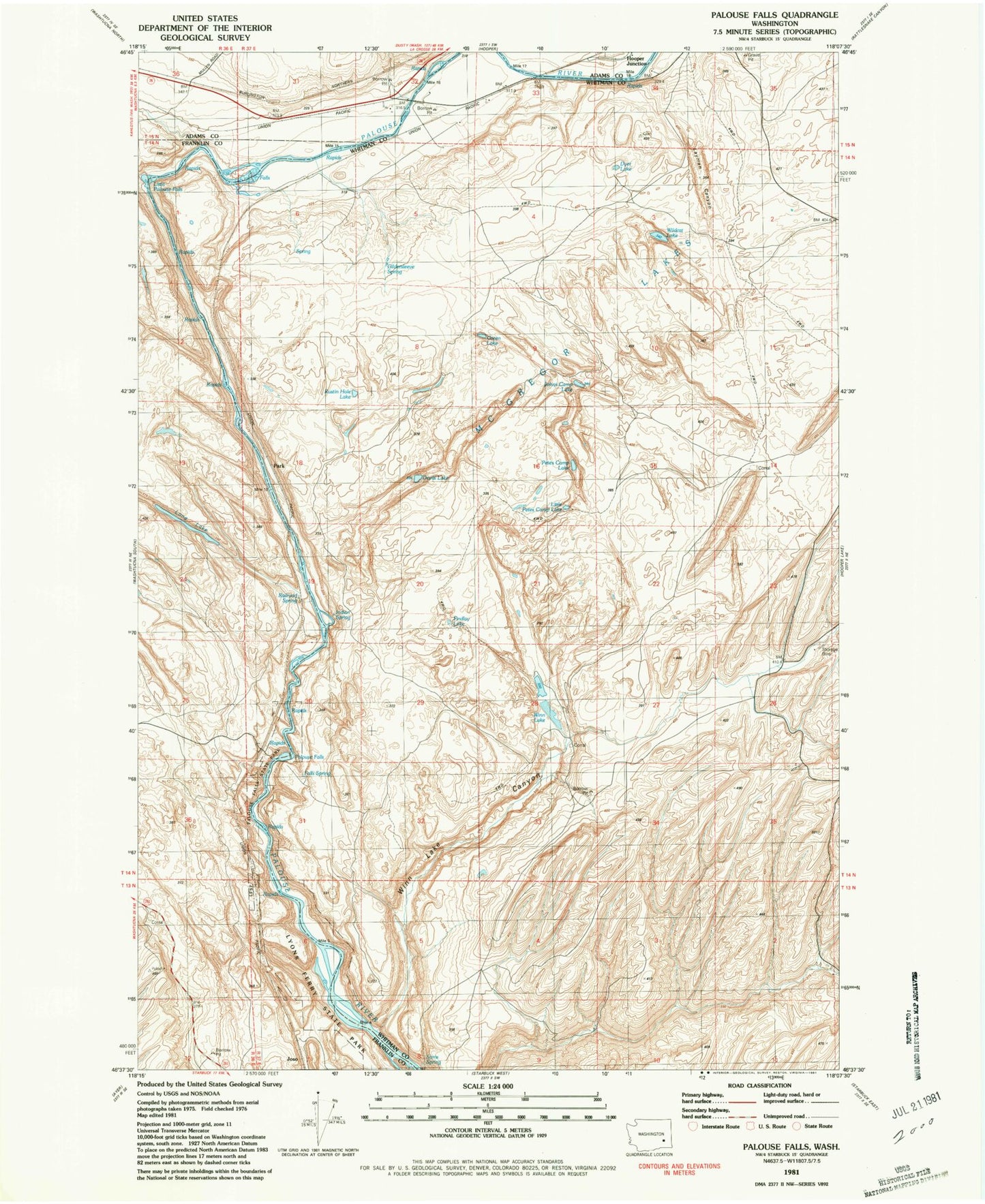
Classic USGS Palouse Falls Washington 7.5'x7.5' Topo Map
Couldn't load pickup availability
Historical USGS topographic quad map of Palouse Falls in the state of Washington. Map scale may vary for some years, but is generally around 1:24,000. Print size is approximately 24" x 27"
This quadrangle is in the following counties: Adams, Franklin, Whitman.
The map contains contour lines, roads, rivers, towns, and lakes. Printed on high-quality waterproof paper with UV fade-resistant inks, and shipped rolled.
Contains the following named places: Devils Lake, Dyer Lake, Falls Spring, Findley Lake, Fryxell Overlook, Gildersleeve Spring, Green Lake, Holliday Coulee, Indian Spring, Johns Camp Lake, Layman Canyon, Little Palouse Falls, Little Petes Camp Lake, Long Lake, McGregor, McGregor Lakes, McGregory Dam, Palouse Falls, Palouse Falls State Park, Park, Petes Camp Lake, Railroad Spring, Rustin Hole Lake, Wildcat Lake, Winn Lake, Winn Lake Canyon, ZIP Code: 99333