MyTopo
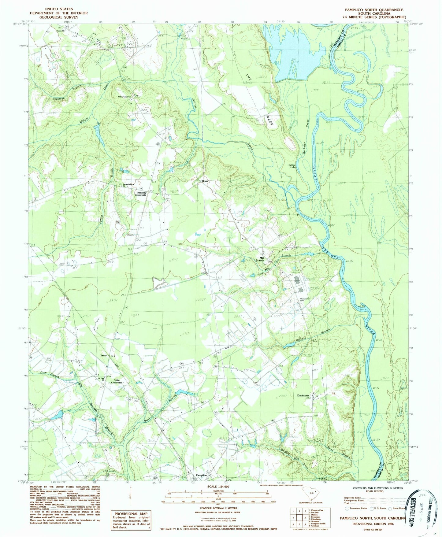
Classic USGS Pamplico North South Carolina 7.5'x7.5' Topo Map
Couldn't load pickup availability
Historical USGS topographic quad map of Pamplico North in the state of South Carolina. Map scale may vary for some years, but is generally around 1:24,000. Print size is approximately 24" x 27"
This quadrangle is in the following counties: Florence, Marion.
The map contains contour lines, roads, rivers, towns, and lakes. Printed on high-quality waterproof paper with UV fade-resistant inks, and shipped rolled.
Contains the following named places: Bachelor Creek, Barfields Old Mill Creek, Bigham Branch, Booger Pond, Bowling Pond, Bowling Pond Dam D-3580, Brier Branch, Browns Old Mill, Buck Branch, Claussen Branch, Claussen Cemetery, Davistown, Gibbs Cemetery, Gibbs Crossroads, Gibbs School, Gum Branch, H S Hyman Pond, H S Hyman Pond Dam D-3578, Hannah - Salem - Friendfield Fire District Station 4, High Hill School, Horse Bay, Howe Springs Fire Department Station 4, Jeffries Creek, Kennedy Crossroads, Lyndhurst School, Mill Branch, Mill Branch Church, Mill Branch School, Mount Elon Church, Munns Siding, Orum, Palles Pond Dam, Pamplico Division, Pauls Plantation, Perrot, Pleasant Hill Cemetery, Pleasant Hill Methodist Church, Salem Church, South Carolina Noname 21009 D-3563 Dam, Spring Branch, Spring Branch Church, The Neck, Wateree Deer Club, Willow Creek, Willow Creek Church, WMXT-FM (Pamplico), Woodland School, Yellow Lake