MyTopo
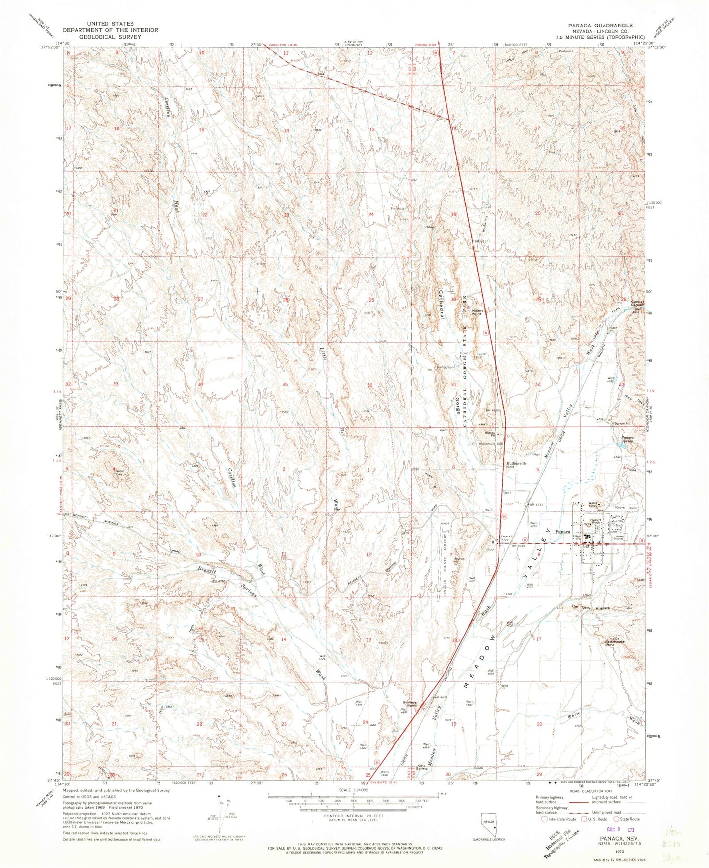
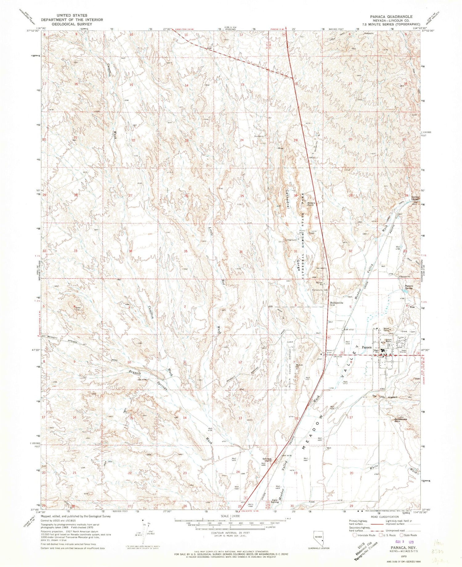
Classic USGS Panaca Nevada 7.5'x7.5' Topo Map
Couldn't load pickup availability
Historical USGS topographic quad map of Panaca in the state of Nevada. Map scale may vary for some years, but is generally around 1:24,000. Print size is approximately 24" x 27"
This quadrangle is in the following counties: Lincoln.
The map contains contour lines, roads, rivers, towns, and lakes. Printed on high-quality waterproof paper with UV fade-resistant inks, and shipped rolled.
Contains the following named places: Bullion Mining and Reduction Company Mill, Bullionville, Bullionville Cemetery, Bullionville Post Office, Bullionville Smelting Company Mill, C Kenneth Lee South Well, Caselton Wash, Cathedral Gorge, Cathedral Gorge State Park, Cathedral Gulch State Game Refuge, Chicago Mill, Cold Spring, Comet, Condor Canyon, Condor Mill, Court Rock, Delmue Brothers North Well, Kenneth D Lee South Well, Lester Mathews Well, Lincoln County Airport, Lincoln County High School, Little Red Wash, Meadow Valley Middle School, Meadow Valley Volunteer Ambulance Panaca, Millers Point, Morgan Bush Mine, Newman Ranch, Page Mill, Panaca, Panaca Census Designated Place, Panaca Elementary School, Panaca LDS Church Well, Panaca Post Office, Panaca Spring, Panaca Volunteer Fire Department, Rattlesnake Point, Raymond Ely Mill, Smileys Point, The Little Hogback, White Wash