MyTopo
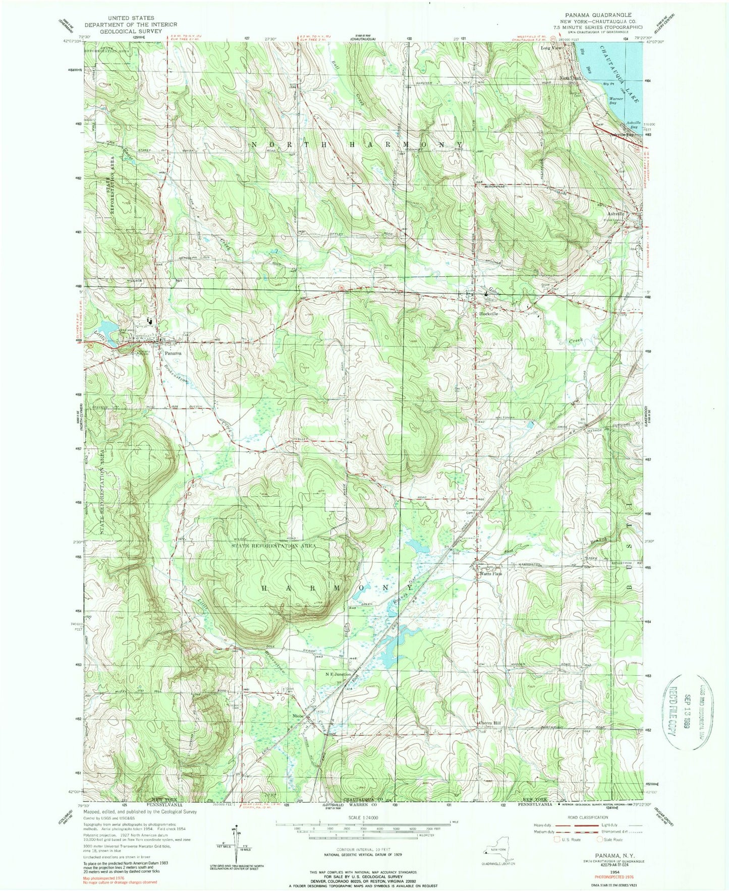
Classic USGS Panama New York 7.5'x7.5' Topo Map
Couldn't load pickup availability
Historical USGS topographic quad map of Panama in the state of New York. Map scale may vary for some years, but is generally around 1:24,000. Print size is approximately 24" x 27"
This quadrangle is in the following counties: Chautauqua.
The map contains contour lines, roads, rivers, towns, and lakes. Printed on high-quality waterproof paper with UV fade-resistant inks, and shipped rolled.
Contains the following named places: Ashville, Ashville Bay, Ashville Free Library, Ashville Methodist Church, Ashville Post Office, Baker School, Blockville, Blockville Union Burial Ground, Bly Cemetery, Bly Point, Cherry Hill, East Branch Little Brokenstraw Creek, Goose Creek Airport, Grant Cemetery, Greenwood Cemetery, Long View, Maple Grove Cemetery, Niets Crest, Niobe, Niobe Baptist Church, Niobe Post Office, North East Junction, Odell Farms, Our Lady of the Snows, Panama, Panama Baptist Church, Panama Fire Department Station 1, Panama Fire Department Station 2, Panama High School, Panama K - 6 School, Panama Post Office, Panama Rocks, Panama Union Cemetery, Panama United Methodist Church, Tillotson Cemetery, Town of Harmony, Village of Panama, Warner Bay, Watts Flats, Wesleyan Methodist Church, ZIP Code: 14710