MyTopo
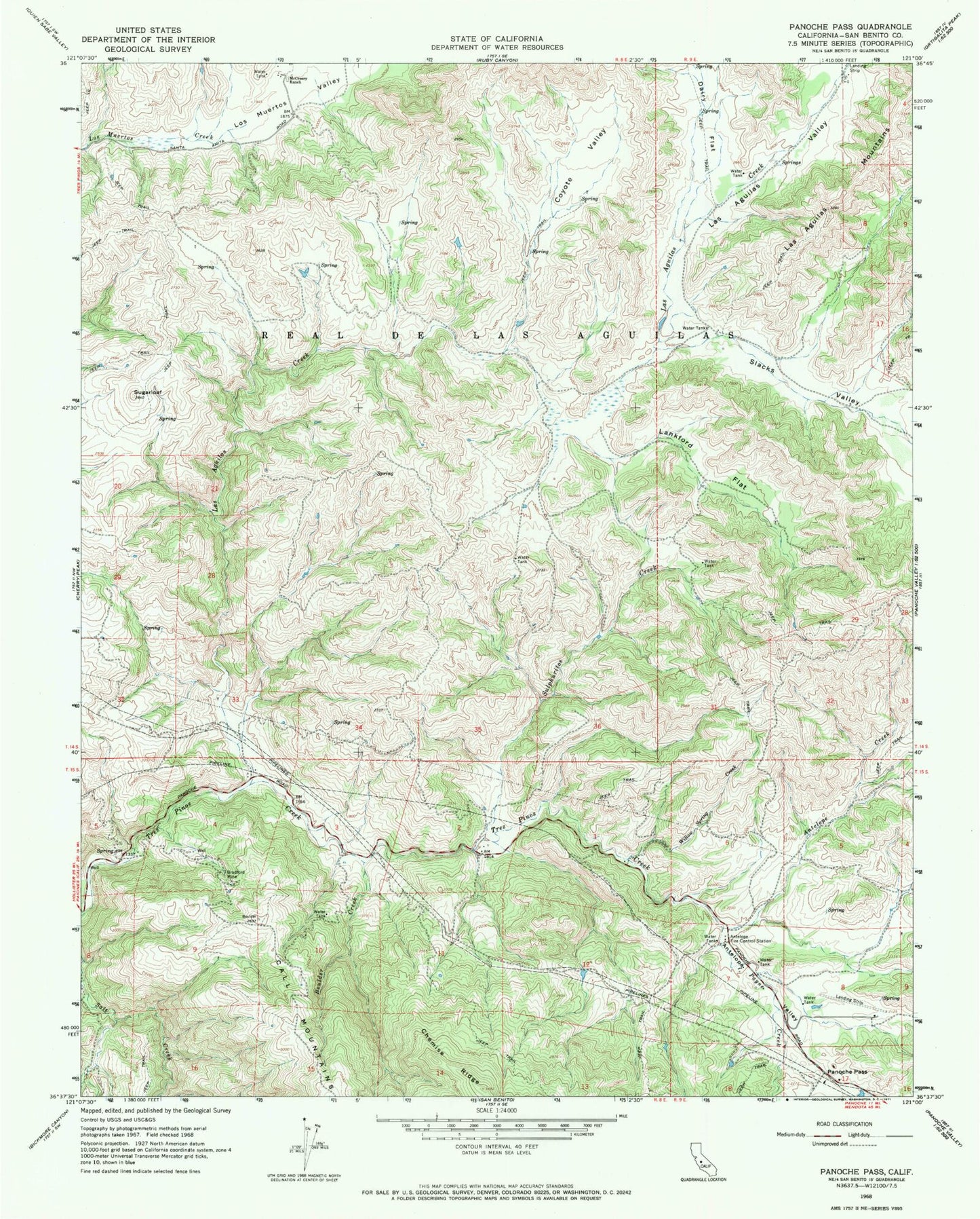
Classic USGS Panoche Pass California 7.5'x7.5' Topo Map
Couldn't load pickup availability
Historical USGS topographic quad map of Panoche Pass in the state of California. Map scale may vary for some years, but is generally around 1:24,000. Print size is approximately 24" x 27"
This quadrangle is in the following counties: San Benito.
The map contains contour lines, roads, rivers, towns, and lakes. Printed on high-quality waterproof paper with UV fade-resistant inks, and shipped rolled.
Contains the following named places: Antelope Creek, Antelope Fire Control Station, Antelope School, Boulder Creek, Bradford Mine, Call Mountains, Chemise Ridge, Coyote Valley, Dairy Flat, Department of Forestry and Fire Protection Antelope Fire Station, Lankford Flat, Las Aguilas Creek, Las Aguilas Mountains, Las Aguilas Valley, Los Muertos Valley, McCreery Ranch, Panoche Pass, Payne Creek, Payne Valley, Real De Las Aguilas, Slacks Valley, Sugarloaf, Sulphuritos Creek, Willow Spring Creek