MyTopo
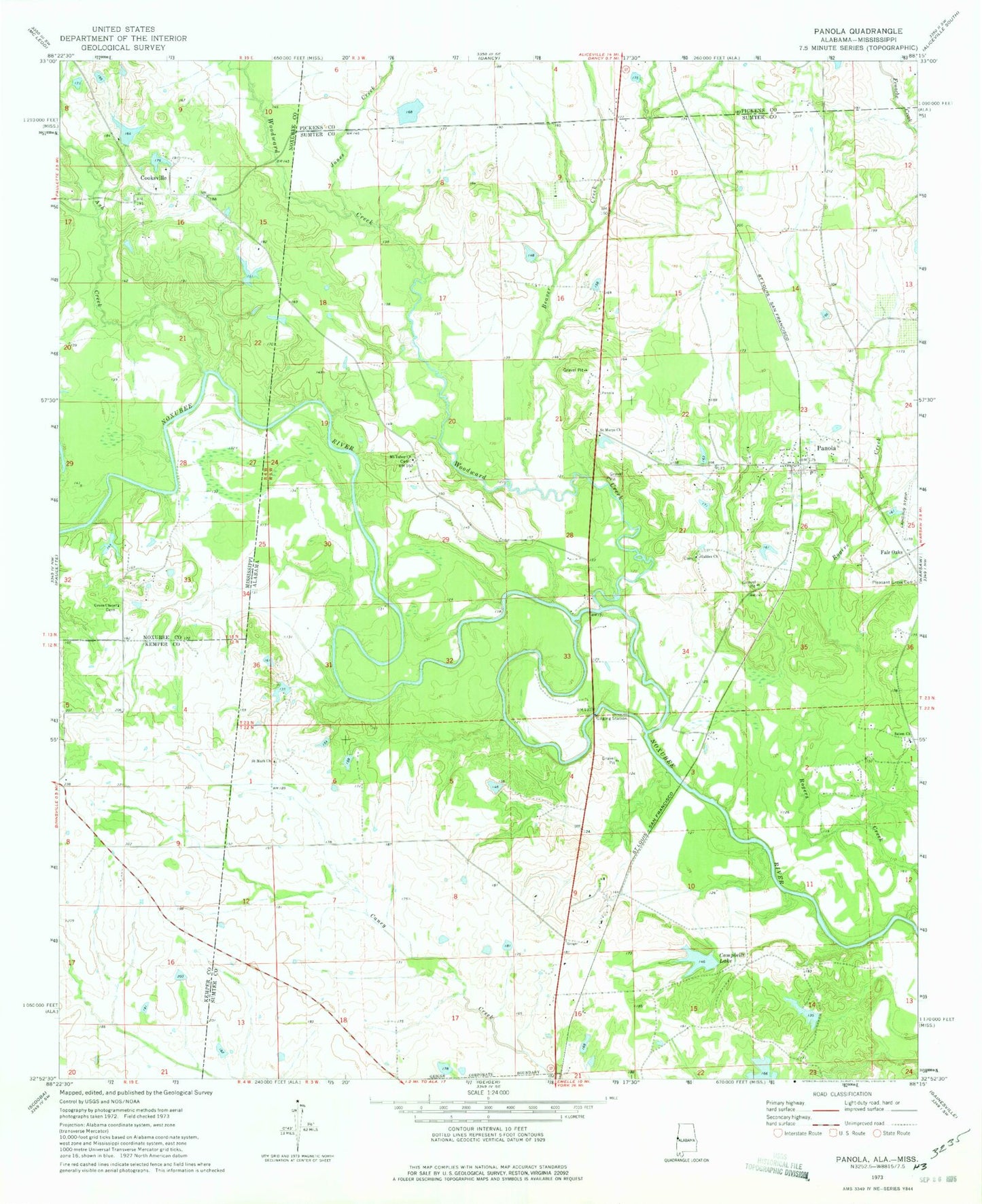
Classic USGS Panola Alabama 7.5'x7.5' Topo Map
Couldn't load pickup availability
Historical USGS topographic quad map of Panola in the states of Alabama, Mississippi. Map scale may vary for some years, but is generally around 1:24,000. Print size is approximately 24" x 27"
This quadrangle is in the following counties: Kemper, Noxubee, Pickens, Sumter.
The map contains contour lines, roads, rivers, towns, and lakes. Printed on high-quality waterproof paper with UV fade-resistant inks, and shipped rolled.
Contains the following named places: Allie McElroy School, Ash Creek, Beaver Creek, Campbells Lake, Cooksville, Cooksville Cemetery, Cooksville Methodist Church, Duck Pond Branch, Fair Oaks, Fairview Farms Airport, Galilee Baptist Church, Green Chapel, Henley Ranch Airport, Jones Creek, Mount Tabor Church, Mount Tabor School, Neville School, Noxubee Ferry, Noxubee Island, Panola, Panola Census Designated Place, Panola Post Office, Panola-Geiger Division, Pleasant Grove Church, Rogers Creek, Saint Luke Church, Saint Mark Baptist Church, Saint Marys Church, Salem, Salem Methodist Church, Shady Grove Cemetery, Shady Grove Church, Sherman, Sibley Pond, Sparkman Lake Dam, Sumter Farm and Stock Company Dam, Sumter Lake Number Four, The Cutt Off, Wall Ferry, Watts Cemetery, Whiten, Wild Horse Prairie, Woodward Creek