MyTopo
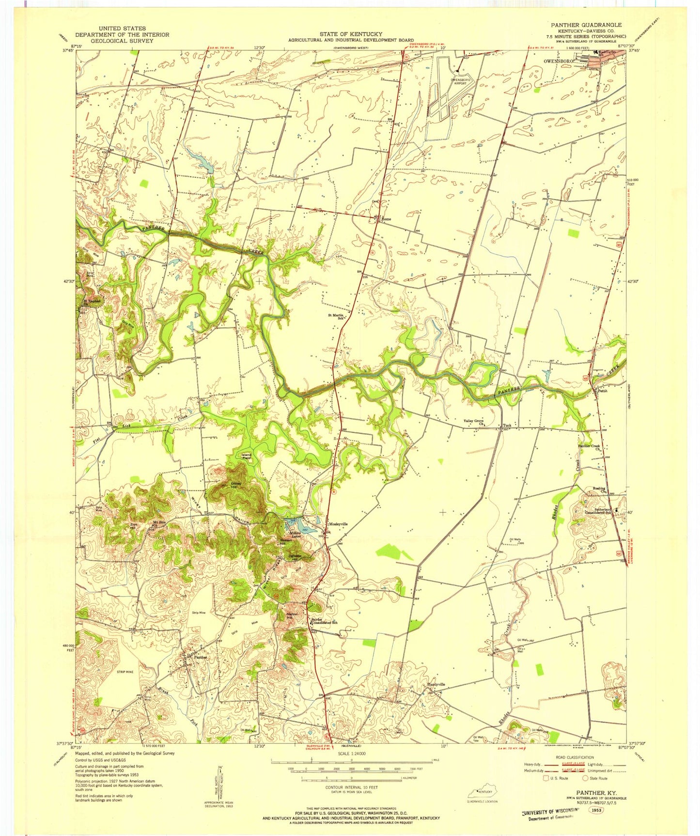
Classic USGS Panther Kentucky 7.5'x7.5' Topo Map
Couldn't load pickup availability
Historical USGS topographic quad map of Panther in the state of Kentucky. Map scale may vary for some years, but is generally around 1:24,000. Print size is approximately 24" x 27"
This quadrangle is in the following counties: Daviess.
The map contains contour lines, roads, rivers, towns, and lakes. Printed on high-quality waterproof paper with UV fade-resistant inks, and shipped rolled.
Contains the following named places: Albert Smith Marks birthplace Historical Marker, Big Ditch, Crow, Daviess County Fire Department Airport Station, Dithey Hill, Flat Lick Creek, Ford Ditch, Geotz Ditch, Goode Airpark, Handyville, Henry, Island Field, Keller Ditch, Lewis Lane Church, Miles Airport, Miller Lake, Moseleyville, Moseleyville Census Designated Place, Moseleyville Volunteer Fire Department, Mount Zion Church, Nation Hill, New Hope Church, Nickel Ridge, Nickel Ridge Church, Oglesby Hill, Old Panther Creek, Owensboro-Daviess County Regional Airport, Panther, Panther Census Designated Place, Panther Creek Baptist Church, Panther Creek Battle Historical Marker, Pettit, Rhodes Creek, Rome, Rushing Church, Russell Hill, Saint Martin School, Saint Raphael, Saint Raphael Church, Snyder, Snyder Consolidated School, Sutherland Consolidated School, Sutherland Hill, Tamarack School, The Immaculate School, Tuck, Twin Lakes, Utica-Stanley Division, Vance Ditch, Washington School, Windy Hollow, Windy Hollow Lakes, Wolf Branch Ditch, Zion Hill, ZIP Code: 42301