MyTopo
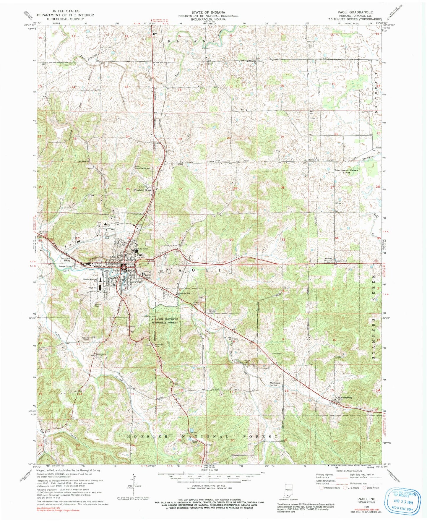
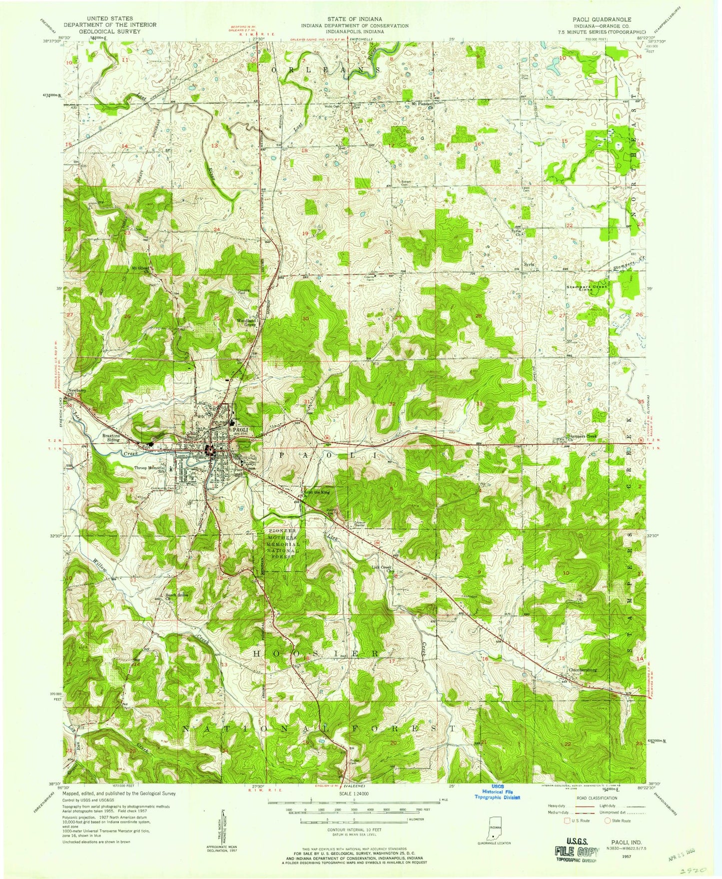
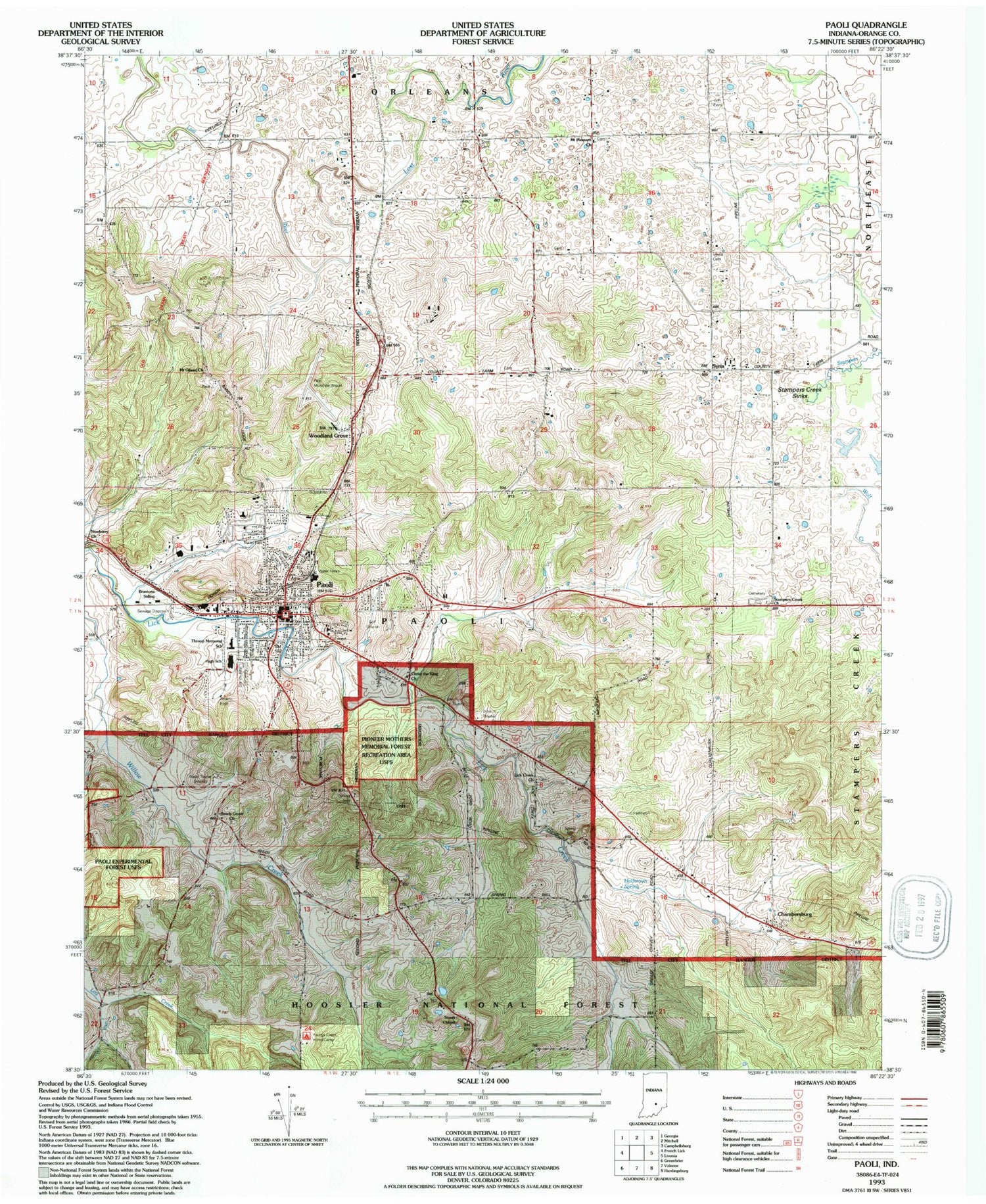
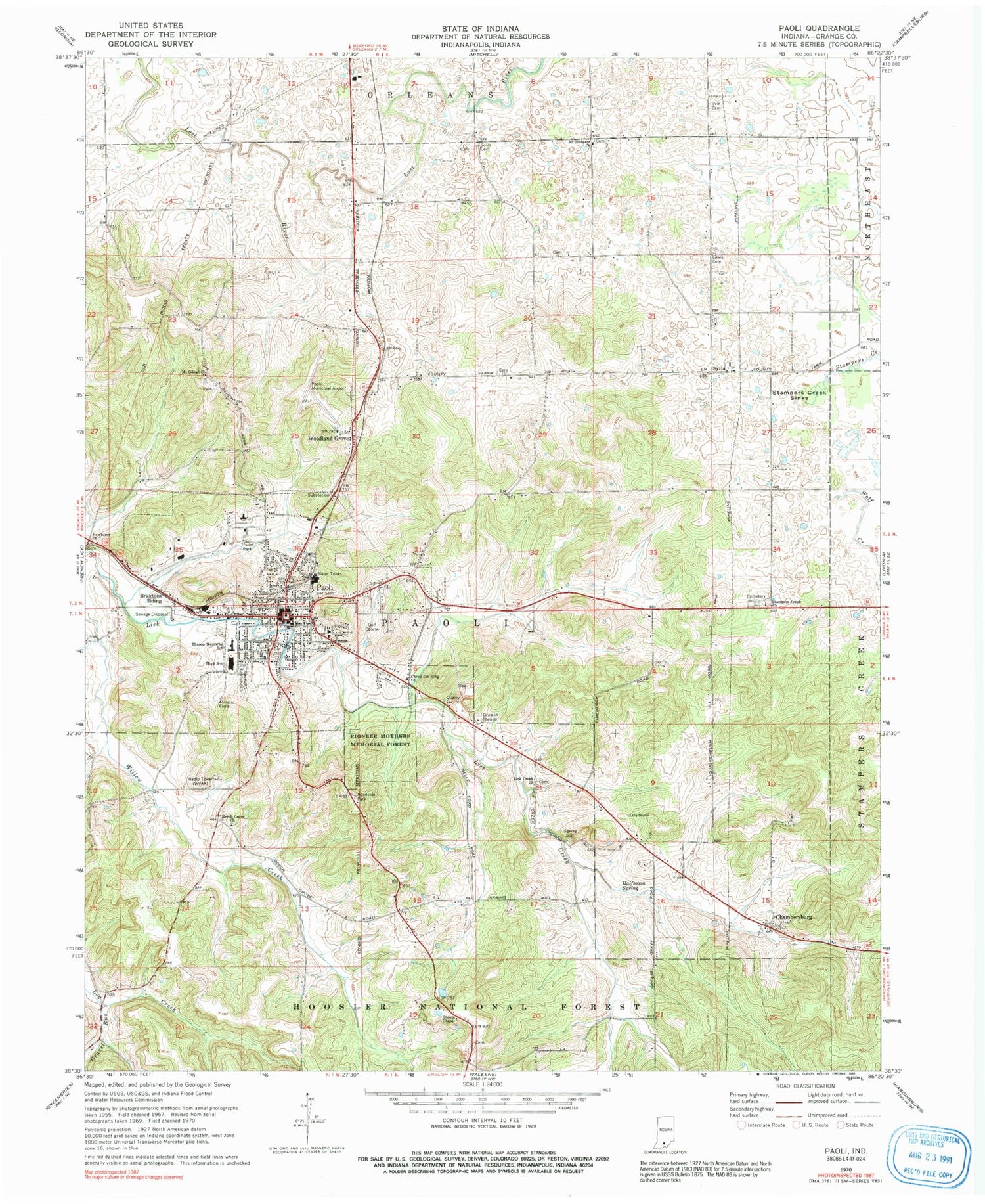
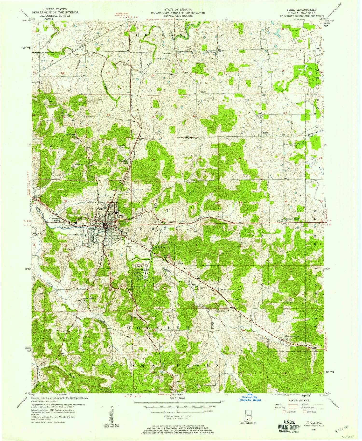
Classic USGS Paoli Indiana 7.5'x7.5' Topo Map
Couldn't load pickup availability
Historical USGS topographic quad map of Paoli in the state of Indiana. Map scale may vary for some years, but is generally around 1:24,000. Print size is approximately 24" x 27"
This quadrangle is in the following counties: Orange.
The map contains contour lines, roads, rivers, towns, and lakes. Printed on high-quality waterproof paper with UV fade-resistant inks, and shipped rolled.
Contains the following named places: Air Evacuation Lifeteam 17 Emergency Medical Services, Beech Grove Church, Braxtons Siding, Calcar Quarry, Chambersburg, Christ of King Church, Gravel Run, Halfmoon Springs, Irvin Cemetery, IU Health Paoli Hospital, Lewis Cemetery, Lick Creek Church, Lost River, Lost River Game Farm, Mount Gilead Church, Mount Pleasant Church, Newberry Church, Orange County, Orange County Courthouse, Orange County Sheriff's Office, Paoli, Paoli Community Cemetery, Paoli Fire Department, Paoli Junior and Senior High School, Paoli Municipal Airport, Paoli Police Department, Paoli Post Office, Pioneer Mothers Memorial Forest, Pioneer Mothers State Wayside, Scott Cemetery, Spring Mill, Stampers Creek, Stampers Creek Church, Stampers Creek Sinks, Stouts Chapel, Syria, Throop Elementary School Number 1, Town of Paoli, Township of Paoli, WKKX-AM (Paoli), Wolf Creek, Woodlawn Grove, WVAK, WVME-FM (Paoli), ZIP Code: 47454