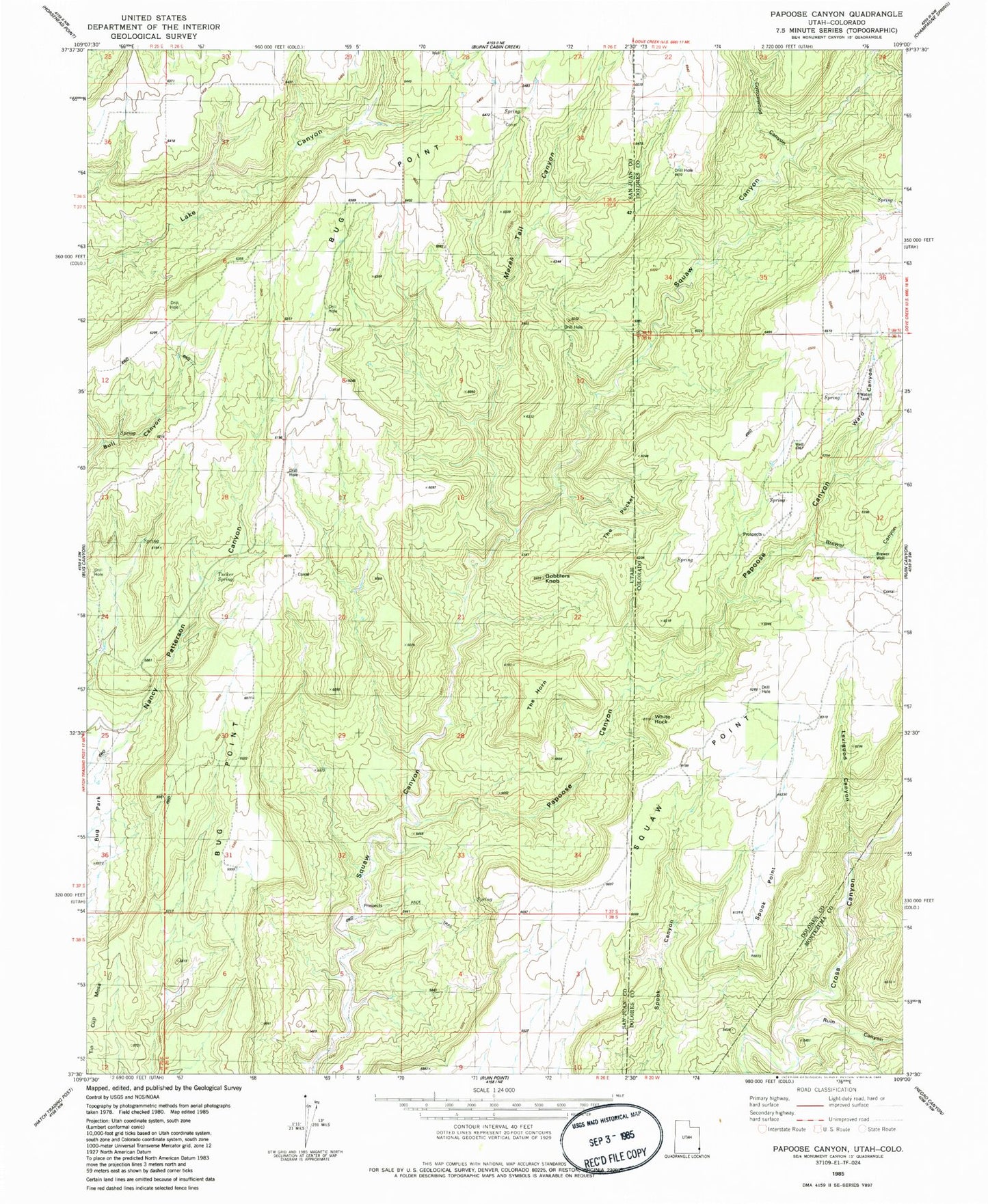
MyTopo
Classic USGS Papoose Canyon Utah 7.5'x7.5' Topo Map
Regular price
$16.95
Regular price
Sale price
$16.95
Unit price
per
Couldn't load pickup availability
Historical USGS topographic quad map of Papoose Canyon in the states of Utah, Colorado. Map scale may vary for some years, but is generally around 1:24,000. Print size is approximately 24" x 27"
This quadrangle is in the following counties: Dolores, Montezuma, San Juan.
The map contains contour lines, roads, rivers, towns, and lakes. Printed on high-quality waterproof paper with UV fade-resistant inks, and shipped rolled.
Contains the following named places: Brewer Canyon, Brewer Well, Cottonwood Canyon, Gobblers Knob, Levigood Canyon, Mares Tail Canyon, Papoose Canyon, Ruin Canyon, Spook Point, The Horn, The Pocket, Tucker Spring, Ward Canyon, White Rock