MyTopo
Classic USGS Papoose Creek California 7.5'x7.5' Topo Map
Couldn't load pickup availability
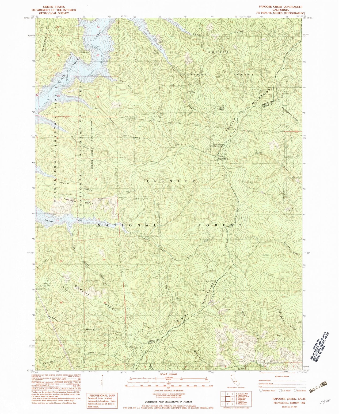
Historical USGS topographic quad map of Papoose Creek in the state of California. Map scale may vary for some years, but is generally around 1:24,000. Print size is approximately 24" x 27"
This quadrangle is in the following counties: Shasta, Trinity.
The map contains contour lines, roads, rivers, towns, and lakes. Printed on high-quality waterproof paper with UV fade-resistant inks, and shipped rolled.
Contains the following named places: Bear Gulch, Captains Point Campground, Comstock Slide, Crystal Spring, East Fork Papoose Creek, Fairview Ridge, Five Pines Mine, Halfway Gulch, Highland Ridge, Honeymoon Ridge, Keno, Keno Camp, Langdon Gulch, Little Bear Gulch, Little Papoose Creek, Lookout Ridge, North Fork Fivemile Gulch, North Fork Papoose Creek, Palace of the Oaks, Papoose Arm, Papoose Creek, South Fork Eastman Gulch, South Fork Papoose Creek, Trinity Lake, Trinity Mountain, Trinity Mountain Forest Service Station, Van Ness Creek