MyTopo
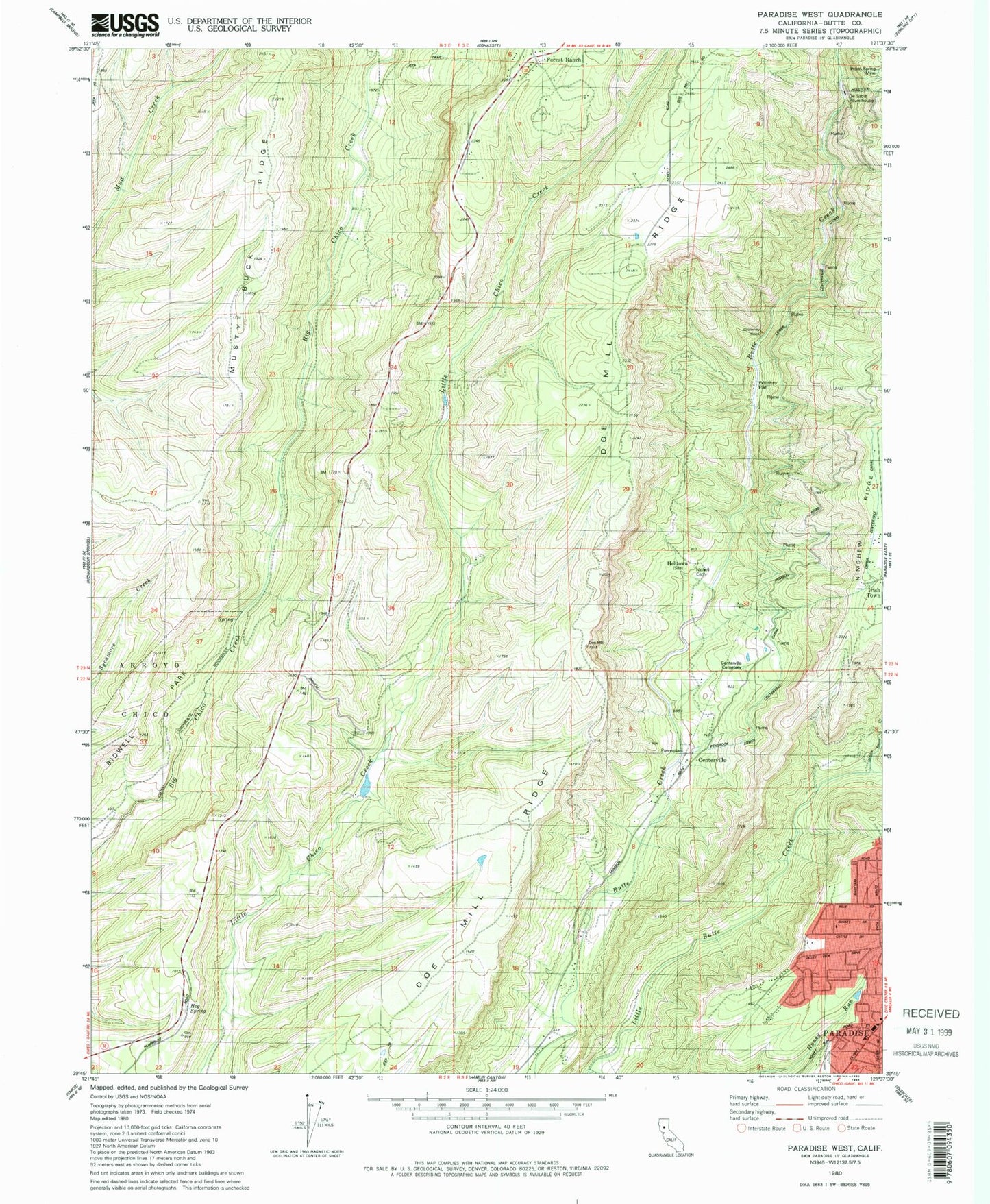
Classic USGS Paradise West California 7.5'x7.5' Topo Map
Couldn't load pickup availability
Historical USGS topographic quad map of Paradise West in the state of California. Map scale may vary for some years, but is generally around 1:24,000. Print size is approximately 24" x 27"
This quadrangle is in the following counties: Butte.
The map contains contour lines, roads, rivers, towns, and lakes. Printed on high-quality waterproof paper with UV fade-resistant inks, and shipped rolled.
Contains the following named places: Bille Park, Butte County Fire Department Station 27, Centerville, Centerville Cemetery, Chimney Rock, Christian Center, De Sabla Powerhouse, First Responder Emergency Medical Services Station 14, Forest Ranch Post Office, Fourteenmile House, Helltown, Hog Spring, Indian Spring Mine, Irish Town, KCHH-FM (Paradise), KNVR-FM (Paradise), KZFR-FM (Chico), Lone Pine Lookout, Middle Butte Creek, Nicholl Cemetery, Tenmile House, Whiskey Flat