MyTopo
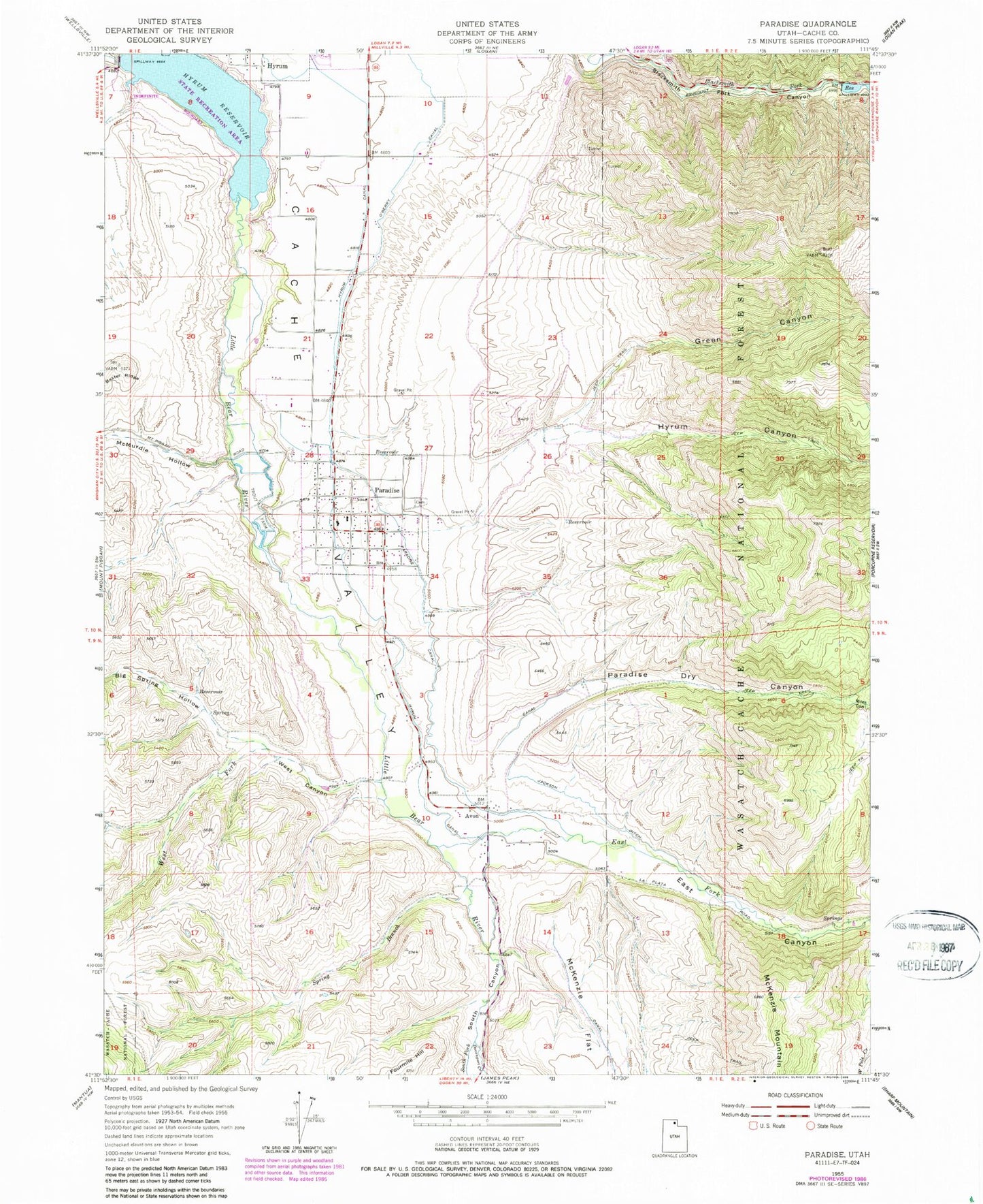
Classic USGS Paradise Utah 7.5'x7.5' Topo Map
Couldn't load pickup availability
Historical USGS topographic quad map of Paradise in the state of Utah. Map scale may vary for some years, but is generally around 1:24,000. Print size is approximately 24" x 27"
This quadrangle is in the following counties: Cache.
The map contains contour lines, roads, rivers, towns, and lakes. Printed on high-quality waterproof paper with UV fade-resistant inks, and shipped rolled.
Contains the following named places: Avon, Avon Cemetery, Avon Census Designated Place, Big Spring Hollow, Davenport Creek, East Canyon, East Fork Little Bear River, Fourmile Hill, Green Canyon, Highline Canal, Hyrum Canal, Hyrum Canyon, Hyrum Division, Hyrum Lake Campground, Hyrum Reservoir, Hyrum Reservoir State Park, Indian Head and Trapper, Indian Trail Hollow, Jackson Ditch, Little Bear River, McMurdie Hollow, Miles Canyon, Musselman Airstrip, O'Berry Canal, Paradise, Paradise Canal, Paradise Cemetery, Paradise Dry Canyon, Paradise Fire Department, Paradise Post Office, South Canyon, South Fork Little Bear River, Spring Branch, The Church of Jesus Christ of Latter Day Saints, Town of Paradise, West Canyon, West Fork Little Bear River, ZIP Code: 84328