MyTopo
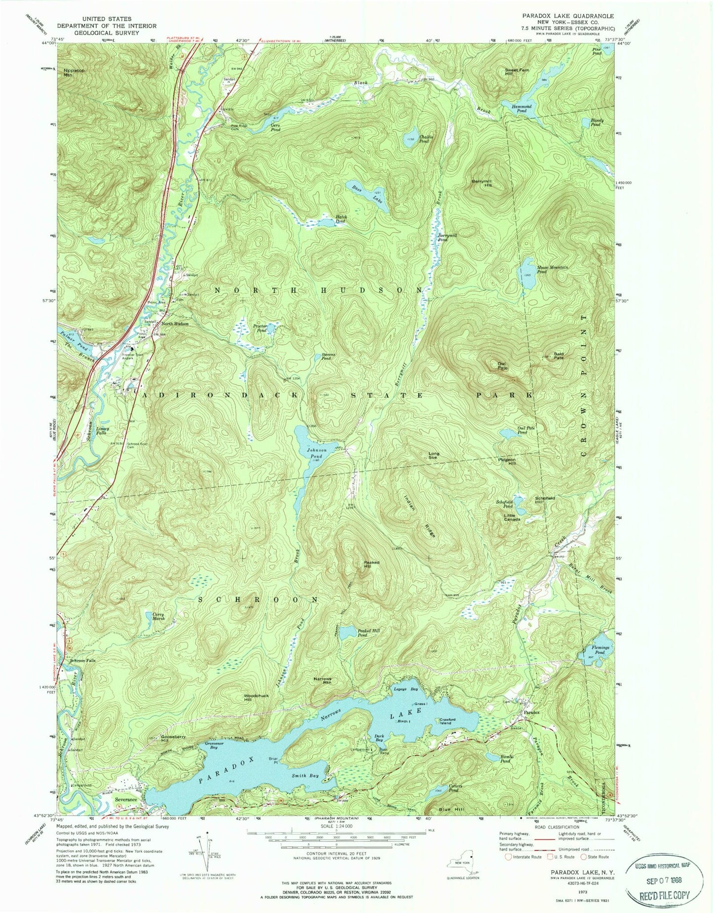
Classic USGS Paradox Lake New York 7.5'x7.5' Topo Map
Couldn't load pickup availability
Historical USGS topographic quad map of Paradox Lake in the state of New York. Typical map scale is 1:24,000, but may vary for certain years, if available. Print size: 24" x 27"
This quadrangle is in the following counties: Essex.
The map contains contour lines, roads, rivers, towns, and lakes. Printed on high-quality waterproof paper with UV fade-resistant inks, and shipped rolled.
Contains the following named places: Bald Pate, Bass Lake, Berrymill Hill, Berrymill Pond, Birch Island, Black Brook, Bloody Pond, Briar Point, Bumbo Pond, Burnt Mill Brook, Carey Marsh, Challis Pond, Cotters Pond, Crawford Island, Dark Bay, Flemings Pond, Gero Pond, Gooseberry Hill, Grass Island, Grosvenor Bay, Hammond Pond, Hatch Pond, Indian Ridge, Johnson Pond, Johnson Pond Brook, Legoys Bay, Linsey Falls, Little Canada, Long Sue, Moose Mountain Pond, Narrows Mountain, North Hudson, Owl Pate, Owl Pate Pond, Palmer Pond, Paradox, Paradox Creek, Paragon Brook, Peaked Hill, Peaked Hill Pond, Peaked Hill Trail, Pidgeon Hill, Pine Ridge Cemetery, Proctor Pond, Schofield Hill, Schofield Pond, Schroon River Cemetery, Severance, Smith Bay, Stevens Pond, Sweet Fern Hill, The Branch, Walker Brook, Paradox Lake, Woodchuck Hill, Schroon Falls, North Hudson Town Landfill, North Hudson Volunteer Fire Department, Paradox Post Office, North Hudson Post Office, Severance Post Office, Holy Name of Jesus and Mary Cemetery